DatenproduktionGIS & Geospatial
Aktualisierung der Gebäudedatenbank aus Orthophotos
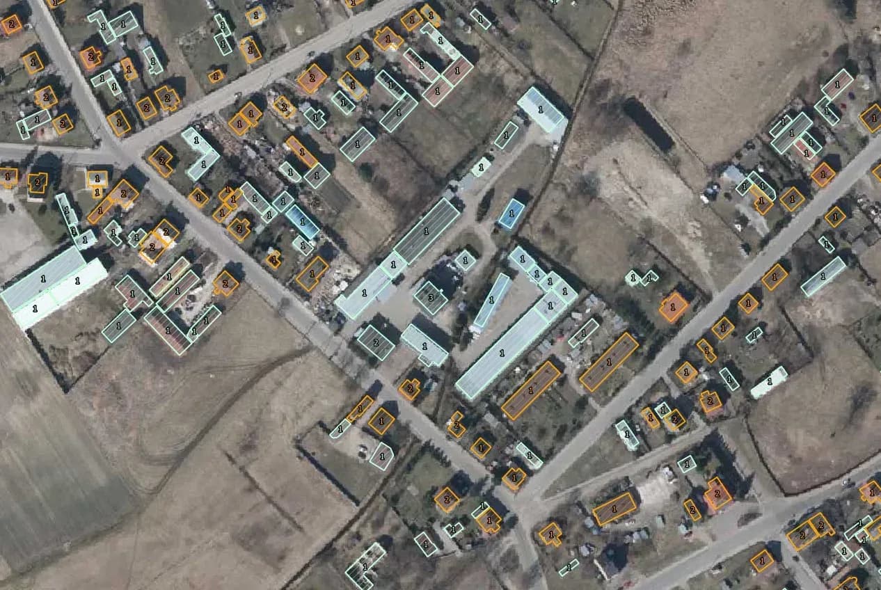
Vorhandene Gebäude prüfen und fehlende ergänzen, anhand von Orthophotos, Street View und topografischen Karten, um die Datenbank wieder auf den aktuellen Stand zu bringen.
Projektüberblick
Umweltschutzunternehmen mit Schwerpunkt auf Emissionsmessungen, Abwasseranalytik, Abfallwirtschaft und Bewertung von Umgebungslärm.
- Location
- Polen
- Team
- 8 GIS-Fachleute und eine Qualitätsprüfung.
Stack
- Survey & CAD
- The project utilized QGIS as the primary tool for the verification and updating of the building database.
Die Aufgabe und was sie gelöst hat
Technical challenge
Es handelt sich um Spezialkarten, und ihre Kartierungsmerkmale setzten den Maßstab, insbesondere für die Genauigkeit von Gebäudegeometrien und Attributen.
Was wir gemacht haben
Prüfung und Aktualisierung der Gebäudedatenbank, einschließlich Geometriekorrekturen und Attributaktualisierungen anhand von Orthophotos, Street View und topografischen Karten.
Warum wir
Die Arbeit begann mit dem Zusammentragen und Auswerten von Orthophotos, Street-View-Aufnahmen und topografischen Karten, um den aktuellen Stand der Gebäudedatenbank festzustellen. In QGIS prüfte das Team die vorhandenen Gebäude und fand neue, die nie erfasst worden waren. Gebäudegeometrien wurden korrigiert, wo sie falsch waren. Attribute wurden aktualisiert, darunter Typ, Nutzung und Geschosszahl. Topologische Prüfungen beseitigten Überlappungen, Lücken und weitere Widersprüche in den Geodaten. Anschließend wurde die Attributdatenbank gegen den neuesten Informationsstand geprüft. Die bearbeitete Fläche betrug über 500 km².
Ergebnisse
Die Gebäudedatenbank wurde aktualisiert und bildet nun die im bearbeiteten Gebiet stehenden Bauwerke ab.
Was wir geliefert haben
Prüfung und Aktualisierung der Gebäudedatenbank, einschließlich Geometriekorrekturen und Attributaktualisierungen anhand von Orthophotos, Street View und topografischen Karten.