DatenproduktionGIS & Geospatial
Straßenkarte und Verkehrszeichen erstellen
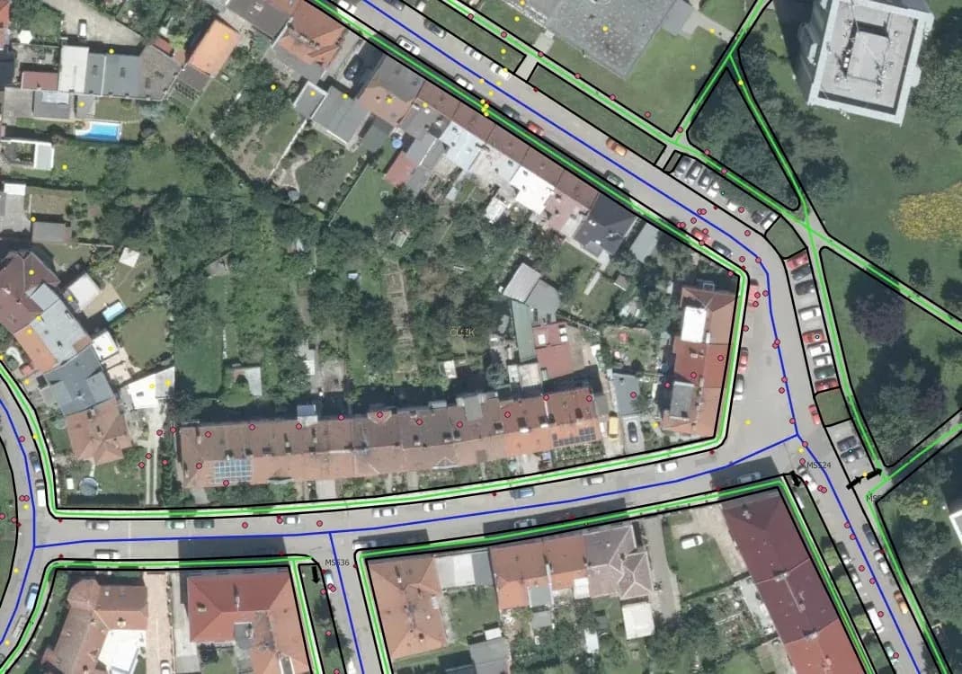
Eine detaillierte 2D-Vektorkarte von Prostějov für unsere tschechischen Partner: Verkehrswege, Gehwege, Radwege, Parkflächen und Verkehrszeichen samt Ausrichtung.
Projektüberblick
Ein Vermessungs- und Ingenieurunternehmen, spezialisiert auf Vermessung, Liegenschaftsverwaltung und Geodatenlösungen.
- Location
- Tschechien
- Team
- GIS-Fachleute von GisPoint arbeiteten 2 Monate an diesem Projekt, in QGIS.
Stack
- Survey & CAD
- QGIS was the main tool for processing and building the map. It handles spatial data well, and it is what got the level of detail the result carries.
Die Aufgabe und was sie gelöst hat
Technical challenge
GisPoint und unsere Fachleute standen in diesem Projekt vor mehreren Anforderungen. Genauigkeitsvorgaben und Datenmenge setzten die Latte gleichermaßen hoch. Die wichtigsten: Genauigkeit der Vektorisierung: Versorgungsanlagen, Gehwege, Radwege und Parkflächen aus hochgenauen Orthophotoplänen und Panoramaaufnahmen zu vektorisieren. Gemischte Datenarten: Orthophotopläne und Panoramaaufnahmen zu einer einzigen Vektordarstellung zusammenzuführen. Verkehrszeichen: Zeichen mit ihrer Drehung (horizontal, vertikal, Tafel) und ihren Attributangaben zu verorten. Attributangaben: Für jedes vektorisierte Objekt die Attribute zu füllen, einschließlich des Zustands des Straßennetzes, und sie korrekt und aktuell zu halten. Datenabstimmung: Eine große Datenmenge zu steuern und konsistent zu halten, damit die Karte korrekt dargestellt wird. Datenkomplexität: Die Daten so zu ordnen und zu korrigieren, dass doppelte oder fehlende Objekte vermieden werden.
Was wir gemacht haben
Erstellung einer detaillierten 2D-Vektorkarte für Prostějov. Vektorisierung von Verkehrswegen, Gehwegen, Radwegen und Parkflächen. Genaue Verortung und Dokumentation der Verkehrszeichen. Einbindung von Ausrichtungs- und Attributdaten der Verkehrszeichen. Nutzung hochgenauer Orthophotopläne und Panoramaaufnahmen.
Warum wir
Eingangsdaten waren Orthophotopläne mit 5 cm Genauigkeit und Panoramaaufnahmen. Daraus vektorisierte unser QGIS-Team die Straßeninfrastruktur: Versorgungsanlagen, Gehwege, Radwege und Parkflächen. Ergänzt haben wir die Verkehrszeichen, einschließlich Standort und Ausrichtung.
Ergebnisse
Das Projekt lieferte eine 2D-Karte der Stadt Prostějov mit der Straßeninfrastruktur und deren Attributangaben. Jedes Verkehrszeichen wurde fotografiert und sein Zustand erfasst.
Was wir geliefert haben
Erstellung einer detaillierten 2D-Vektorkarte für Prostějov
Vektorisierung von Verkehrswegen, Gehwegen, Radwegen und Parkflächen
Genaue Verortung und Dokumentation der Verkehrszeichen
Einbindung von Ausrichtungs- und Attributdaten der Verkehrszeichen
Nutzung hochgenauer Orthophotopläne und Panoramaaufnahmen