DatenproduktionGIS & Geospatial
Topologische Prüfung und Korrektur
GIS-Point arbeitete mit einem Unternehmen für Meeresbodenkartierung an der Genauigkeit und Verlässlichkeit seiner Geodaten.
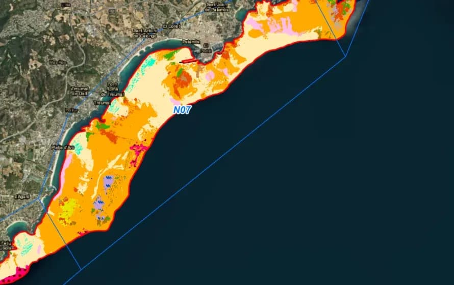
Projektüberblick
Umweltberatung mit Schwerpunkt auf Meeres- und Offshore-Projekten.
- Location
- Spanien
- Team
- Ein Team von GIS-Point mit Qualitätsprüfern und Projektleitung führte die Topologieprüfung durch.
Stack
- Survey & CAD
- ArcGIS ran the topology checks and corrections.
Die Aufgabe und was sie gelöst hat
Technical challenge
Meeresbodenkarten sind eine besondere Form der maritimen Kartografie, und ihre Eigenheiten bestimmten die Arbeit. Es sind hochgenaue Karten, sodass jede topologische Korrektur innerhalb der Kartierungsstandards bleiben musste. Die Datenmengen waren groß genug, dass der Durchsatz ebenso zählte wie die Genauigkeit.
Was wir gemacht haben
Sicherung der topologischen Integrität von Meeresbodenkarten.
Warum wir
Die Arbeit begann mit einer Analyse der Kartierungsdaten des Meeresbodens, um die topologischen Fehler zu finden. Wir wählten die Verfahren, die sie in kürzester Zeit beheben, ohne Genauigkeit aufzugeben. Zu den Standardprüfungen gehörten überschneidungsfreie Objekte („Must Not Overlap“), lückenlose Polygone („Must Not Have Gaps“) und Polygone innerhalb einer festgelegten Maximalgröße (zum Beispiel „Polygone dürfen höchstens 1 Quadratmeter groß sein“). Diese liefen in ArcGIS.
Ergebnisse
Die topologische Integrität der Meeresbodendaten verbesserte sich, und die maritimen Anwendungen des Kunden laufen nun auf verlässlicheren Karten. Das wirkt bis in die Sicherheit der Seebetriebe hinein, die darauf aufsetzen.
Was wir geliefert haben
Sicherung der topologischen Integrität von Meeresbodenkarten