Data ProductionArchitecture & BIM
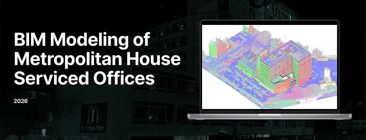
BIM Model: Metropolitan House Offices
GIS-Point was engaged to update the digital documentation of an existing multi-storey commercial building following significant changes since the previous survey conducted in 2012.
Project snapshot
A UK-based architectural practice specializing in architectural design, planning, and project delivery for commercial and mixed-use developments.
- Location
- Potters Bar, United Kingdom
- Team
- BIM specialists and a BIM coordinator. They processed the point cloud data and built the LOD 100–500 BIM model of the building to the client’s technical requirements and modelling standards. Continuous coordination and internal quality control kept the floors consistent with each other and delivered the BIM model and CAD documentation within the agreed scope.
Stack
- Survey & CAD
- The project utilized Autodesk Revit for BIM model development, Autodesk ReCap for processing the point cloud data, and AutoCAD for generating 2D CAD drawings. Internal cloud storage supported the management and segmentation of the large point cloud dataset
The challenge, and what closed it
Technical challenge
The point cloud was very large and the documentation requirements were demanding. GIS-Point worked through both with adjusted BIM workflows and a coordinated team. Main challenges: Very large point cloud: The supplied point cloud was too large to process in a single BIM environment. GIS-Point segmented it and split it across the BIM specialists. High-specification workstations and internal cloud storage carried the processing without loss of model accuracy. Multi-floor coordination: The building has multiple levels whose structural and architectural elements had to line up. Standardised BIM workflows held accuracy across the whole model. Missing Revit annotation library: The client had no Revit annotation library to hand over for the drawing documentation, so GIS-Point built a custom one for consistent drawings. Working through these produced an accurate BIM model and a coordinated set of CAD documentation.
What we did
3D BIM modeling of the existing building based on point cloud survey data. Development of an LOD 100–500 Revit model including structural elements, external envelope, and building services. Generation of accurate 2D CAD drawings (plans, elevations, and sections at 1:50 scale) from the BIM model. The project involved processing newly acquired point cloud data and developing an accurate LOD 100–500 BIM model covering the basement, ground floor, and seven upper levels. The scope included modeling structural elements, architectural components, and visible building services, as well as generating coordinated 2D CAD drawings including floor plans, elevations, and sections at 1:50 scale.
Why us
Work started with preparing and processing the supplied point cloud data as the basis for BIM development. GIS-Point read the scan data and reconstructed the existing building geometry in the BIM environment, holding consistency across all floors and meeting the client’s technical requirements and LOD standards. Our process: Importing and processing point cloud data in Autodesk Revit. Building the LOD 100–500 BIM model, structural and architectural elements included. Modelling visible building services, plant equipment, and external building features from the scan data. Generating coordinated 2D CAD drawings: floor plans, elevations, and sections at 1:50 scale. Running internal quality control and checking accuracy and project requirements with the client. The result is a digital representation of the building the client can plan and design against.
Results
An accurate LOD 100–500 BIM model of the building was developed from point cloud data in Autodesk Revit. The model includes structural and architectural elements, visible services, and external features across all floors. In total, the model contains 13,500+ modeled elements and represents a building with an approximate processed area of 26,000 m². A coordinated set of 1:50 CAD drawings, including floor plans, elevations, and sections, was generated directly from the BIM model. The resulting BIM model provides an up-to-date digital representation of the building to support the client’s planning and design process.
What we delivered
3D BIM modeling of the existing building based on point cloud survey data
Development of an LOD 100–500 Revit model including structural elements, external envelope, and building services.
Generation of accurate 2D CAD drawings (plans, elevations, and sections at 1:50 scale) from the BIM model.