
CTO
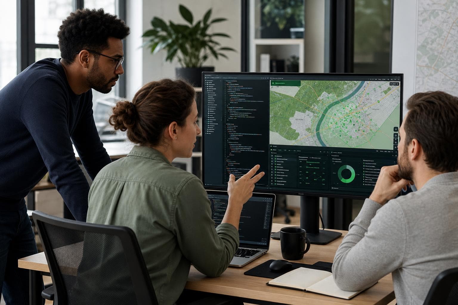
A full product team, from backend and mobile to AI and infrastructure, with one specialisation: the spatial layer where generic IT teams stall.
All code. All IP. Yours from the first commit.
30 min. No deck, no pricing.
Most teams we work with hit the same wall. If two of these are yours, we should talk.
You have the product vision and the budget, but no engineering bench, and hiring one is months you don't have.
A contract landed and the delivery needs spatial engineering you can't recruit in time.
Maps, projections, geospatial databases, where generic IT teams slow down or get it wrong, and your roadmap waits.
Per-call mapping bills grow with every user, and the engine isn't yours to tune.
Satellite, sensors, machines, operations: bought and collected, but never unified into one operational view.
A long recruitment cycle for niche spatial skills, when the work needs to ship now.
Services
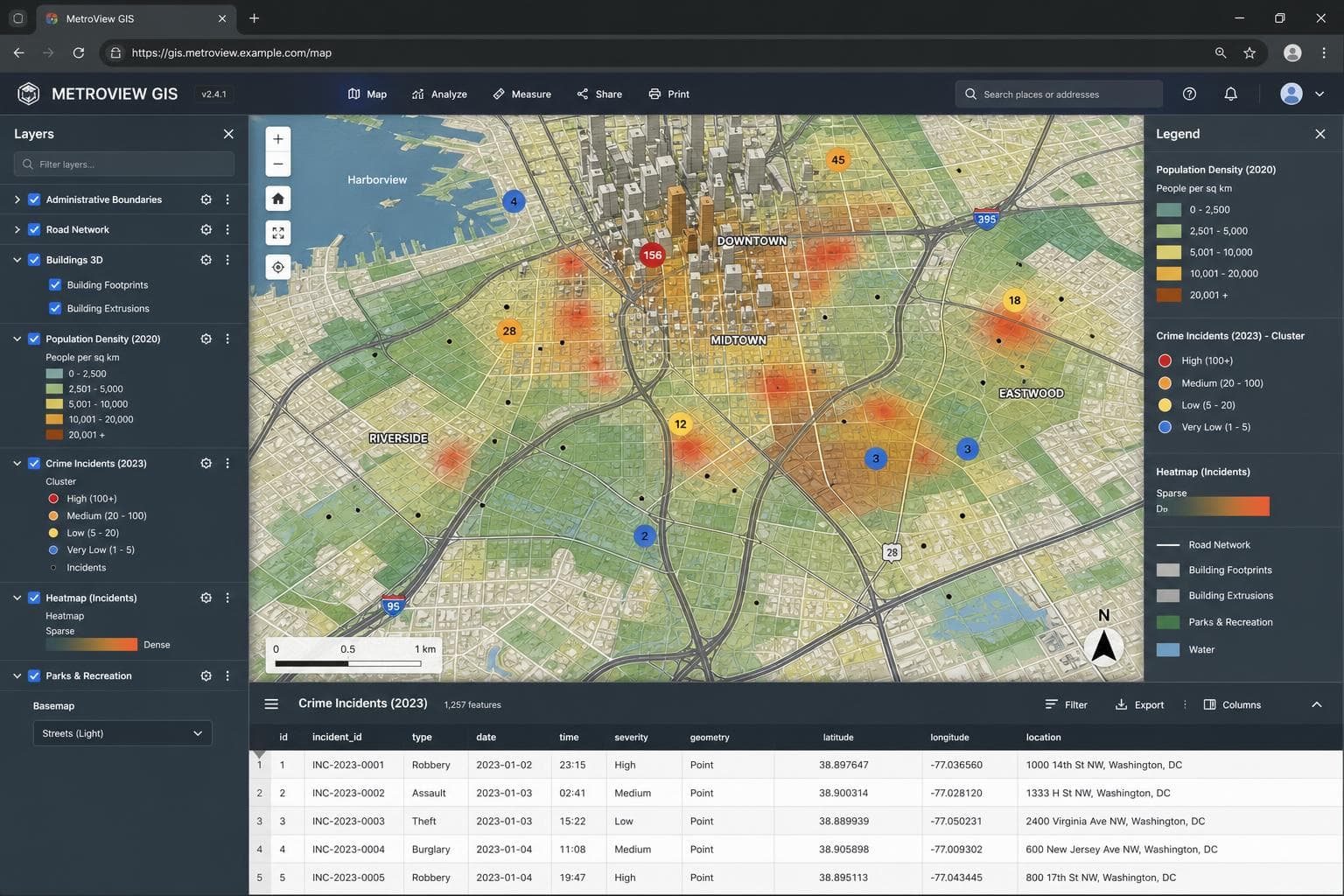
Full-stack product engineering with a spatial core. We design the architecture, build backend and frontend, and ship to production: map composition with spatial querying, publishing via OGC WMS/WFS, AI-assisted QA pipelines and role-based access control.
See what's included GIS Software Engineering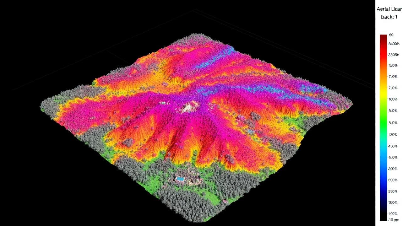
AI-native capability applied across all verticals, with every AI output validated by domain experts. We have automated forest inventory from orthophotos, located drone imagery with no satellite fix, and answered plain-English questions against live GIS layers.
See what's included GeoAI & Spatial Analytics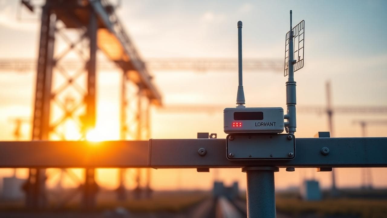
We build the spatial intelligence layer; we do not sell IoT hardware. Live feeds land alongside your existing geodata, as in the precision-agriculture site monitoring platform and the weather analysis platform we built and now run in production.
See what's included IoT Spatial Integration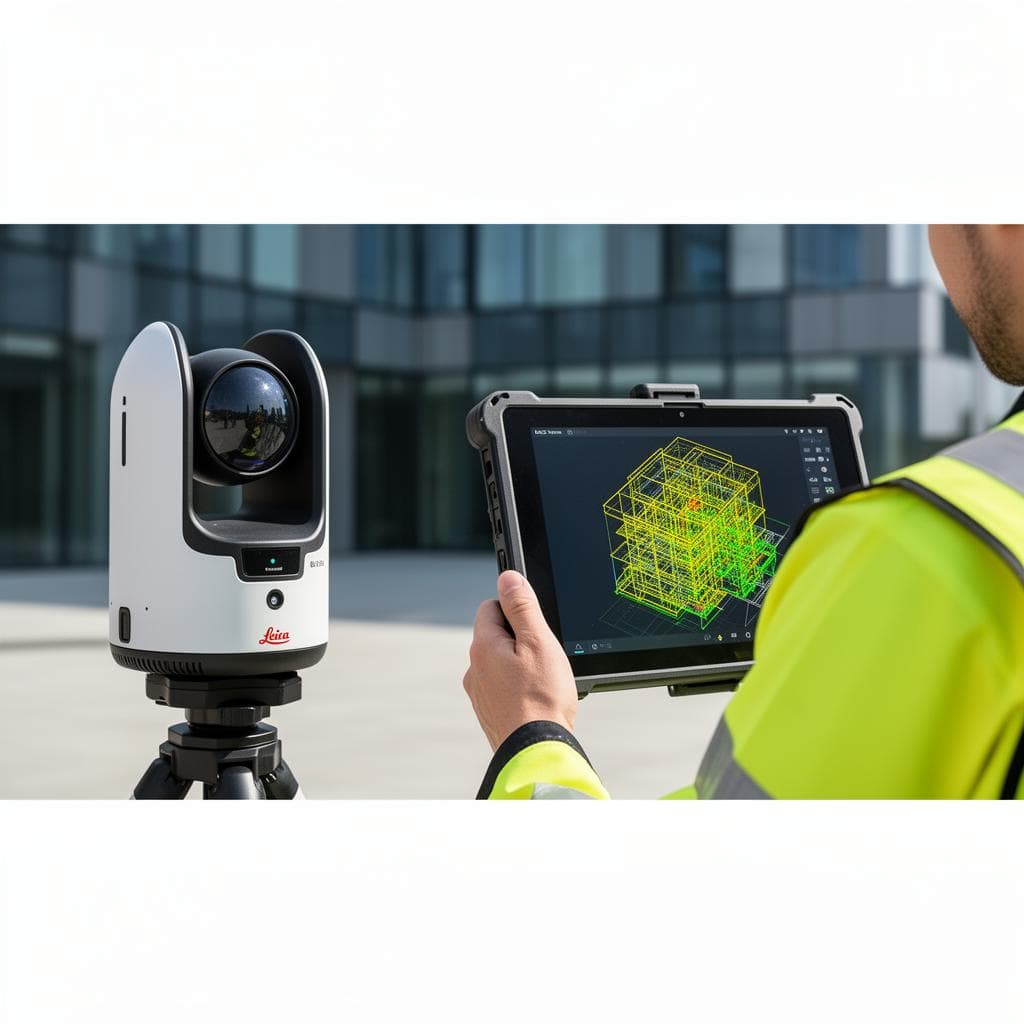
We bridge GIS and BIM. Point clouds, terrain, BIM and live IoT feeds fused into one queryable browser environment, no plugins. Delivered as BIM models of occupied buildings, 3D models of tunnels and poles, and a viewer for high-volume point clouds.
See what's included 3D & Digital Twins
Autonomous spatial workflows on the data infrastructure we already build for you. The first step is shipped: a natural-language interface that turns a question asked the way you would ask a colleague into a filtered layer from live GIS services.
See what's included Agent-Enabled Spatial Systems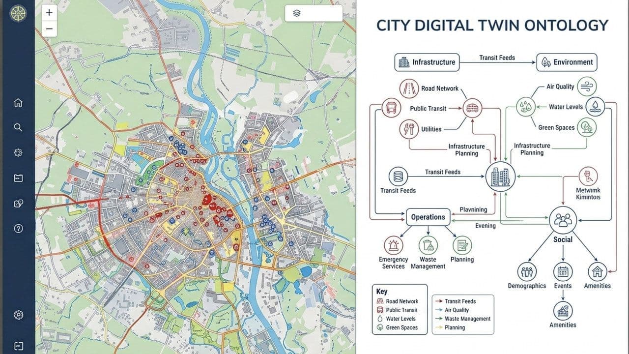
Vendor-neutral platform evaluation, architecture design and migration planning, technical due diligence and team training. We audit what you already run before recommending anything, as with the topological verification of a seabed mapping dataset.
See what's included GIS Consultancy & Strategy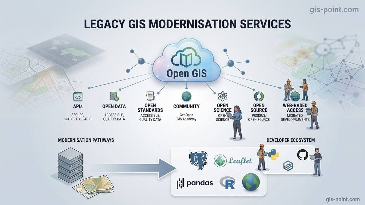
On-premise to cloud, desktop to web, with geodatabase consolidation and performance optimisation. We have converted cadastral archives between formats with every attribute carried across, and digitised utility networks into a city's ArcGIS geodatabase.
See what's included Legacy GIS Modernisation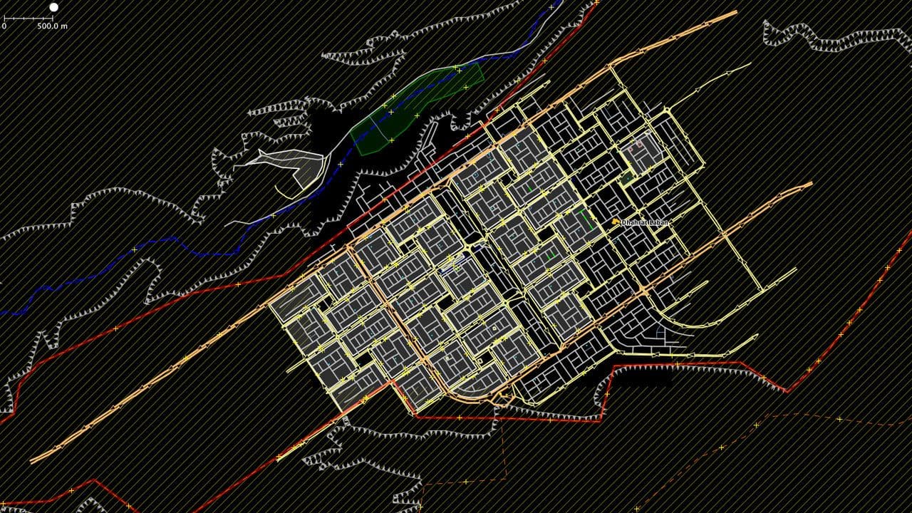
Self-hosted pgRouting, OSRM and Valhalla, with turn-by-turn navigation in driver and rider apps and full data ownership. Built on road data we produce ourselves: 1,600 km of autobahns, bridges and roads brought to standard, and city networks vectorised.
See what's included Navigation & Routing EnginesWhat the software unit builds
For CTOs and Heads of Product whose geodata delivery is still manual: own the software instead of scaling headcount. Spatial platforms, GeoAI, AI agents and automation. We build the software that turns your manual geodata delivery into an owned product, from business analysis to launch. Have a dev team to extend, or none to start from? We plug geospatial engineers into your R&D, or become your outsourced product team.
500 km LiDAR classified in 3 days at 97.2% · 8,000 ha NDVI in 48h · AgroDataHub
Web and PostGIS spatial platforms, asset management, routing engines, legacy GIS modernisation, consulting
GIS software engineers, backend (PostGIS/TimescaleDB), full-stack, DevOps
Natural-language spatial query (LLM to PostGIS), predictive spatial modelling for flood, crop yield and demand, LiDAR and EO AI classification
GeoAI / ML engineers, data scientists
Spatial QA agents, route-optimisation agents, compliance-monitoring agents, delivered as managed services on a monthly fee
AI agent engineers, automation engineers
ISOBUS to PostGIS connectors, telemetry ingestion middleware over MQTT, IoT-ready platform templates
IoT integration engineers, backend
BIM-GIS bridge, digital twin environments for defence and construction monitoring
3D and digital-twin engineers
Mobile and web applications, business process automation, product launch from business analysis to market
Business analysts, product managers, mobile developers, QA
Technology
We build on whatever stack is right for the project. Our default is open-source: PostGIS, GeoServer, OpenLayers. Zero licensing. Full code ownership. We also deliver on Esri, Trimble, and Hexagon ecosystems when the project requires it.
PostGIS, GeoServer, pgRouting, OSRM, React, OpenLayers. Zero licensing. Full code ownership.
ArcGIS Enterprise, Trimble, Hexagon, FME. We deliver on proprietary platforms when required.
Esri for data management + open-source for web delivery. We design the bridge.
allgis.io runs on our open-source stack. Client projects are delivered on the architecture the project requires. Both approaches are in production.
Scope
This unit builds, extends and fixes software. Geospatial data production (LiDAR classification, terrain, vectorisation, Scan-to-BIM) is delivered by our production unit.
Technology Ecosystem
Open standards first: OGC WMS and WFS, OGC API Features, STAC, and Cloud Optimised GeoTIFF. Your data stays portable.
| What we build | PostGISPythonReactMapLibre GeoServerTileServer GLpgRoutingOSRMValhallaFastAPIDjangoFlaskJava/Spring Boot.NET/C#ASP.NET CoreABP FrameworkNode.jsNestJSGraphQLTypeScriptAngularVue.jsNext.jsViteTailwind CSSPayload CMSStreamlitOpenLayersLeafletCesiumJSResiumdeck.glThree.jsGiro3DPotreeD3.jsTurf.jsproj4H3ShapelyGeoPandasGDALPDALOGRFionarasteriolaspyEntwineGeoDjangoGeoAlchemy2NetTopologySuite3D TilesglTFGaussian splatting |
|---|---|
| AI and computer vision | PyTorchOpenCVYOLOv8 / YOLOv10CUDA / GPU inference TensorFlowscikit-learnUltralyticsOpen3D-MLkornia LoFTRLangChain / LangGraphOllama (self-hosted LLMs)Anthropic ClaudeOpenAI |
| Data and storage | PostgreSQLTimescaleDBElasticsearchS3-compatible object storage SQL ServerOpenSearchMongoDBRedisSQLite (offline-first)MinIOMBTilesDrone imagerySatellite (Sentinel-2, commercial)Sentinel Hub / CopernicusSkyFi & SkyWatch imagery APIsLiDAR (airborne, mobile, terrestrial)Point cloud scanners360° panoramic imageryReference orthophotosCAD drawingsSRTM / DEM elevationNOAA GFS weather (GRIB)GPS/GNSSLive camera streams (HLS/MJPEG)IoT sensor networksAgricultural machinery (ISOBUS)Vehicle telematics |
| Infrastructure | DockerKubernetesTerraformGitHub Actions HelmnginxTraefikCaddyAzure PipelinesBitbucket PipelinesAWSAzureVercelCloudflare WorkersHetznerCoolifyCeleryRabbitMQBullMQTrigger.devSignalRWebSocketsOAuth2 / OIDCOpenIddictJWTClerkauthentikSentryOpenTelemetrySonarCloudPlaywrightVitestpytest |
| Mobile | React NativeFlutterSwift (iOS)Kotlin (Android) Riverpodflutter_mapMapLibre NativeArcGIS Maps SDK for Flutternative and cross-platformoffline-firstmap-aware |
| What we integrate with | Esri / ArcGIS RESTOGC WMS/WFSSTACBigQuery Google Cloud PlatformSnowflakeArcGIS EnterpriseTrimbleHexagonFMEMapTilerMapboxOpenStreetMap / GeofabrikOSM NominatimCesium IonOGC API FeaturesCOGDJI TerraOBD-IICAN busLoRaWANNB-IoTMQTTISOBUSStripePostHogSendGrid / Resend / SMTPProprietary GIS → open-sourceDesktop-only → web-basedClosed-box routing → self-hostedPer-call API → owned infrastructure |
Not sure where to start? Platform evaluation, architecture design, migration roadmaps. Vendor-neutral, based on your project needs.
Book a 30-minute strategy callHow we build
AI-assisted coding, automated test and QA generation, and agentic tooling are part of how our engineers work day to day. We use them to shorten delivery cycles and catch errors earlier. A BSc+ engineer reviews and owns every output. This is separate from the GeoAI capabilities we build into client products.
GeoAI & ML
GeoAI and ML run through the whole delivery: in the pipelines we write for you, in the analytics we put inside your product, and in how our engineers build and test. The effect is the same everywhere: less manual work, shorter delivery cycles, and lower cost for the same scope.
The recurring processing your team does by hand becomes an ETL pipeline with ML in the loop. Written once, rerun forever, at the cost of compute instead of headcount.
Objects, damage, crop stress and change over time detected from satellite and drone imagery, so your team reviews the exceptions instead of every frame.
Models that turn spatial history into forecasts and recommendations, delivered as an API or as a screen inside your product.
Ask live spatial data questions in plain language, with a human checkpoint before anything consequential is acted on.
Agents that run the repetitive steps inside your workflow: query, check, route, report. Built on open tooling, with the governance and evaluations that keep them honest.
Accuracy is measured against a benchmark set before anything ships, thresholds are agreed with you, and a qualified engineer signs off. A number you can check, not a score you have to trust.
Every AI output is reviewed and owned by a BSc+ engineer. When we ship agents, you own them too: models, pipelines, prompts, tool schemas, governance and evaluations all land in your repository, with no proprietary agent framework licensed back to you.
Who we build for
GIS & Geospatial
GIS team at capacity. Six-month search for developers ends with zero hires. Clients expect web delivery. No in-house team to build it.
Proof: allgis.io, our own production Web GIS, and a delivered multi-tenant Web GIS platform.
Entry point: CTO · Head of Technology
Agriculture & AgriTech
Satellite data purchased but unprocessed. No in-house GIS capability. Disconnected sources: machines, sensors, satellite, logistics. No unified operational view.
Proof: a GeoAI farm-intelligence platform turning agronomic and machine data into field-level insight.
Entry point: CTO · Head of Product
Architecture & BIM
Scan-to-BIM demand outpaces the team. Point clouds too heavy to share with clients. BIM and GIS live in separate tools with no shared view.
Proof: Scan-to-BIM production delivered to LOD 100–500 for UK architecture practices.
Entry point: CTO · Head of Digital
Logistics & Mobility
Routing API cost shock. Static routing that fails at scale. No unified spatial layer connecting tracking, analytics, and dispatch.
Proof: self-hosted routing engines replacing per-call APIs at 78–95% lower cost.
Entry point: CTO · IT Director
Utilities & Energy
Regulatory submissions rebuilt by hand each cycle. Asset systems hold conflicting truths. Condition data never reaches the map.
Proof: NUAR compliance gap analysis delivered for a UK utility network.
Entry point: CTO · Head of Asset Data
Fibre & Telecom
As-built records lag the build. PIA submissions bounce on data quality. Every integration between GIS and OSS/BSS is a manual export.
Proof: AI-assisted fibre route extraction cutting manual digitisation time.
Entry point: CTO · Network Planning Director
Defence
Funded and need to build fast. No access to engineers with operational spatial context. Generic IT teams take 3 months to reach spatial fluency.
Engagement by network introduction only.
Entry point: Network introduction only · CTO or Co-founder
Who you work with
The same project manager, lead engineer and QA engineer stay on your project. Any replacement is agreed with you in writing.
CTO

CEO & Owner

Head of Business Development
Case studies
Production Web GIS, built in-house. Upload Shapefile, GeoJSON, GeoTIFF, and KML. Compose maps with spatial querying. Publish via OGC WMS/WFS. AI-assisted QA pipelines. Role-based access control.
Architected and delivered a production multi-tenant Web GIS with strict tenant data isolation, per-tenant branding, role-based access, and OGC-compliant map publishing (WMS/WFS).
Farm Intelligence AI
A GeoAI platform that turns agronomic and machine data into field-level insight. Natural-language querying against live spatial data, with a human checkpoint on every consequential output.
Verified on Clutch
I'm impressed by GIS-point's professionalism and attitude, knowing they're working during a war.
Custom software development · Nov 2025, ongoing · Overall 5.0, reviewed 3 April 2026
The breadth of GIS-Point's technical scope was genuinely impressive.
Custom software development · Jun 2024, ongoing · Overall 5.0, reviewed 15 April 2026
With a minimum amount of guidance from us, they’ve understood our end goals and delivered perfectly as requested.
UX/UI design · Oct 2025, ongoing · Overall 5.0, reviewed 29 April 2026
Why teams work with us
2-3 weeks
Time to assembled team
Named GIS-native engineers in your workflow, your tools, your standup. No recruitment cycle, no spatial ramp-up on your budget.
100%
Code and IP ownership
Every line of code, every repository, every data schema yours from day one. English-law contracts with explicit IP assignment. Open-source stack by default. No vendor lock-in.
100% BSc+
GIS-native engineers
Every engineer understands CRS, topology, PostGIS, and OGC standards from week one. The spatial layer is where most IT teams hit a wall; it is where we start.
CET/BST
Working hours that overlap yours
Real-time collaboration for UK and Europe: a file sent at 9am returns with QA notes by 3pm. North America briefs us at 5pm Eastern and finds deliverables by 9am. Geospatial engineering heritage through Mirnychyj Engineering Group, est. 2009.
100% code and IP ownership from the first commit.
How we work together
Defined scope. Milestone-based delivery. Full IP transfer on completion. Web platforms, mobile apps, AI pipelines, and spatial data infrastructure.
from $1,500 ex-VAT
Scope, integrations, data volume, deadline.
Named engineers embedded in your workflow. Consistent team, no rotation. Scales from 1 to 10+.
from $6,500 per engineer per month, ex-VAT
Seniority mix and team size. Junior and mid-level engineers at this floor; senior and lead rates quoted on scope.
Vendor-neutral platform evaluation, architecture design, migration roadmaps.
$40 per hour, ex-VAT
Ad-hoc, non-committed time, booked by the hour rather than reserved.
One scoped integration between a spatial data source and your existing system, handed over with the repository, a runbook and 4 weeks of warranty support, starts at $1,500 ex-VAT. The True-Cost Calculator gives an instant estimate for your own scope.
Start here
Bring the platform, pipeline or GeoAI model you need built, and we will scope it in a fixed-price Discovery Sprint. Three fields. The person who replies does the work.
How we start
two-week iterations, each ending in a working demo
Architecture review, stack alignment, bottleneck map.
SoW, milestones, team shape. English-law contract.
Weekly demos, CI/CD, observability from day one.
Extend, maintain, iterate. You keep the code and the team.
Start with a 30-minute technical session
We map the bottleneck and the path to production.