SoftwareentwicklungGIS & Geospatial
Webbasierter 3D-Punktwolken-Viewer
Der Kunde wollte, dass Ingenieur- und Geodatenteams große Punktwolkenbestände öffnen und bearbeiten können, ohne eine schwere Desktop-Installation.
Projektüberblick
Anbieter von Ingenieur- und Vermessungslösungen (Saudi-Arabien)
- Location
- Saudi-Arabien
- Team
- Softwareentwickler, Fachleute für 3D-Darstellung und Cloud-Infrastruktur-Ingenieure. Eine Projektleitung steuerte die Entwicklung im agilen Zyklus, wobei Frontend (Angular, Potree) und Backend (Python) eng zusammenarbeiteten. Ein eigenes QA-Team prüfte Leistung, Genauigkeit und Stabilität über verschiedene Datenbestände und Anwendungsfälle hinweg.
Stack
- Backend
- Python, Django, Celery
- Frontend
- Angular, Leaflet
- Data & AI
- laspy
- Infrastructure
- Docker
Die Aufgabe und was sie gelöst hat
Technical challenge
Riesige Datenmengen: Billionen von Punkten im Browser darzustellen, ohne Metadaten oder Bildtreue zu verlieren. Interaktive Leistung: Mess- und Analysewerkzeuge, die sofort reagieren, ohne Verzögerung zwischen Eingabe und Ergebnis. Sicherheit: feingranulare Zugriffssteuerung und sichere Auslieferung hochwertiger Geodaten.
Was wir gemacht haben
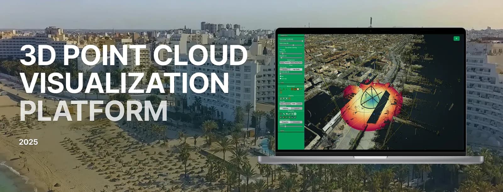
Eine Webanwendung zum Betrachten, Verwalten und Bearbeiten sehr großer 3D-Punktwolkenbestände. Sie verarbeitet LiDAR, Photogrammetrie und weitere 3D-Formate, und Nutzer messen, annotieren, schneiden und exportieren Daten im Browser. Den 3D-Viewer bauten wir auf Potree und Angular auf, mit einem Python-Backend und SQL Server für die Metadaten. Die PotreeConverter-Strecke überführt rohe LiDAR-Daten in ein Octree-Format, und genau das macht das Laden nahezu sofort und die Bedienung flüssig. Die Plattform bringt Nutzerauthentifizierung, rollenbasierten Zugriff, Volumenmessung, Höhenprofile, Schnittwerkzeuge und layerbasierte Darstellung mit, in einer Oberfläche, die in jedem WebGL-fähigen Browser läuft.
Warum wir
Der Entwicklungsprozess umfasste: Anforderungsaufnahme und Planung der Lösungsarchitektur; Einbindung von Potree und PotreeConverter für performante Darstellung; Backend-Entwicklung mit Python und SQL Server; Frontend-Entwicklung mit Angular und WebGL für die interaktiven Werkzeuge; Nutzerauthentifizierung mit JWT und sicherem rollenbasiertem Zugriff; Cloud-unabhängigen Betrieb (AWS, GCP und eigenes Rechenzentrum); Lasttests mit sehr großen Datenbeständen; Betrieb mit NGINX und sicher konfigurierter Speicherung.
Ergebnisse
Die Punktwolken-Plattform ermöglichte dem Kunden, Vermessern, GIS-Fachleuten und Ingenieuren 3D-Darstellung aus der Cloud anzubieten. Sie nahm schwergewichtige Desktop-Software aus dem Ablauf und machte komplexe Datenbestände leichter zugänglich. Genutzt wird sie heute in Stadtplanung, Umweltmonitoring, Infrastrukturinspektion und Forschung, von öffentlichen wie privaten Stellen.
Was wir geliefert haben
Eine Webanwendung zum Betrachten, Verwalten und Bearbeiten sehr großer 3D-Punktwolkenbestände. Sie verarbeitet LiDAR, Photogrammetrie und weitere 3D-Formate, und Nutzer messen, annotieren, schneiden und exportieren Daten im Browser.