SoftwareentwicklungGIS & Geospatial
GeoServer-Plattform - mandantenfähiges Web-GIS
Ein mandantenfähiges Web-GIS für ein niederländisches Technologieunternehmen: Kommunen und Behörden laden interaktive Kartenlayer hoch, gestalten und veröffentlichen sie, ganz ohne Desktop-GIS.
Projektüberblick
Ein GIS-Technologieunternehmen in den Niederlanden, das Kommunen und Umweltbehörden betreut.
- Location
- Niederlande
- Team
- Eine Projektleitung mit agiler Steuerung, Backend- und Frontend-Entwicklung, GIS-Fachleute, DevOps und QA.
Stack
- Frontend
- React, TypeScript, Vite, MUI, i18next
- Backend
- FastAPI (Python), SQLAlchemy, Pydantic
- Data & AI
- PostgreSQL, PostGIS
- Integrations
- GeoServer, OpenLayers, Leaflet, WMS/WFS
- Infrastructure
- Docker, Nginx, GitHub Actions CI/CD
Die Aufgabe und was sie gelöst hat
Technical challenge
Die Daten der Organisationen auf gemeinsam genutzter Infrastruktur vollständig getrennt zu halten. Vier Geodatenformate zu übernehmen, mit automatischer Erkennung der Projektion und Ermittlung der Ausdehnung. Die interaktive Darstellung flüssig zu halten, auch bei überlagerten Vektor- und Rasterlayern mit großen, seitenweise geladenen Objektmengen. Externe OGC-Dienste einzubinden, deren Capabilities-Dokumente stark voneinander abweichen, ohne bei einem nicht erreichbaren Endpunkt auszufallen.
Was wir gemacht haben
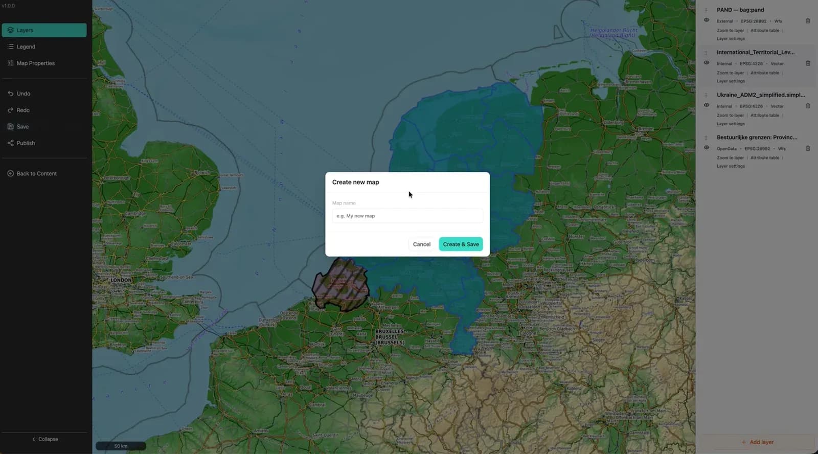
Hierarchische Dateiverwaltung für Geodatenbestände, die Shapefile, GeoJSON, GeoPackage und CSV verarbeitet. Karteneditor mit Layer-Gestaltung und Attributabfrage. Veröffentlichung mit einem Klick, die teilbare URLs für öffentlichen oder organisationsinternen Zugriff erzeugt. Unterstützung externer OGC-Dienste, sodass WMS- und WFS-Layer Dritter in eine Karte einfließen. Getrennte Arbeitsbereiche je Organisation mit eigenem Erscheinungsbild, rollenbasiertem Zugriff und zweisprachiger Oberfläche (Englisch/Niederländisch).
Warum wir
Zuerst Geschäftsanalyse und Rollendefinition, dann Architektur und Entwurf der GeoServer-Anbindung. Backend und Frontend entstanden parallel: eine asynchrone REST-API gegen PostGIS und ein Single-Page-Karteneditor mit einem eigenen, schlanken Viewer für veröffentlichte Karten. Es folgten die Behandlung der Geodatenformate und die OGC-Anbindung, danach Funktions-, Integrations- und Sicherheitstests sowie der containerisierte Betrieb hinter einem Reverse Proxy mit automatisierter CI/CD.
Ergebnisse
Geliefert als produktive Plattform für Kommunen, Umweltbehörden und GIS-Fachleute in den gesamten Niederlanden. Sie fasst Datenhaltung, Kartenerstellung und Veröffentlichung in einer Weboberfläche zusammen und nimmt den Desktop-GIS-Schritt aus dem Veröffentlichen und Teilen von Geodaten heraus. Die Architektur trägt beliebig viele Organisationen bei vollständiger Datentrennung, eigenem Erscheinungsbild und länderspezifischer Konfiguration.
Was wir geliefert haben
Hierarchische Dateiverwaltung für Geodatenbestände, die Shapefile, GeoJSON, GeoPackage und CSV verarbeitet.
Karteneditor mit Layer-Gestaltung und Attributabfrage.
Veröffentlichung mit einem Klick, die teilbare URLs für öffentlichen oder organisationsinternen Zugriff erzeugt.
Unterstützung externer OGC-Dienste, sodass WMS- und WFS-Layer Dritter in eine Karte einfließen.
Getrennte Arbeitsbereiche je Organisation mit eigenem Erscheinungsbild, rollenbasiertem Zugriff und zweisprachiger Oberfläche (Englisch/Niederländisch).