DatenproduktionUtilities & Energy
Digitalisierung von Hausanschlüssen
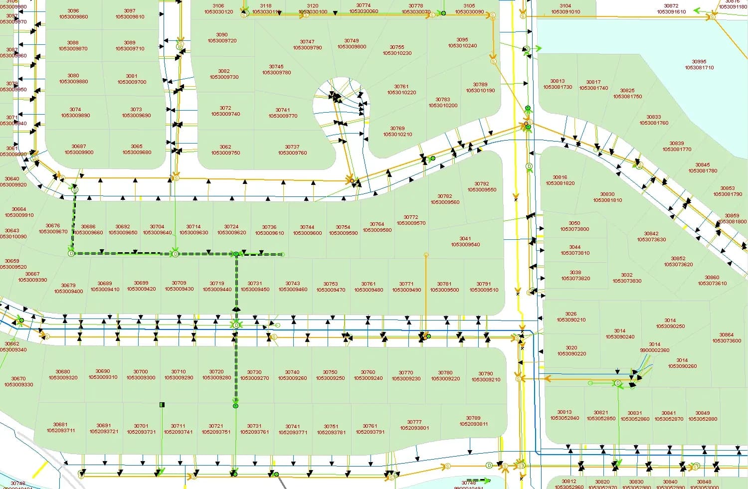
Im Projekt wurden Hausanschlüsse für Wasser, Abwasser und Regenwasser in der ArcGIS-Geodatenbank der Stadt digitalisiert.
Projektüberblick
Eine Abteilung der Stadtverwaltung mit Schwerpunkt Innovation, Strategie und Zusammenarbeit zwischen Verwaltungsebenen.
- Location
- Kanada
- Team
- 10 GIS-Fachleute, 2 Qualitätsprüfer und eine Projektleitung. Die Arbeit war in Wochenphasen geplant, um innerhalb eines Monats fertig zu werden. Jede Phase war terminiert, und der Kunde erhielt regelmäßige Berichte über Fortschritt, aufgetretene Probleme und deren Lösung. Das Team blieb in Kontakt, um Fragen sofort zu klären. Die Qualitätskontrolle lief durchgehend mit, und das Projekt wurde termingerecht und mit 100 % Qualitätsstandard geliefert.
Stack
- Survey & CAD
- ArcGIS was used for geospatial management and mapping, while SQL was employed for querying and verifying attribute data.
Die Aufgabe und was sie gelöst hat
Technical challenge
Die historischen Daten stammten aus Papierbeständen von den 1900er-Jahren bis heute, mit Maßeinheiten und technischen Angaben, die je nach Epoche verschieden waren. Jeden Hausanschluss vollständig und korrekt zu erfassen war bei diesem Volumen der schwierige Teil. Die Datenbestände waren groß genug, dass die Integrität der Netzinformationen an sorgfältiger Arbeit in jedem Schritt hing.
Was wir gemacht haben
ArcGIS-Geodatenbank um Hausanschlüsse erweitert. Anschlüsse den Flurstücken zugeordnet. Detaillierte Attribute in die Datenbank aufgenommen. Historische Daten ins GIS überführt.
Warum wir
Der Weg von analogen zu digitalen Daten umfasste mehrere technische Schritte: Datenaufbereitung und Digitalisierung: Die bestehende ArcGIS-Geodatenbank wurde erweitert, indem Hausanschlüsse (Wasser, Abwasser, Regenwasser) mit den Wohngrundstücken verknüpft wurden. Gescannte technische Unterlagen wurden eingebunden und die historischen Papierbestände in digitale Form überführt und den richtigen Flurstücken in der Geodatenbank zugeordnet. Attributanreicherung: Die Geodatenbank wurde um Attribute je Anschluss ergänzt: Verlegetiefe, Durchmesser und Länge, entnommen aus den technischen Unterlagen. Topologische Prüfung: Topologische Kontrollen prüften räumliche Beziehungen und Verbindungen im Leitungsnetz, und Widersprüche wurden korrigiert. Qualitätssicherung: Genauigkeit und Vollständigkeit wurden über systematische Prüfungen abgesichert. Alle topologischen und attributiven Daten wurden gegen die Projektvorgaben geprüft. Das Ergebnis ist ein digitales Leitungsnetz mit korrekten Attributen und geprüften räumlichen Beziehungen.
Ergebnisse
Eine vollständig digitalisierte Leitungsnetzdatenbank für die Stadt, topologische Prüfungen inbegriffen. Die historischen Daten liegen nun als digitaler Bestand im GIS für Betrieb und Planung der Netze vor.
Was wir geliefert haben
ArcGIS-Geodatenbank um Hausanschlüsse erweitert
Anschlüsse den Flurstücken zugeordnet
Detaillierte Attribute in die Datenbank aufgenommen
Historische Daten ins GIS überführt