Data ProductionGIS & Geospatial
Road & Bridge Geospatial Data Editing
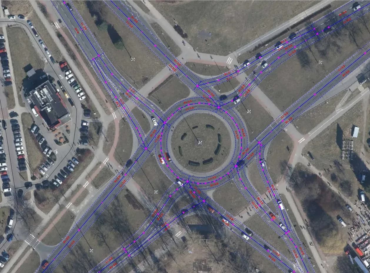
Our team edited and updated a database of autobahns, bridges, and roads spanning 1600+ km, and brought its accuracy and currency up to standard.
Project snapshot
Environmental protection company, specializing in air emission measurements, wastewater analysis, waste management, and environmental noise assessment.
- Location
- Poland
- Team
- 8 GIS professionals, including quality controllers and a project manager. At the start the client ran a training session of several hours covering the project’s requirements, methods, and data processing standards. The team then organised the workflow around the technical specification. Quality controllers checked data accuracy and consistency as work went on, running validation and verification passes. Project managers coordinated tasks, tracked progress, and kept the team aligned with project goals and deadlines.
Stack
- Survey & CAD
- For editing geometric vector data, creating attribute databases, and performing topological checks, we utilized QGIS.
The challenge, and what closed it
Technical challenge
The project faced several challenges, including the extensive 1600+ km length of infrastructure requiring updates. Analyzing a diverse range of input materials – orthophoto maps, Street View imagery, and topographic maps – required detailed examination and cross-referencing. The need for accurate comparison and integration of this data, along with making precise adjustments to geometry and attributes, added to the complexity of the task.
What we did
Data verification. Geometric correction. Attribute enrichment. Quality assurance.
Why us
Work started by pulling together the geospatial sources: orthophoto maps, Street View imagery, and topographic maps. The team imported and overlaid these in QGIS as the frame for the analysis. The existing data was checked against real-world conditions, segment by segment, to find where it was wrong. In QGIS we corrected the geometry of roads, bridges, and autobahns, moving positions and reshaping features to match what the auxiliary materials showed. Alongside that we filled out the attribute tables with the types of infrastructure objects, specifying the classifications and characteristics of roads, bridges, and autobahns. Quality assurance ran throughout: every correction and update was validated as applied and consistent across the database. A final review confirmed the updated geospatial data was accurate and consistent.
Results
The geospatial database was updated, and infrastructure data for Poland is now accurate and current. Planning and decisions about infrastructure development rest on it.
What we delivered
Data Verification
Geometric Correction
Attribute Enrichment
Quality Assurance