Data ProductionGIS & Geospatial
2D Orthophoto Mosaic from Aerial Survey
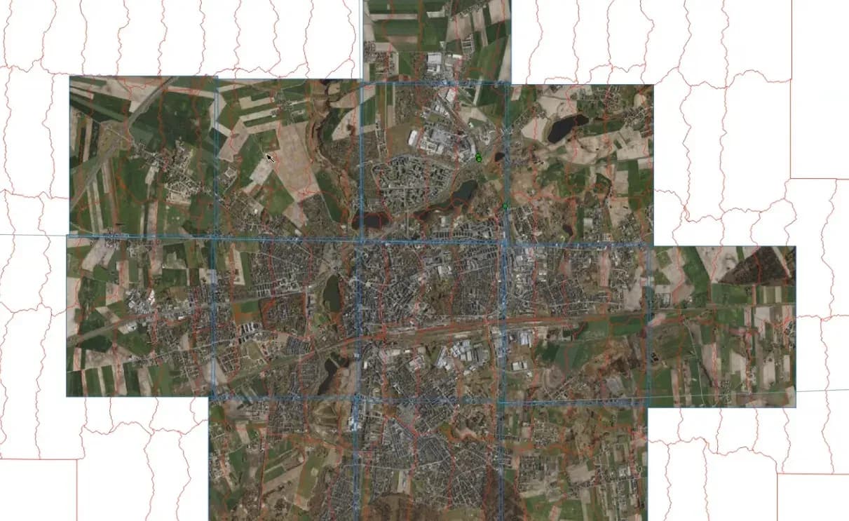
The project produced a 2D orthophoto mosaic for an area covered by aerial imagery.
Project snapshot
The leader of the Polish ALS and LiDAR market.
- Location
- Poland
- Team
- A team of GisPoint specialists working in geographic information systems and image processing. Every step, from data collection to final processing, was carried out against the client’s requirements.
Stack
- Survey & CAD
- QGIS: geospatial data processing and mosaic creation. PhotoShop: correcting visual distortions in the final orthophoto mosaic.
The challenge, and what closed it
Technical challenge
The team hit the following during implementation: Correction of mosaic lines: automatic mosaic lines had to be corrected so the edges of buildings, bridges, and other infrastructure did not break. Processing of moving objects: moving objects and their shadows stop images from stitching together correctly. Image overlap: images need enough overlap or the mosaic tears. Distortion correction: distortions of bridges, buildings, and roads had to be corrected so the final mosaic matched the geographic area. Image editing: PhotoShop was used to correct visual distortions and inaccuracies in the orthophoto mosaic.
What we did
A 2D orthophoto mosaic built to represent the aerial imagery accurately. Mosaic lines corrected so building edges, bridge edges, and infrastructure objects do not overlap wrongly. Moving objects and their shadows adjusted for, including cars, pedestrians, and bicycles. Enough overlap between aerial images to hold continuity. Distortions in bridges, buildings, and tracks corrected in PhotoShop.
Why us
Data Collection: aerial imagery was collected and prepared for processing. Mosaic Creation: the initial orthophoto mosaic was generated from the imagery. Correction: automated lines in the mosaic were corrected for building edges, bridge edges, moving objects, and infrastructure. Overlap Adjustment: overlap between images was set so the mosaic stayed continuous. Distortion Fixing: PhotoShop was used on distortions affecting bridges, buildings, and tracks. Final Review: a final pass checked the accuracy and quality of the orthophoto mosaic.
Results
The project produced a 2D orthophoto mosaic that represents the surveyed area accurately. Overlaps, distortions, and moving objects were all corrected, and the mosaic reads as one continuous image.
What we delivered
Creation of a detailed 2D orthophoto mosaic for accurate aerial imagery representation
Correction of mosaic lines to prevent incorrect overlaps, such as building edges, bridge edges, and infrastructure objects
Adjustment for moving objects and their shadows, including cars, pedestrians, and bicycles
Enough overlap between aerial images to hold continuity
Correction of distortions in bridges, buildings, and tracks using PhotoShop