Data ProductionGIS & Geospatial
Topographic & Utility Database at 1:500
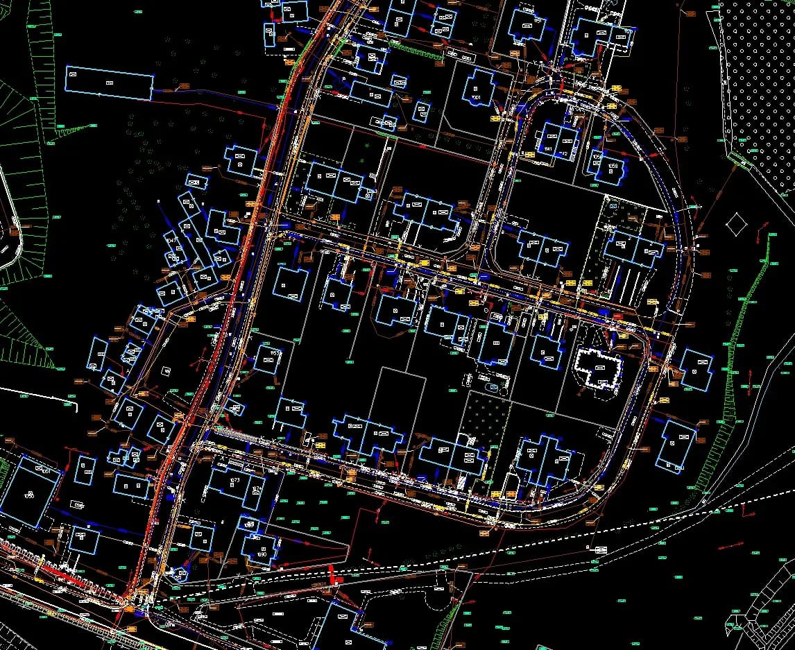
Creating and updating a topographic, geodetic and utility network database at 1:500, to produce an electronic map meeting legislative requirements.
Project snapshot
A department in Polish counties responsible for geodesy and property management.
- Location
- Poland
- Team
- GIS-Point assembled a dedicated team of 25 GIS specialists, 5 quality controllers, and 2 project managers for long-term collaboration on these projects, with the team continually expanding. At the beginning of the collaboration, the client conducted a brief training session on the specific requirements and specialized software for a few key specialists. Subsequently, GIS-Point independently trained their internal team and managed the project processes.
Stack
- Survey & CAD
- The projects were executed using specialized Polish state software such as TurboMAP, WorkEwid, and Ewmapa.
The challenge, and what closed it
Technical challenge
Keeping the electronic map accurate and compliant with legislative requirements across a large data volume, at the precision vectorisation and data processing demanded. The incoming data ran from the 1900s to the present and had to be worked through in sequence. The whole project ran in specialised software and in Polish. The data volume called for careful management and quality control at every stage.
What we did
Vectorization of existing raster data (topographic maps). Handling geodetic and land documentation. Building an extensive attribute database. Integrating data related to municipal utility networks.
Why us
Work started with vectorising the existing raster data: topographic maps and orthophotography. The team worked through the geodetic and land documentation, pulling out coordinates and land plot delineations. That fed the attribute databases. Separate databases were built per infrastructure type. Underground and above-ground engineering networks: water supply, power grids, gas lines, sewage. A topographic objects database covering roads, sidewalks, embankments, and contour lines. A buildings database holding location, dimensions, and attributes. Topological checks validated the data, including the connectivity and continuity of the mapped features, which is what makes a municipal utility network usable. The team added metadata and attribute information, linking each mapped feature to its data. The databases were checked against legislative requirements and industry standards, and the new data was cross-referenced with existing records and maps.
Results
The data now runs on geospatial portals and other platforms, used for city planning and infrastructure management among other things. The project produced current electronic maps that meet the legislative requirements in full.
What we delivered
Vectorization of existing raster data (topographic maps)
Handling geodetic and land documentation
Building an extensive attribute database
Integrating data related to municipal utility networks