Software EngineeringDefence
Locating Drone Imagery Without GPS
A validated proof of concept that locates a drone photo with no satellite fix, matching it against a georeferenced orthophoto to return WGS84.
Project snapshot
Internal capability development. This is a completed proof of concept, not a delivered client engagement.
- Location
- Ukraine
- Team
- A small research and engineering team working across computer vision, geodesy and backend services.
Stack
- Backend
- Python, FastAPI
- Data & AI
- Computer vision feature matching, geodetic coordinate transformation
- Frontend
- React, Leaflet
- Infrastructure
- Docker
The challenge, and what closed it
Technical challenge
The core difficulty is that the search is blind. With no satellite fix there is no starting estimate, so a photograph has to be compared against the whole reference area rather than a likely neighbourhood. Terrain, season and viewing angle all shift how the ground appears between the photograph and the reference imagery, so a method that matches well in ideal conditions can fail on real flights. A wrong answer delivered confidently is worse than no answer, so the system had to be able to report that it could not place an image. Reference imagery also arrived without a usable coordinate reference system attached, and an approximate substitute puts results out by more than a hundred metres.
What we did
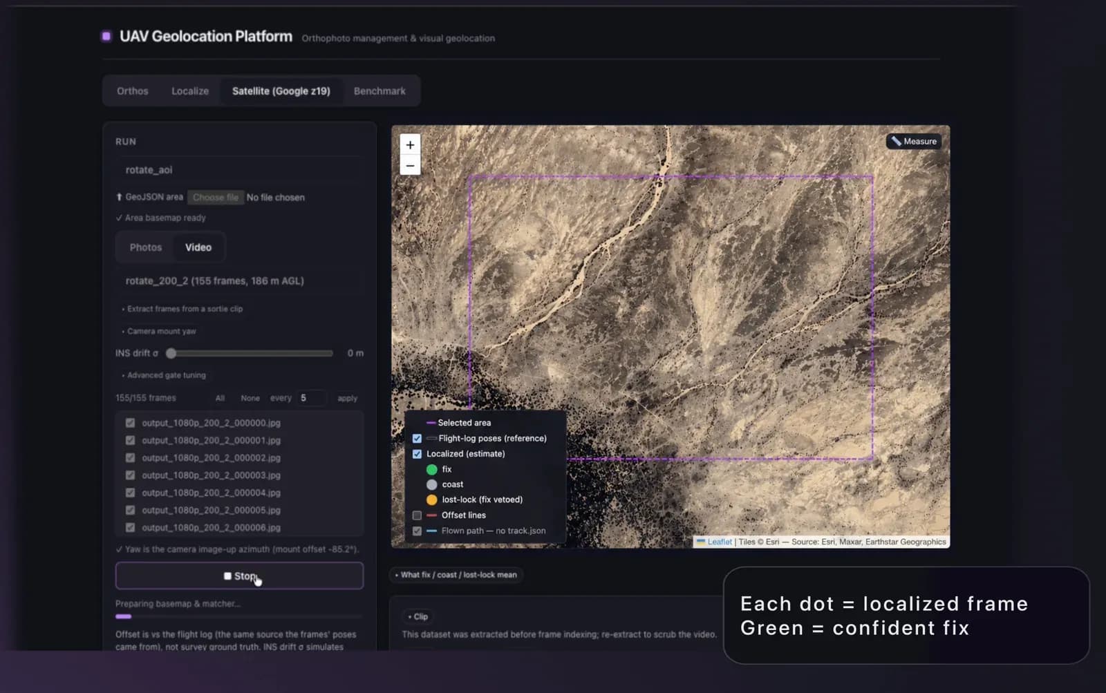
Position a drone photograph from image content alone, with no satellite fix and no positional prior. Return a WGS84 coordinate per photo, together with a confidence signal and an explicit no-fix result when the image cannot be placed. Validated end to end against centimetre-accurate RTK ground truth rather than self-reported estimates. Web dashboard for running a batch and reviewing the resulting positions on a map.
Why us
The work began by establishing ground truth: a set of drone photographs carrying centimetre-accurate RTK positions, flown over real terrain, so that every result could be scored against a known answer rather than judged by eye. A georeferenced orthophoto of the same area was prepared as the reference surface. Candidate approaches were then benchmarked blind against that set and compared on three measures that matter operationally: how close the estimated position lands, how often it lands on the right ground at all, and how long each photo takes. Getting the coordinate reference system right turned out to matter more than any other single decision.
Results
Median positional error of 3.34 metres against RTK ground truth, with every photograph in the validation set placed on the correct ground and no failures to return a fix. Processing takes well under a second per photo, which makes batch runs over a flight practical. The approach is validated and reproducible; it has not yet been delivered into an operational deployment.
What we delivered
Position a drone photograph from image content alone, with no satellite fix and no positional prior.
Return a WGS84 coordinate per photo, together with a confidence signal and an explicit no-fix result when the image cannot be placed.
Validated end to end against centimetre-accurate RTK ground truth rather than self-reported estimates.
Web dashboard for running a batch and reviewing the resulting positions on a map.