
GIS Services and Software
Company in UK
0
+
years
0
+
projects
Our Services
-

Get a managed team to take over the entire or part of your geospatial processing and analyses data and seamlessly integrating them with your in-house staff.
We helps expedite project initiation by handling satellite imagery, LiDAR data, 2D and 3D mapping, and digitizing paper maps.
This collaboration model suits both startups and large enterprises, ensuring effective cooperation and flexibility.
We are your go-to partner for high-level spatial data analysis, providing the expertise and support needed to drive your projects to success.
-

Maximize the value of your geospatial data and enterprise GIS with expert consultancy tailored to your industry’s needs.
At GIS-Point, we help businesses and organizations leverage GIS technologies for strategic decision-making, process optimization, and operational efficiency.
-

Whether you need 360° panoramic images, GPS tracks, LiDAR point clouds, or POIs, Gis Point Ltd can collect any type of data according to your specifications.
Our experienced team of mapmakers and GIS analysts can manage all types of geospatial content, ensuring top-notch quality and seamless integration into your database.
We capturing LiDAR data for:
Highways and road planning
Power line infrastructure
Railway assessment
Urban planning
Oil and gas planning
Forestry and wooded environmentsWe processing data, including:
Point cloud classification
Terrain modeling
Feature extraction
Technical mapping. -

We offer comprehensive in-house Scan to BIM services, capturing terrestrial laser scanning data to produce precise 3D models or 2D drawings.
Whether you supply the data or we conduct the site survey, we deliver a full service from initial survey to final model.
Our expertise covers a wide range of projects, from simple dwellings to complex industrial facilities.With the increasing demand for BIM, especially in government projects, our models serve as valuable resources for professionals.
Our millimeter-accurate point clouds cater to residential, commercial, industrial, heritage, and civil sites.
-

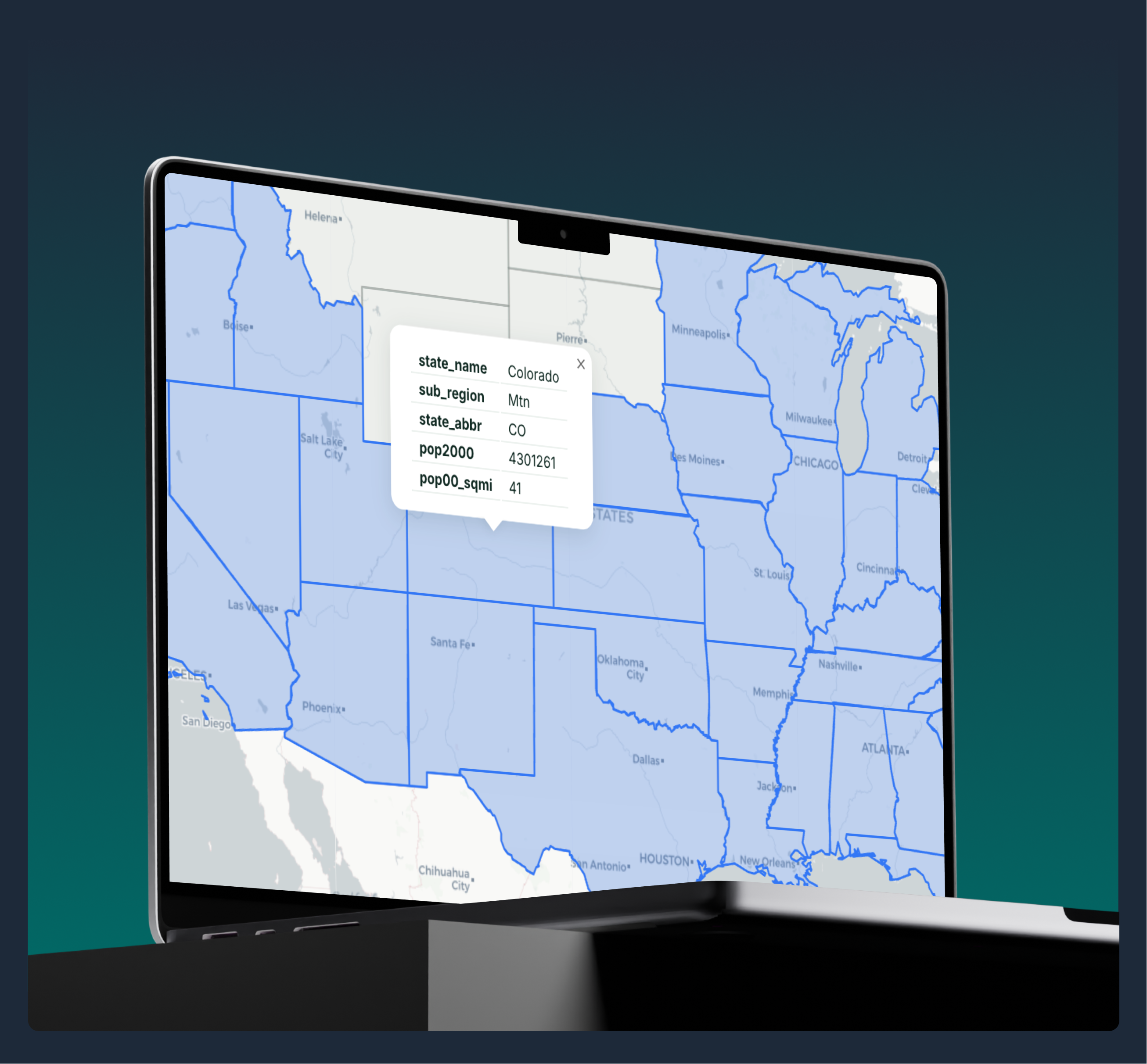
GIS Data Conversion Services simplify the transformation of geospatial data into compatible formats for seamless use across systems and applications. This involves converting data between projections, file types, and software platforms while preserving accuracy and detail. These services ensure that your spatial data is fully optimized, accessible, and ready to support efficient workflows and informed decision-making.
-

GIS Data Management Services streamline the collection, organization, and maintenance of geospatial data to ensure accuracy and usability. This includes integrating data from diverse sources, cleaning and standardizing it, and securely storing it for efficient access and analysis. These services empower businesses to make data-driven decisions, optimize operations, and unlock the full potential of spatial insights.
-

Unlock Location Insights: Geospatial App Development. Seamlessly integrate with your surroundings using our geospatial app. From mapping routes to optimizing services, elevate your app experience now.
-

Our GIS-Point team equips you with specialized desktop applications. Edit geospatial datasets, create custom maps, and generate insightful reports – all while harnessing the full potential of geographic information.
-

Discover top-tier GIS mobile application development services in the UK with GIS-Point. We specialize in creating bespoke GIS mobile apps tailored to your specific needs, ensuring optimal geospatial data management.
-

Our GIS web app development services offer cutting-edge solutions for geospatial data management and analysis. Enhance your projects with interactive maps and dashboards.
About Us
GIS-Point is a technology company with two core business directions:
1️⃣ IT Solutions & Software Development – We develop custom GIS-driven software, including mapping services, navigation systems, asset management tools, and geospatial analytics platforms for businesses looking to integrate GIS into their operations.
2️⃣ Geospatial Data Processing & Analysis – We specialize in processing and analyzing geospatial data for businesses that capture large volumes of geographic information. Our services help companies manage, clean, and transform raw geodata into actionable insights. We also support businesses in scaling their operations by building remote GIS teams, integrating GIS engineers, data analysts, and specialists into their workflows.
We help small and medium-sized businesses (SMBs) and startups implement geospatial technologies to optimize workflows, improve efficiency, and make data-driven decisions.
What We Do
🔹 Remote GIS Teams
We offer dedicated teams and team augmentation, integrating GIS engineers, developers, IT specialists, and project managers into your workflow—seamlessly and without recruitment or administrative costs.
🔹 Geospatial Solutions
We develop geo tools, mapping services, navigation systems, business portals, and asset management platforms tailored for industries such as logistics, agriculture, construction, real estate, insurance, energy (oil, gas, renewable energy), utilities, GIS, and geodesy.
We help companies optimize geospatial data management by developing solutions for data analysis, processing, and visualization of large datasets, as well as supporting geodata processing and analysis.
Why GIS-Point?
Deep Expertise
With over 15 years of experience, GIS-Point is a subsidiary of Mirnychyj, a geodesy and geology company, giving us a unique advantage—combining real-world field data expertise with cutting-edge IT solutions.
Flexibility & Cost Optimization
Our collaboration model helps businesses scale their operations while reducing costs by 15-30% in data processing and software development. We handle recruitment, insurance, taxes, and office expenses, allowing clients to work with a dedicated team at a predictable, fixed monthly rate—with no surprises or hidden fees.
International Experience
GIS-Point partners with clients across the UK, Canada, the USA, Germany, Saudi Arabia, the UAE, the Netherlands, Sweden, and Australia.

GIS-Point Technology Stack
🌍 GIS Technologies:
- GIS Platforms: ArcGIS, QGIS, AutoCAD, MapInfo
- Data Processing & Analysis: LiDAR, satellite imagery, analog maps, planimetry
- Data Cleaning & Standardization: Error correction, deduplication, formatting
- Data Conversion & Transformation: SHP, GeoJSON, KML, CSV, DWG, DXF, GeoTIFF
💻 IT Technologies:
- Programming Languages: Python, JavaScript
- Web Development: Leaflet, OpenLayers
- Mobile & Web Platforms: React, Angular, Vue.js, Flutter, React Native
- AI & Machine Learning: Machine Learning, Computer Vision
GIS-Point is your trusted partner in geospatial data processing and GIS-powered digital transformation.
📩 Contact us today to explore how we can support your business!
We have been supporting our partners at all stages of business processes!
Don’t hesitate to contact us.
Industries we
serve

Transportation
to emphasize road safety.

Logistics
enviromenrt over time.

Energy industry

Agriculture

Automotive

Delivery

Retail & E-Commerce

Real Estate
Successful Client Projects
-
Location:
Germany
Automatic Tree Recognition with ArcGIS Pro is a project that aims to develop and implement an algorithm for automatic recognition of tree species based on remote sensing data.

-
Location:
Canada
The project encompasses the digitization of utility service connections, specifically for water, sewer, and storm services, spanning across 12,706 properties (parcels) within the City.


-
Location:
Poland
The databases are created and updated by vectorizing existing raster data (topographic maps), orthophotomaps and processing geodetic files and land documentation (by coordinates and sketches).

-
Location:
Poland
Editing the automatically generated database of motorways, bridges and roads.

-
Location:
Latvia
Precision 2D Vector Map Creating at 1500 Scale

-
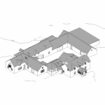
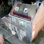
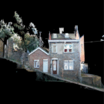
GIS-Point was commissioned to develop a digital BIM model of an existing historic farmhouse based on laser scanning data. The project included point cloud processing and modeling of the building envelope and basic interior layout in Autodesk Revit at LOD 300.

-
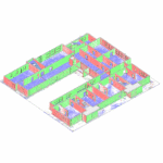
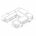
GIS-Point was engaged to develop a BIM model of a two-storey kindergarten building based on available architectural documentation and point cloud data. The project focused on creating an accurate digital representation of the building geometry, including key architectural elements such as walls, floors, roofs, and openings. The resulting BIM model was structured and optimized to support coordination workflows and prepared for export in IFC format to ensure compatibility with industry-standard BIM platforms.
-
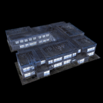
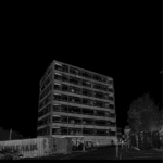
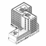
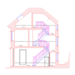
GIS-Point was engaged to update the digital documentation of an existing multi-storey commercial building following significant changes since the previous survey conducted in 2012. The project involved processing newly acquired point cloud data and developing an accurate LOD300 BIM model covering the basement, ground floor, and seven upper levels. The scope included modeling structural elements, architectural components, and visible building services, as well as generating coordinated 2D CAD drawings including floor plans, elevations, and sections at 1:50 scale. The resulting BIM model provides an up-to-date digital representation of the building to support the client’s planning and design process.

-
GIS-Point was engaged to process the laser scan data and produce accurate architectural drawings of the building. Using the provided point cloud dataset, the team analyzed the existing structure and developed detailed floor plans, building sections, and façade drawings reflecting the current condition of the property. The project focused on transforming complex survey data into clear and structured documentation to support further architectural and engineering work.
-
Location:
France
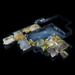
Acquiring a point cloud with a detailed classification of power lines, including the determination of the phases for each wire, and a thorough classification of the DSM terrain within a 60-meter corridor.

-
Location:
Poland
Acquiring a point cloud with specific target classes: road, sidewalk, buildings, ground, vegetation, road signs, street infrastructure, and street furniture.

-
Project on vectorization of objects obtained from mobile map data


-
Location:
Poland
Classification and build a DEM, DSM, DMT, TIN

-
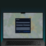
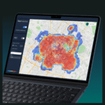
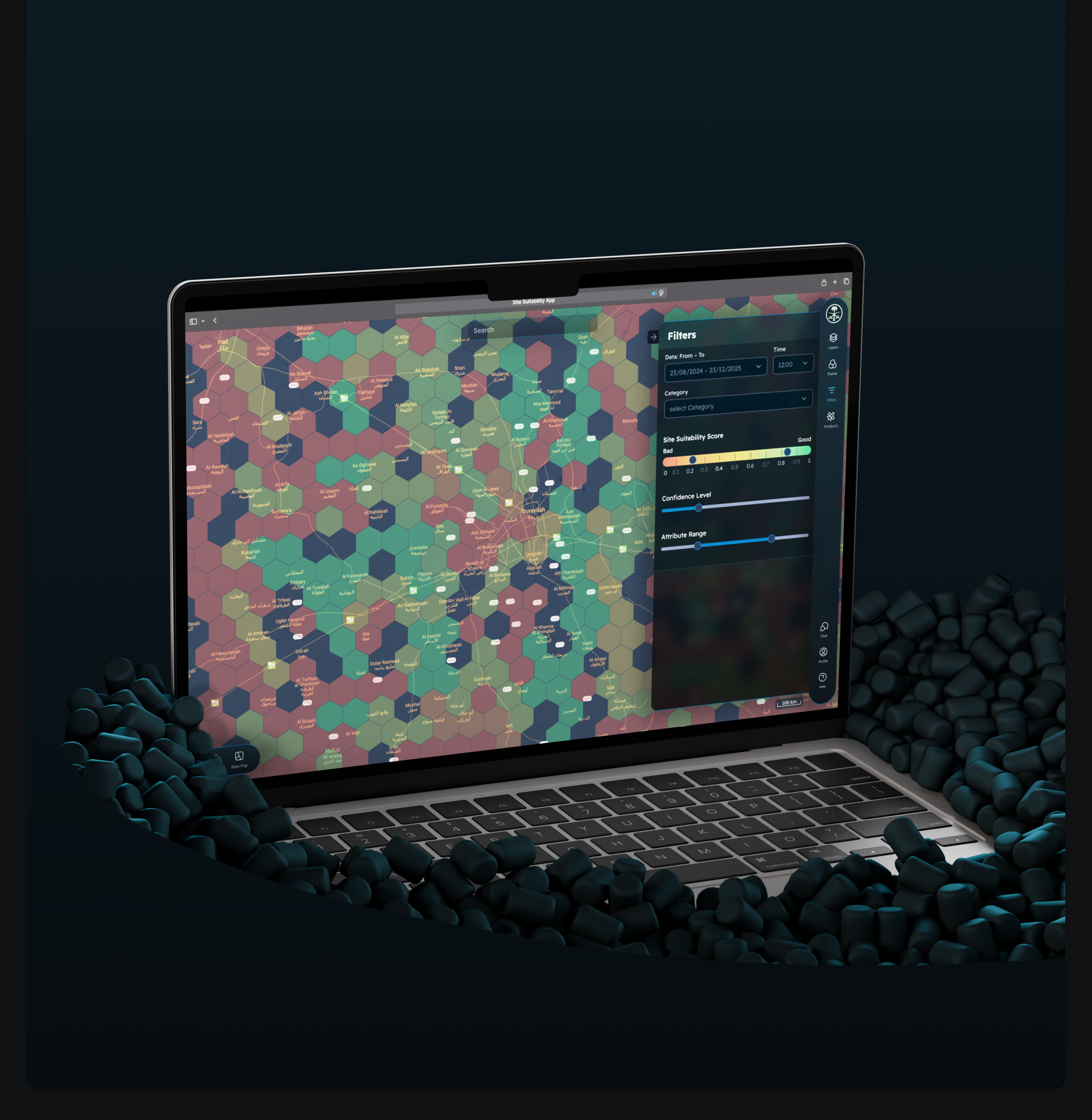
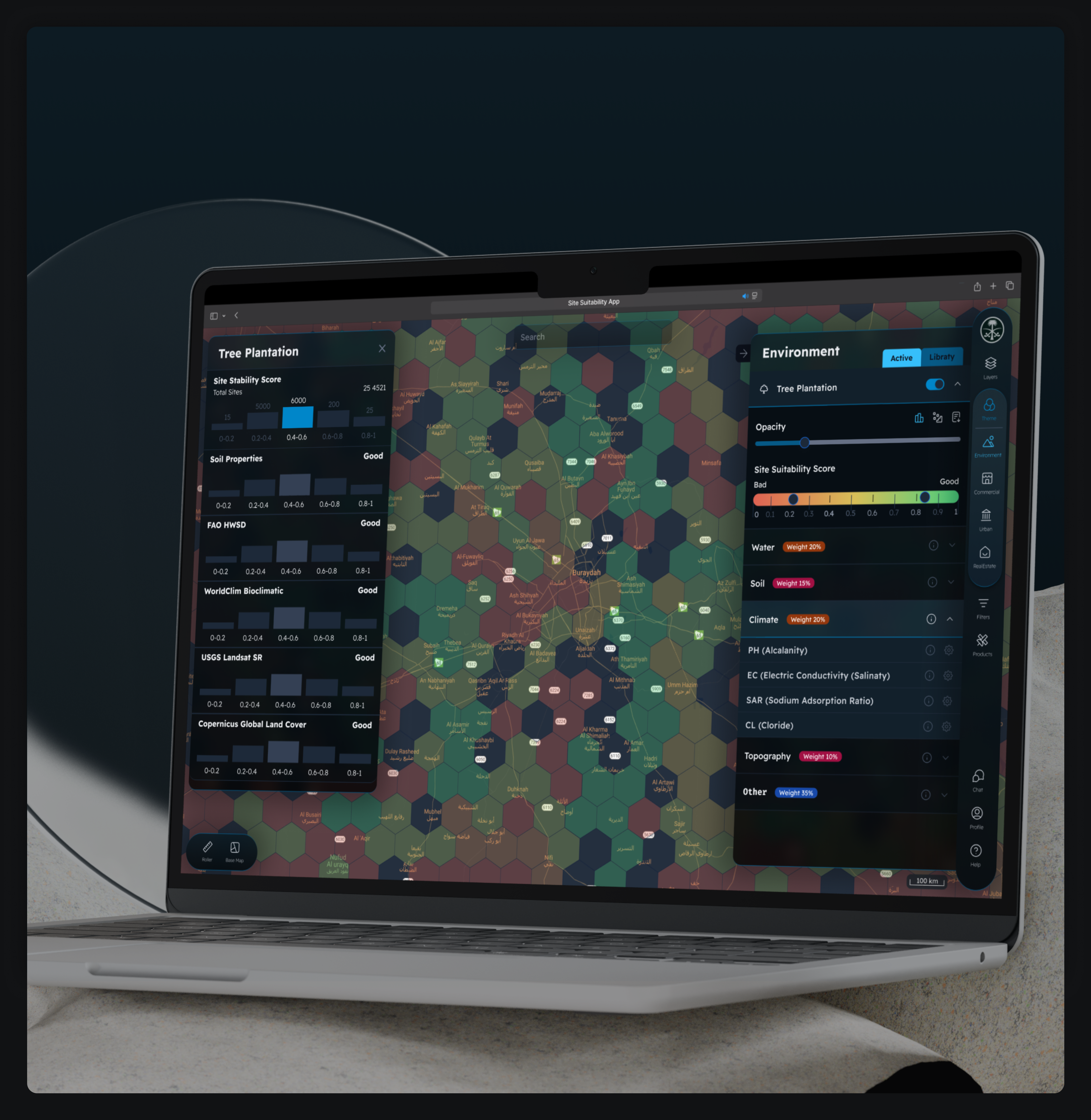
A large European retail chain was planning rapid expansion and needed a faster way to evaluate potential store locations. GIS-Point developed a GeoAnalytics platform that consolidates mobility, population, and competitive data into a single analytical environment, enabling the client to assess new locations through automated spatial analytics and interactive maps.
-
An AgTech startup needed a way to transform large volumes of agricultural spatial data into actionable insights for farm managers. GIS-Point developed Farm Intelligence AI, an AI-powered geospatial analytics platform that allows users to analyze farm data through natural language queries and visualize results instantly on an interactive map.
-
A portal for the sale of satellite images


-
Development of an Interactive Street Panorama and GIS Layer Management Platform


-
Software development for a weather forecast program


-
Development of a Precision Agriculture Site Monitoring Platform


-
Development of a Web-Based 3D Point Cloud Visualization Platform


-
Development Web Platform for Digital Soil Mapping and Analysis
Our team of
professionals

Ievgen Lavrishko

Khrystyna Bochko

Alevtyna Kostianchuk

Andriiana Pavlyshyn

Roman Nahaiovskyi

Maria Kizim

Ivanna Soltys
Our clients say

Working on the Project:
A Step-by-Step Journey to Success
PREPARATION
task, provide samples, templates,
instructions.
PILOT PROJECT
for FREE, according to all your
instructions.
AGREEMENT
the cost of further work
LET’S STARTED!
NDA, after which our team gets to
work.
Our way in
business
OUR INTERNATIONAL PARTNERS

Germany
Experts for project, product & business development within construction, infrastructure and manufacturing.

Ukraine
The largest IT community in Ukraine.

Latvija
Provides services related to geodetic works and acquisition and processing of geospatial data.
Ukraine

Mirnychiyj – geodetic and geological group.

United Kingdom
An independent UK organisation representing the geospatial sector
United Kingdom
An independent organisation advancing agricultural innovation by connecting farmers, science, and technology.
United Kingdom
A network uniting farmers, researchers, and tech leaders to solve real agricultural challenges through innovation.

Belgium
A non-profit organization that promotes standards, innovation, and collaboration in the aerial geospatial industry.
Looking for expert project implementation or advice?
Contact us now!
Office United Kingdom
Devonshire str., 41, Ground
Floor, London W1G 7AJ, UK
Office Estonia
Harju maakond, Tallinn, Kesklinna linnaosa, Kaupmehe tn 7-120, 10114, Estonia