Software EngineeringGIS & Geospatial
Asking a Map Questions in Plain English
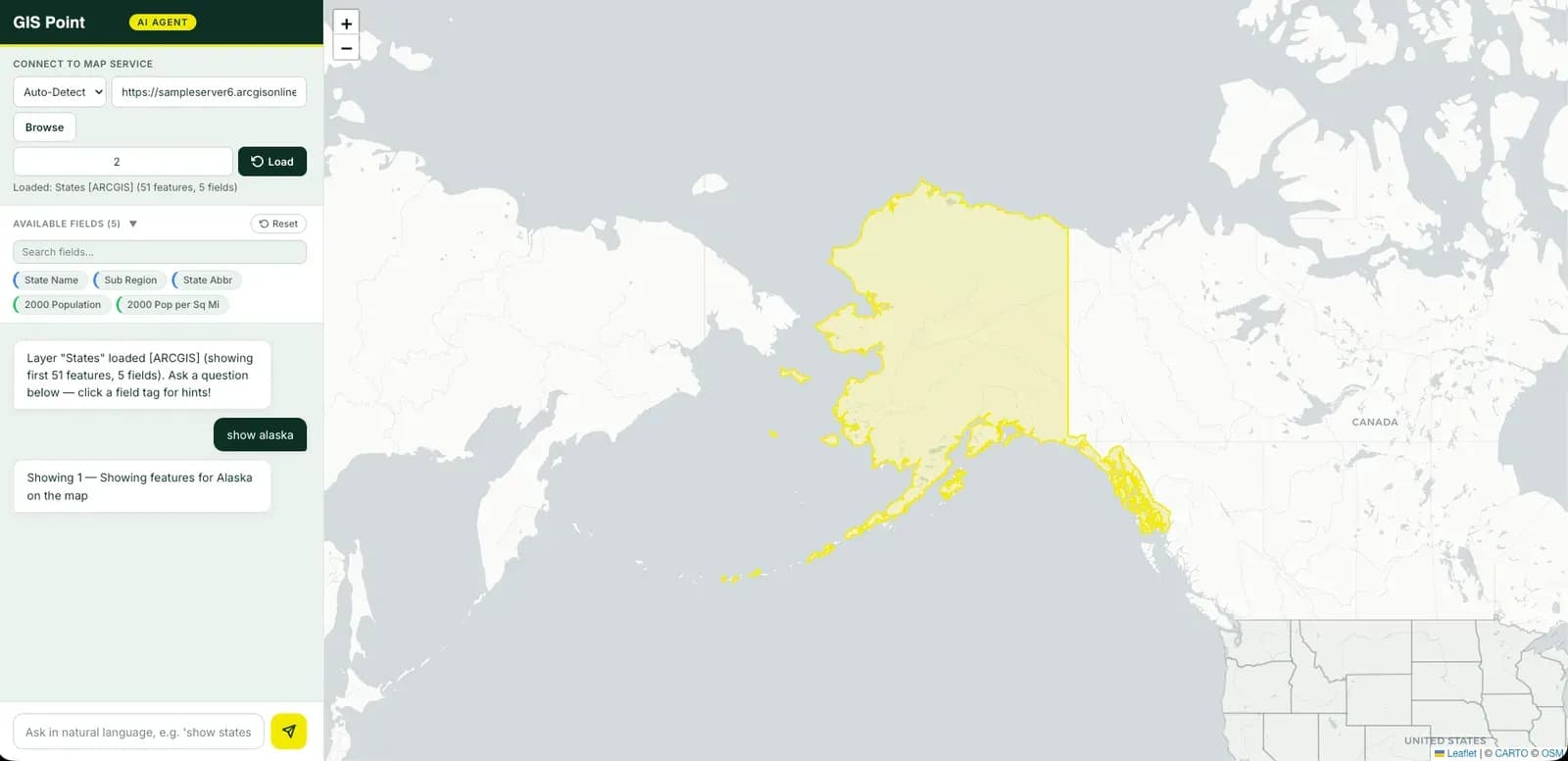
A natural language interface to existing GIS services. A user types a question the way they would ask a colleague, and gets the answer back as a filtered layer on an interactive map.
Project snapshot
Internal capability development, built against public GIS services.
- Location
- On-premise deployment
- Team
- A small team across backend engineering, applied AI and frontend.
Stack
- Backend
- Python, FastAPI
- Data & AI
- Self-hosted open-weight language model, PostGIS, Elasticsearch
- Frontend
- React, TypeScript, Leaflet
- Integrations
- ArcGIS REST services
- Infrastructure
- Docker
The challenge, and what closed it
Technical challenge
Language models produce plausible output whether or not it is correct, so nothing they generate can be trusted directly against a data source. Users also ask questions loosely, with vague terms and implicit context, while the underlying services expect precise field names and exact values. Different data sources answer different kinds of question, so routing a question to the right one is part of the problem rather than a detail. And a self-hosted model must stay small enough to run on ordinary hardware while still handling the translation reliably.
What we did
Ask a question in plain English and see the matching features on a map, with no query language to learn. Works against services an organisation already runs, rather than requiring data to be migrated somewhere new. Reads across several kinds of data source, so one question can be answered from whichever holds the answer. Runs entirely on the organisation's own infrastructure, with a self-hosted open-weight language model, so no data leaves the premises.
Why us
The starting position was that analysts who understand their data often cannot get answers from it, because the question has to be expressed in a query language first. The design that followed draws a hard line: the language model is a translator, not an executor. It converts a sentence into a query expression and stops there. Application code validates that expression, applies it to the appropriate data source and returns the result, which means a malformed or unexpected model output fails safely instead of reaching the data. Deployment targets the organisation's own hardware from the outset, because the natural users of this are organisations whose data cannot be sent to a third-party service.
Results
Analysts can interrogate spatial data directly instead of routing requests through a GIS specialist, which removes a queue rather than speeding one up. Because the interface sits in front of services an organisation already runs, it adds a capability without a migration. Self-hosting keeps regulated or sensitive data on the organisation's own infrastructure, which is what makes the approach viable for the sectors most likely to want it.
What we delivered
Ask a question in plain English and see the matching features on a map, with no query language to learn.
Works against services an organisation already runs, rather than requiring data to be migrated somewhere new.
Reads across several kinds of data source, so one question can be answered from whichever holds the answer.
Runs entirely on the organisation's own infrastructure, with a self-hosted open-weight language model, so no data leaves the premises.