Data ProductionGIS & Geospatial
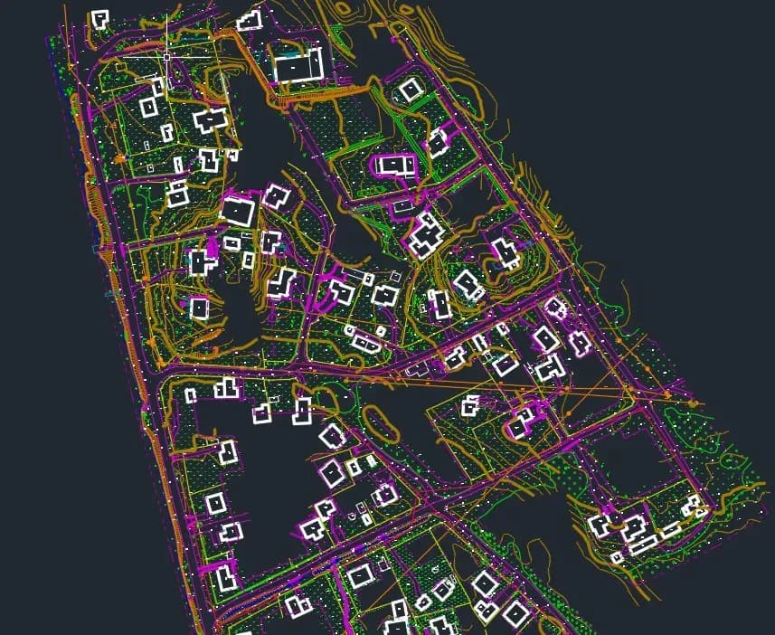
Topographic drawing at a scale of 1:500
A 1:500 topographic drawing over 55 hectares from LiDAR and orthophoto, with elevation marks, roads, ditches and rivers vectorised to spec.
Project snapshot
The market leader in Latvia in providing geodetic and cartographic services.
- Location
- Latvia
- Team
- The GisPoint team involved in the project consisted of four cartographers and a project manager. We worked on a 1:500 scale topographic drawing partner company from Latvia, using AutoCAD Civil 3D software, the team processed LIDAR data and orthophoto images, created a 2D vector map based on laser scanning and complied with Latvian legislation.
Stack
- Survey & CAD
- AutoCAD Civil 3D: the main tool for data processing and mapping. It automates parts of infrastructure design, which cuts development time. MicroStation CONNECT: used for design and modelling, producing engineering models and drawings and integrating with the other tools in use. Together they let the team work through large data volumes at speed and keep the output accurate. Passing data between the applications removed manual steps, which lowered both risk and effort.
The challenge, and what closed it
Technical challenge
Data volume: large amounts of LiDAR data, needing hardware to match and efficient processing algorithms. Detail: the topographic map detail requirement was high, and meeting it took close data analysis and manual revision. Regulatory framework: the maps had to comply with Latvian legislation on topographic map creation.
What we did
Strict compliance with the terms of reference. Clear work schedule. Regular reporting.
Why us
Data analysis: Detailed analysis of lidar data and orthophotos to identify terrain features, infrastructure and other elements to be vectorised. Terrain vectorisation: Horizontals: Create horizontals in 0.5 m increments for detailed mapping of landforms. Elevations: Placement of elevation marks in 20 m increments on roads and at characteristic terrain points (highest and lowest points). In other areas (forest, meadow, etc.), elevations were placed in 15 m increments. Linear objects: Vectorisation of ditches, rivers, ravines and other linear terrain features. Vectorisation of infrastructure objects: Vectorisation of roads, buildings, green spaces and other infrastructure objects based on orthophoto and lidar data. Quality control: Perform detailed visual and attribute quality control of vectorisation to identify and correct errors.
Results
GisPoint produced topographic maps at 1:500 scale across 185.55 hectares. The maps comply with Latvian legislation and are used for: Territory Planning: urban planning documentation, infrastructure design. Engineering Calculations: design of roads, bridges, engineering networks. Cadastre: registration of land plots, determination of property boundaries. Other Purposes: scientific research, monitoring changes in the terrain.
What we delivered
Strict compliance with the terms of reference
Clear work schedule
Regular reporting