Software EngineeringGIS & Geospatial
Web-Based Site Suitability Analysis Platform
A multi-criteria site suitability platform for an urban planning and development organisation in Saudi Arabia.
Project snapshot
An urban planning and development organisation working on smart cities and location intelligence.
- Location
- Saudi Arabia
- Team
- Software developers, remote sensing specialists and cloud engineers, led by a project manager running an agile delivery cycle.
Stack
- Backend
- .NET Core, ABP Framework
- Frontend
- Angular
- Data & AI
- PostgreSQL, Elasticsearch
- Infrastructure
- AWS (EC2, S3)
The challenge, and what closed it
Technical challenge
Rendering thousands of scored hexagons without losing interactivity. Isolating data, branding and permissions across organisations on shared infrastructure. Letting administrators create and tune scoring models without a developer.
What we did
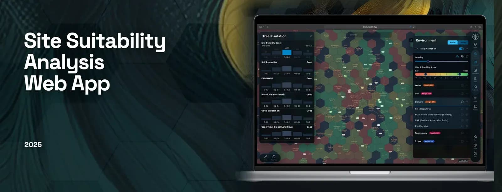
Interactive hexagon grid that adapts resolution to zoom level, so suitability reads at both city and street scale. Toggleable supporting layers - transportation networks, infrastructure, environmental zones - to refine a shortlist. Admin console for model creation and factor configuration, layer management, branding and user roles. Multi-tenant support: separate organisations get their own domain, datasets and configuration.
Why us
Requirements and decision-model workshops with planners, then an interactive map design that adapts resolution to zoom. Delivery ran iteratively through the analytics engine, real-time score visualisation, and multi-tenant setup with custom branding, closing with QA and performance testing of large-scale map rendering.
Results
The platform makes location evaluation tractable for non-GIS specialists, cutting the time and expertise a spatial analysis workflow demands. It now supports data-driven decisions in site planning, infrastructure expansion and environmental assessment.
What we delivered
Interactive hexagon grid that adapts resolution to zoom level, so suitability reads at both city and street scale.
Toggleable supporting layers - transportation networks, infrastructure, environmental zones - to refine a shortlist.
Admin console for model creation and factor configuration, layer management, branding and user roles.
Multi-tenant support: separate organisations get their own domain, datasets and configuration.