Data ProductionGIS & Geospatial
Digital 3D Mapping from Mobile LiDAR
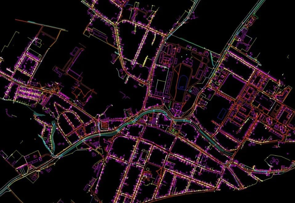
This project involved creating and updating digital spatial 3D maps of road networks across 1135 km and 736 km using mobile LIDAR scanning, orthophoto, and aerial scanning data.
Project snapshot
A geodetic and engineering company specializing in surveying, property management, and geospatial solutions.
- Location
- Czech Republic
- Team
- A GisPoint team specialising in LIDAR scanning, 3D mapping, and infrastructure monitoring handled data collection and processing, and produced the road network representation.
Stack
- Survey & CAD
- Marushka 3D Design: Used for 3D vectorization and map creation Mobile LIDAR and Aerial Scanning: Employed for accurate data collection
The challenge, and what closed it
Technical challenge
Processing and joining data from two scanning technologies, mobile and aerial LIDAR. Holding 3D vectorisation precise enough to represent infrastructure elements correctly. Keeping a large data volume consistent and accurate across the mapped areas.
What we did
Creation and update of electronic vector maps for road networks from mobile LIDAR scanning data. Orthophotos at 5 cm precision for object recognition. 3D vectorisation in X, Y, Z coordinates to represent the road and the infrastructure around it. Aerial scanning and 365-degree photos added for monitoring and analysis. Data integrated for road modernisation and redevelopment planning.
Why us
Data Acquisition: LIDAR scanning, mobile and aerial, was run across large distances, with high-precision orthophotos and 365-degree images alongside. 3D Mapping: the data was processed and vectorised in 3D (X, Y, Z coordinates) in Marushka 3D Design. Data Integration: the sources were combined into current road network maps. Final Adjustments: quality checks confirmed the maps met the requirements for infrastructure monitoring and future project planning.
Results
The project produced detailed, current 3D vector maps of the road networks and the infrastructure around them. The maps go on to serve road condition monitoring, modernisation planning, and future infrastructure work.
What we delivered
Creation and update of electronic vector maps for road networks using mobile LIDAR scanning data
Utilization of orthophotos with 5 cm precision for detailed object recognition
3D vectorization using X, Y, Z coordinates to accurately represent road and surrounding infrastructure
Aerial scanning and 365-degree photos added for monitoring and analysis
Integration of data for road modernization and redevelopment project planning