Data ProductionGIS & Geospatial
Topographic Database Update at 1:10,000
Updating a topographic database from orthophotomaps across 17,000 km²: verifying existing objects, correcting them and adding what was missing.
Project snapshot
A county administrative department specializing in geodesy and property management.
- Location
- Poland
- Team
- 8 cartographers, quality controllers, and a project manager from GIS-Point. Before the project started, the client was trained on the processing technology and the project specifics.
Stack
- Survey & CAD
- The project used ArcGIS for processing orthophotographs, verifying and updating topographic features, and performing geometric corrections.
The challenge, and what closed it
Technical challenge
These are specialised maps, and their mapping characteristics set the standard every update had to meet against the real-world environment.
What we did
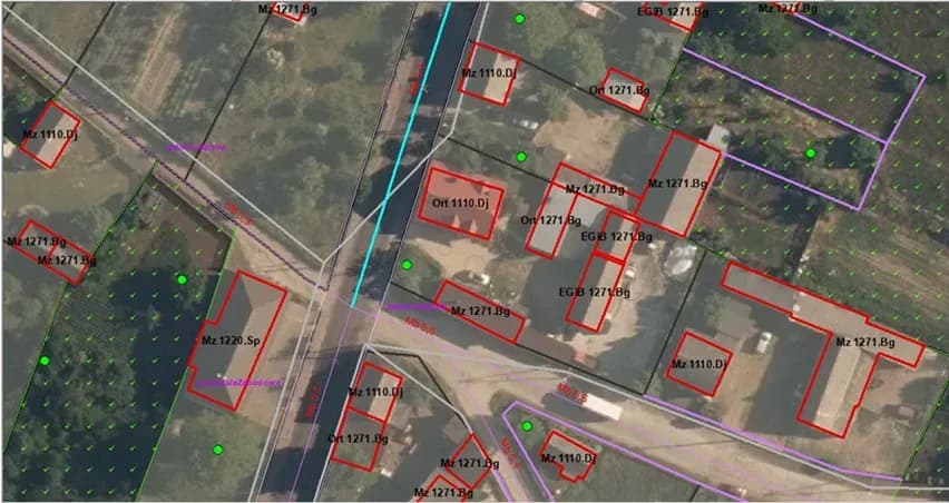
Used orthophotographs to update topographic objects. Verified accuracy of existing database entries. Added new topographic objects as needed. Corrected object geometry. Updated attribute information. Performed topological checks.
Why us
Work started from orthophotographs, used to assess and update the existing topographic database. The team checked the current topographic features against them, corrected discrepancies, and added objects where there were gaps. Geometric adjustments brought features up to current mapping standards. The attribute table was updated with object types, materials, and other attributes. Topological checks found and resolved object overlaps and gaps. The client stayed close to the work throughout, and the updates were integrated back into the database.
Results
The topographic database was updated and now carries more weight for urban planning, infrastructure development, and other uses. Topological issues took little time to resolve.
What we delivered
Used orthophotographs to update topographic objects
Verified accuracy of existing database entries
Added new topographic objects as needed
Corrected object geometry
Updated attribute information
Performed topological checks