Smarter, Sustainable and Profitable Farming with Agro AI
Agro AI by GIS-Point helps you:
1. Grow more with less.
2. Use resources responsibly.
3. Stay resilient to climate risks.
Trusted by Geospatial and Agritech Innovators
We deliver GIS, remote sensing, and data projects for European engineering, mapping, and agriculture-focused companies – and now the same team brings AI and machine learning to the agricultural sector.
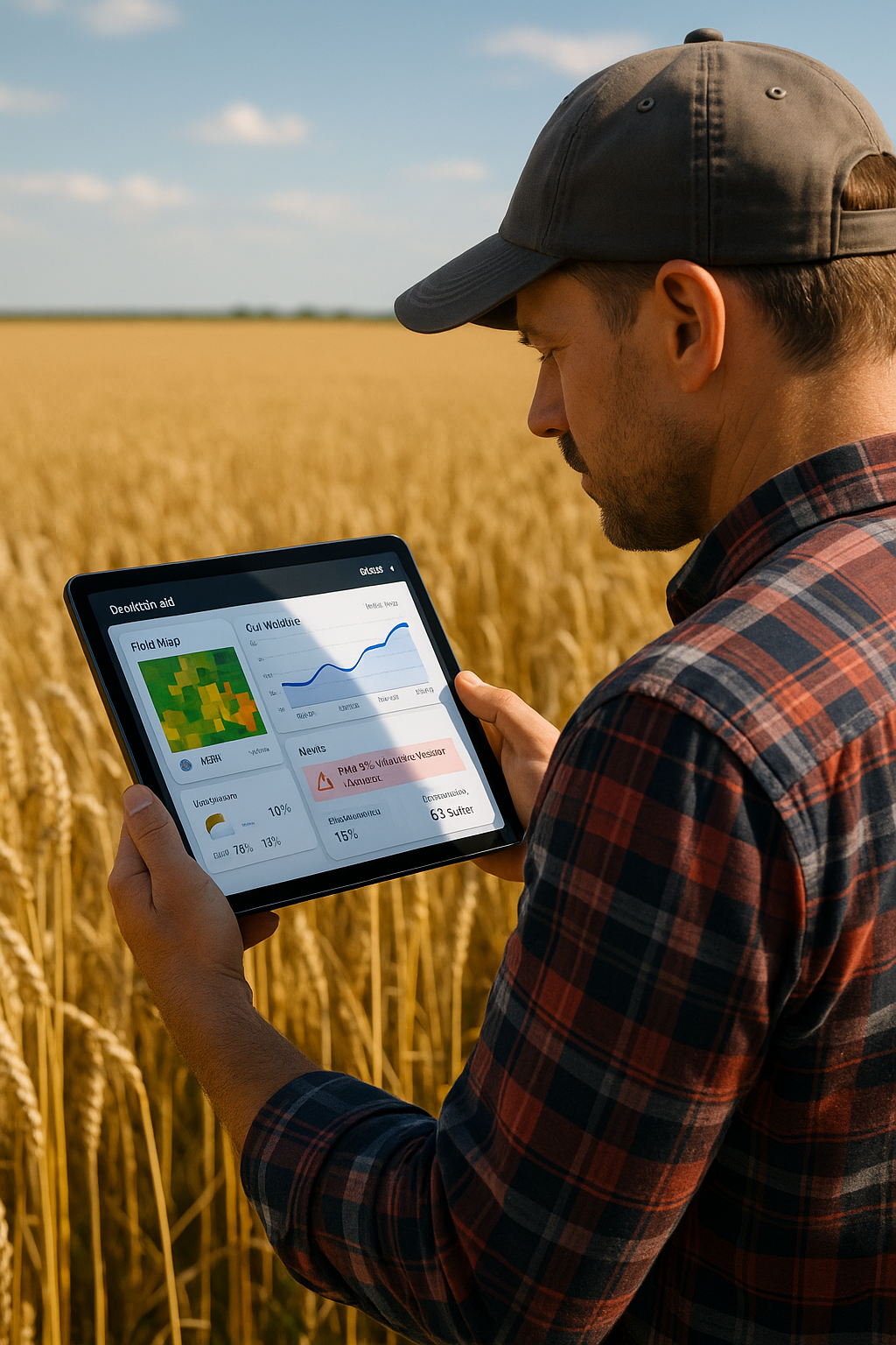
Why Agriculture Needs AI-Powered GIS Today
| Pains | Agro AI Solutions |
|---|---|
| Fragmented data sources. Satellite imagery, drone data, IoT sensors, weather stations, and ERP systems are not connected into one decision-making layer. |
We build unified AI models that merge satellite indices, weather time series, yield history, and machinery data to deliver field-level predictions and risk scores. |
| Investments in technology without clear ROI. You already pay for satellite monitoring, drones, sensors, and software – but decisions are still made “by eye”. |
Our models simulate scenarios and quantify ROI for fertilizer rates, seeding dates, hybrids, and crop-protection strategies, showing real savings in inputs and operational costs. |
| Lack of in-house data science for agriculture. Building your own AI and ML team is expensive and takes years. |
You get a dedicated team of GIS engineers and ML specialists who design, train, deploy, and support AI models tailored to your fields and business goals. |
| Climate volatility and agronomic risks. Weather anomalies, soil degradation, and high field variability make planning and budgeting harder every season. |
Risk and yield models, scenario planning, and recommendations for crop rotation and stress management help you make resilient decisions under uncertainty. |
Have an AI Idea for Your Fields?
Tell us about your agricultural data and challenges – we will help you shape a realistic Agro AI roadmap.
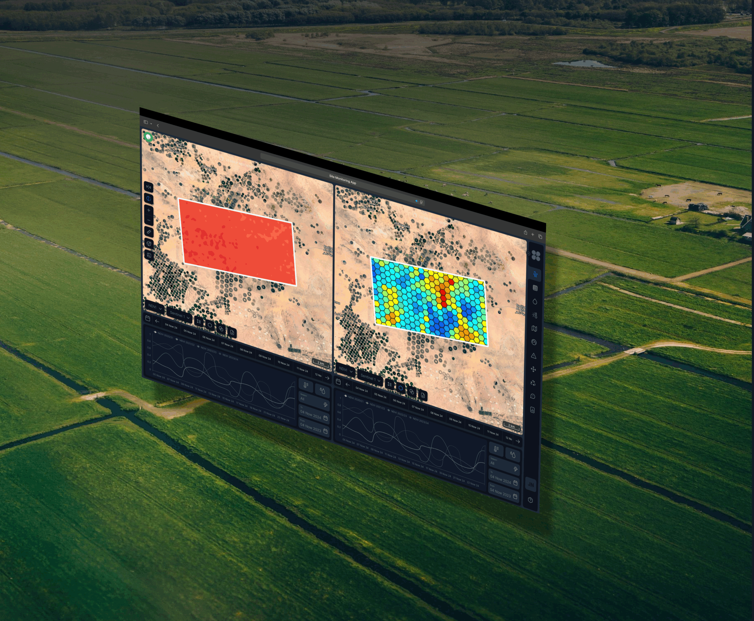
What You Get with Agro AI
-
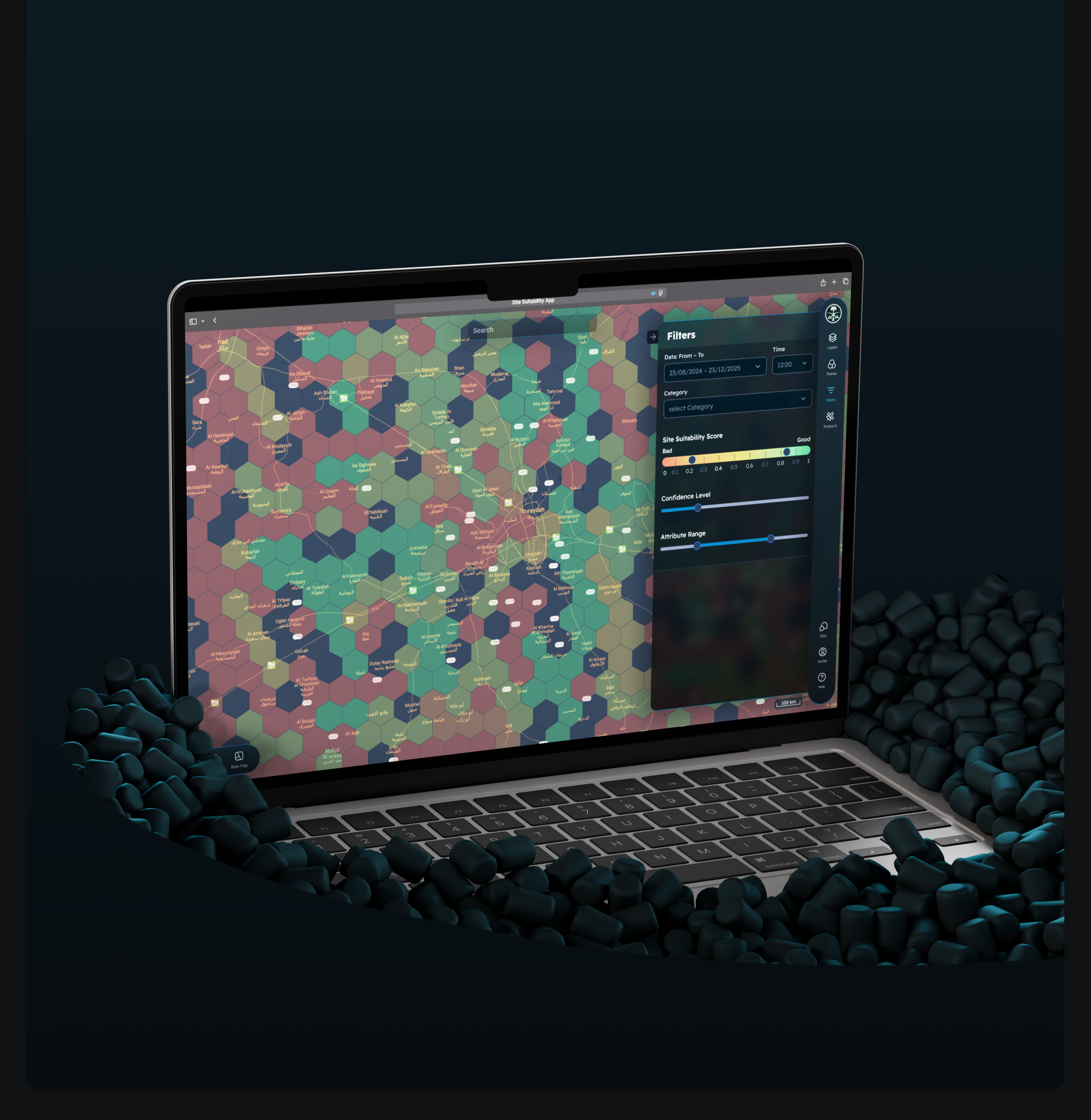
AI-Ready Geospatial Pipeline.
We design data pipelines that turn satellite imagery, drone photos, IoT streams, and field records into clean features ready for machine learning.
-
Crop Health and Yield Prediction.
Predict yield and detect crop stress early using vegetation indices, weather data, soil parameters, and historical performance.
-
Field Zoning and VRA Maps.
Automatically generate management zones and variable-rate application maps for fertilizers, crop protection, and seeding.
-
Explainable AI for Agronomists.
Understand which factors drive model recommendations with feature importance, explainable models, and clear “what-if” scenarios – not a black box.
-
Integration with Your Existing Stack.
Deliver AI insights via APIs, web GIS, dashboards, and mobile apps integrated with your farm management systems and platforms.
-
Dedicated AI and GIS Teams.
Work with a focused team of data scientists, ML engineers, and GIS specialists who know both geospatial technologies and agricultural workflows.
Business Impact with Agro AI
AI-Powered Agriculture Solutions We Deliver
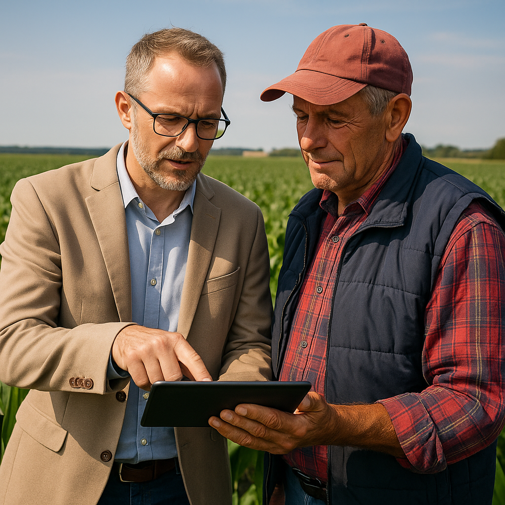
Who Uses Agro AI
- Agribusinesses and cooperatives
Centralised monitoring, benchmarking across fields and farms, and better planning of yields, storage, and logistics. - Agritech startups and platforms
Embedded AI modules – yield models, zoning engines, satellite analytics – delivered as white-label or via APIs.
- Agricultural machinery manufacturers and OEMs
Analytics on telemetry data, predictive maintenance, and decision support for machine operators. - Advisory, research, and climate programmes
Trial analytics, impact assessment of agronomic practices, carbon and soil degradation models, and risk maps.
Our Services
-

Discover agriculture tech and agritech solutions for UK farming: precision GIS mapping, orthophoto, DEM/DTM/DSM, AI/ML analytics and MVP delivery with expert teams.
-
Turn fragmented sensor data into profit. GIS-Point develops custom software ecosystems that integrate disconnected IoT hardware into a single management tool for the British agri-tech market.
-

Rapidly transform your innovative ideas into functional products with GIS-Point’s MVP development services. We specialize in crafting Minimum Viable Products (MVPs) that allow startups and businesses to validate concepts, gather user feedback, and accelerate time-to-market with minimal risk and investment
-

At GIS-Point, we specialize in delivering UX/UI design services that bridge the gap between complex geospatial data and user-friendly digital experiences. With over six years of experience in GIS and software development, our team understands the intricacies of spatial data and how to present it effectively to end-users.
-

Transform geospatial data into strategic insights with artificial intelligence and machine learning.
In an era where geospatial data volumes are rapidly increasing, efficient processing and analysis have become critically important. Our AI/ML solutions assist in automating the processing of GIS and GEO data, detecting anomalies, forecasting changes, and optimizing infrastructure management.
-

Empower your projects with our expert-managed teams. At GIS-Point, we provide dedicated teams tailored to your technical requirements and cultural expectations, ensuring seamless integration, efficiency, and scalability
-

GIS-Point delivers end-to-end support for your startup’s growth.
At GIS-Point, we specialize in supporting startups and scale-ups through every stage of their journey—from initial concept to market-ready product. With over 6 years of experience, our team offers comprehensive services tailored to the unique needs of emerging businesses.
-

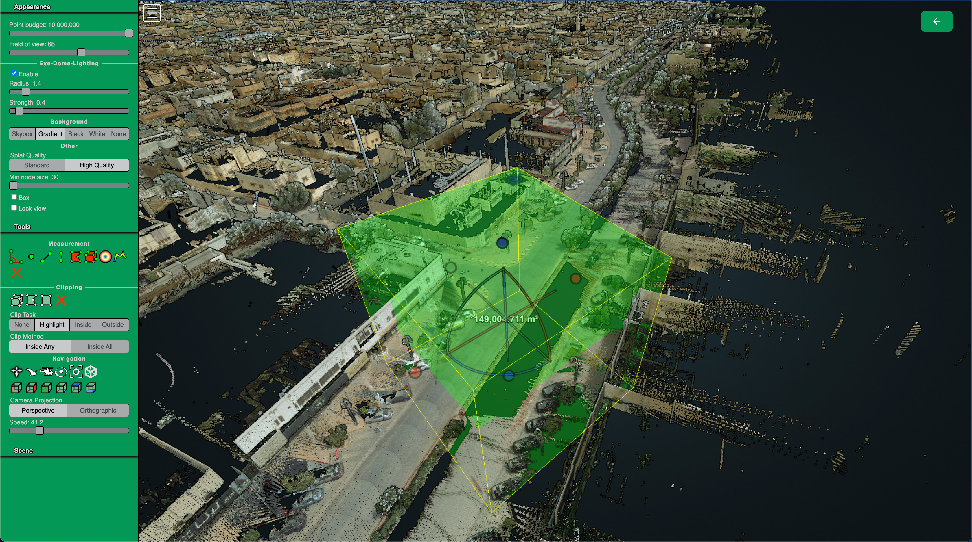
High-Precision Elevation Data for Geospatial Analysis, Terrain Mapping, and Infrastructure Planning
-

Orthophoto generation is the process of transforming aerial and drone imagery into geometrically corrected, true-scale images. Unlike standard aerial photographs, orthophotos eliminate distortions caused by terrain relief, camera angles, and lens distortions, making them highly accurate for GIS applications, land surveying, and infrastructure planning.
Agro AI FAQ
-
What data do we need to start an Agro AI project?
You can start with satellite imagery and basic field data, and then extend to soil maps, yield history, IoT sensors, and machinery telemetry.
-
Can you work with our existing satellite or IoT provider?
Yes. We integrate data from your current providers and platforms instead of forcing you to change your technology stack.
-
Who owns the models and intellectual property?
IP and deployment rights are defined upfront in the contract – we can transfer model ownership or provide managed services.
-
How do you validate model accuracy in the field?
We combine backtesting with field trials, control plots, and agronomist feedback to ensure that models work in real conditions.
-
Do you support on-premise deployments if cloud is not an option?
Yes. We can deploy models and services on your infrastructure in addition to or instead of public cloud.
Let’s Build Your Next Agro AI Solution
Share a short description of your fields, data sources, and goals – we will come back with a tailored Agro AI proposal and timeline.
United Kingdom
Devonshire str., 41, Ground Floor, London W1G 7AJ, UK
Germany
Estonia
Harju maakond, Tallinn, Kesklinna linnaosa, Kaupmehe tn 7-120, 10114, Estonia
Ukraine
Lviv, Sadova street, 2a/1
AI for Agriculture – Agro AI Solutions for Modern Farming
Artificial intelligence in agriculture (agriculture AI) is transforming traditional farming into a high-tech industry capable of addressing global food security challenges. Implementing Agro AI solutions enables farmers to optimise production processes, reduce costs, and increase yields through precise data analysis and intelligent decision-making.
Evolution and Technological Foundations of AI in Farming
The use of artificial intelligence for agribusiness (AI for agribusiness) has come a long way from simple automation systems to advanced machine learning platforms. Modern precision agriculture AI technologies integrate the internet of things (IoT), cloud computing, advanced sensor systems, and edge computing to create comprehensive farm management solutions.
Historically, the use of data in agriculture began in the 1990s with soil and yield maps. By around 2010, automation and large-scale equipment integrated with GPS and automatic steering systems became widespread, reducing operational workload and improving data collection. Around 2012, “decision making in agriculture” emerged, with tractors and harvesters connected to the internet, enabling real-time data collection.
Meet the Team

Ievgen Lavrishko

Khrystyna Bochko

Alevtyna Kostianchuk

Andriiana Pavlyshyn

Roman Nahaiovskyi

Maria Kizim

Ivanna Soltys
Key Applications of AI in Agriculture
Precision Agriculture with Precision Agriculture AI
AI systems for farming (AI for farming) are revolutionising crop production by implementing variable-rate applications of fertilisers and water, driven by GPS and real-time sensor data. Variable-rate application technologies use either a map-based or sensor-based approach to optimise the use of resources.
Map-based systems adjust application rates based on pre-generated prescription maps, taking into account the position in the field via a GPS receiver. Sensor-based systems use real-time data to regulate the dosage and placement of a particular input, ensuring maximum accuracy of treatment.
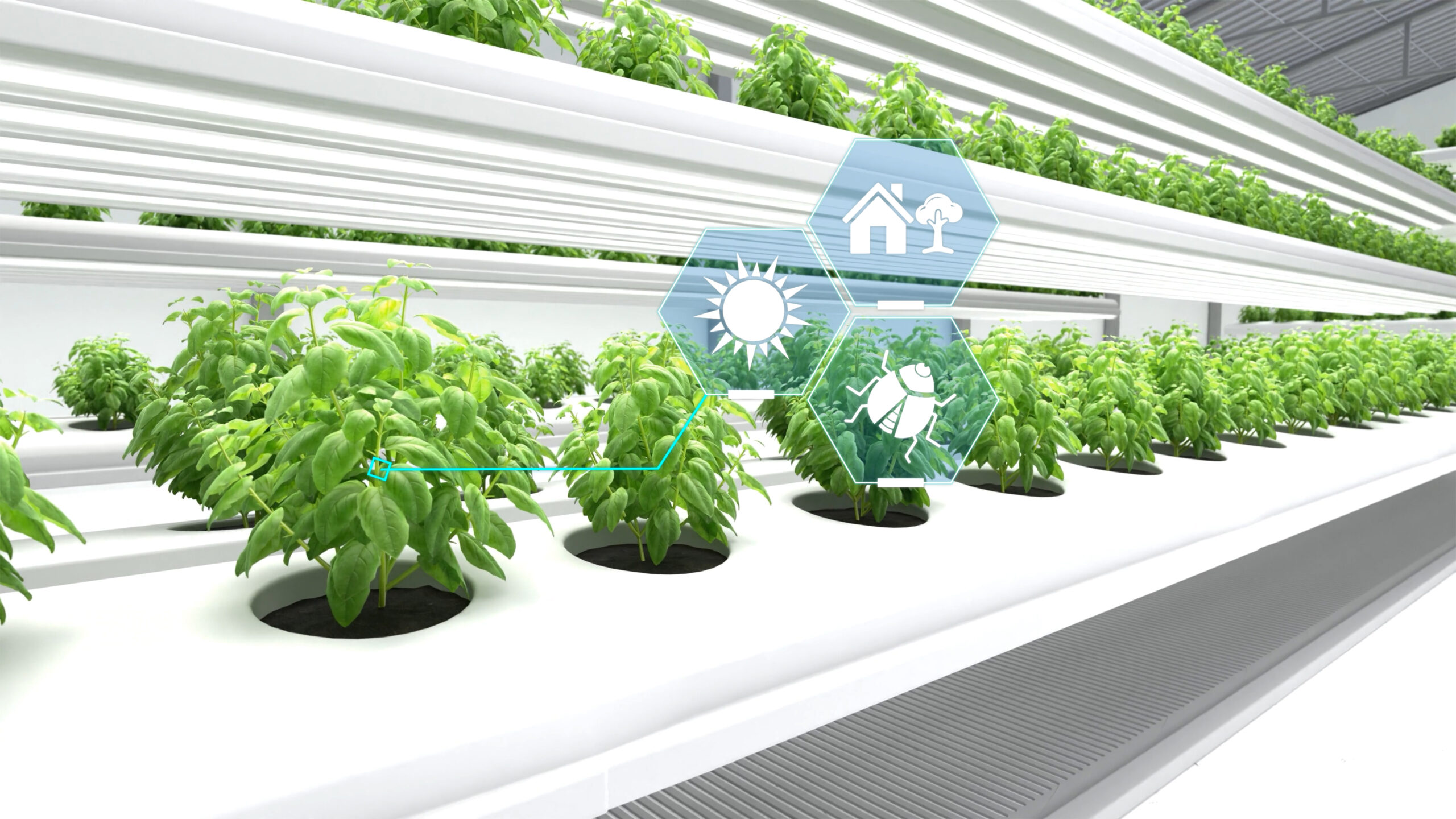
Crop Monitoring Using AI
Intelligent crop monitoring systems use computer vision and deep learning to analyse images captured by drones, satellites, and ground-based sensors. Multispectral imagery makes it possible to detect plant stress, diseases, and pests at early stages, when intervention is most effective.
Image-based disease classification systems demonstrate high accuracy in detecting a wide range of pathogens, enabling farmers to take targeted protective measures. Early problem detection through crop monitoring using AI helps preserve yield and reduce the use of chemical protection products.
Yield Prediction
Yield prediction technologies integrate weather data, soil conditions, historical performance, and satellite imagery to generate accurate forecasts. Neural networks and machine learning algorithms analyse huge volumes of multidimensional data, revealing complex correlations between environmental factors and crop productivity.
Yield prediction systems enable farmers to plan logistics, optimise resource use, and make well-founded economic decisions long before harvest. Economic impact modelling helps identify the most profitable cultivation strategies for a farm’s specific conditions.
Industries
Agriculture
Geospatial Sector
Transport and Supply Chain

Retail & E-Commerce

Real Estate
Energy industry
Quantified Impact of AI and ML Adoption in Agriculture
Research demonstrates clear, measurable benefits from implementing artificial intelligence and machine learning technologies in farming:
| Area of Implementation | Improvement Metric |
|---|---|
| Yield | +15–30% yield increase |
| Water use efficiency | −20–41% reduction in water consumption |
| Reduction of losses from pests and diseases | −30% reduction in yield losses |
| Reduction in use of chemicals | −33% reduction in fertiliser and pesticide use |
| Reduction in labour costs | −25% reduction in labour costs |
| Reduction in carbon footprint | −20% reduction in CO₂ emissions |
| Growth in precision agriculture adoption | +40% growth in recent years |
Table 1: Quantitative indicators of the impact of AI and ML in agriculture
Scientific Publications
Ali, Z. et al. (2025). Artificial Intelligence for Sustainable Agriculture. Sustainability.
Liakos, K. et al. (2018). Machine Learning in Agriculture: A Review. Sensors.
Kumari, K. et al. (2025). AI-Driven Future Farming. AgriEngineering.
Chavula, P. et al. (2025). AI Integration in Agricultural Economics. LatIA.
These figures illustrate the transformative potential of agriculture AI technologies for achieving both economic and environmental goals in modern farming.
AI-Based Decision Support Systems
Intelligent farm management dashboards bring together data from multiple sources into a single interface for comprehensive monitoring and planning. These systems provide visualisation of soil health indicators, crop status, weather forecasts, and recommendations for optimal agronomic practices.
Supply chain optimisation through Agro AI platforms improves the accuracy of demand forecasting and logistics efficiency, reducing product losses and ensuring timely delivery. Risk prediction tools, such as early-warning systems for drought or disease outbreaks, enable farmers to respond proactively to potential threats.
Sustainability and Environmental Impact
Smart irrigation systems driven by AI optimise water consumption based on soil moisture data, rainfall forecasts, and crop water needs at different growth stages. This leads to significant reductions in water use while maintaining or even improving yields.
Monitoring soil health through sensor networks and AI analytics helps maintain optimal levels of nutrients, organic matter, and microbiological activity. Data-driven precision fertiliser application reduces excessive use of chemicals and lowers nitrous oxide emissions.
Using AI for farming in crop protection enables targeted treatments only where and when they are needed, minimising environmental impact while maintaining effective pest and disease control.
The Future of Agriculture AI: Challenges and Opportunities
Despite impressive results, the adoption of artificial intelligence technologies in agriculture faces several challenges. High upfront investment remains a barrier, especially for small farms and farmers in developing countries. However, as technologies evolve and competition in the Agro AI market grows, implementation costs are gradually decreasing.
Data quality and availability are critical for effective machine learning systems. Developing data collection infrastructure, particularly in remote rural regions, requires investment in sensor networks, internet connectivity, and data storage systems.
Training farmers and agronomists to work with AI platforms is essential for successful implementation. Educational programmes and technical support help turn traditional farmers into operators of high-tech agricultural systems.
Ethical issues related to data privacy, fair access to technologies, and potential impacts on rural employment require attention from policymakers and industry leaders.
Artificial intelligence in agriculture is no longer a futuristic concept – it has become a real tool for transforming the sector. From precision agriculture to yield prediction, from crop monitoring to supply chain optimisation, Agro AI solutions deliver measurable results in increasing productivity, reducing costs, and lowering environmental impact.
Further development of agriculture AI technologies, improved accessibility, and lower implementation costs promise even greater transformation of global agriculture. Investment in infrastructure, research, education, and ethically responsible AI for agribusiness will create the foundation for a sustainable and productive future of global farming.