Data ProductionGIS & Geospatial
3D Models of 763 Concrete Poles
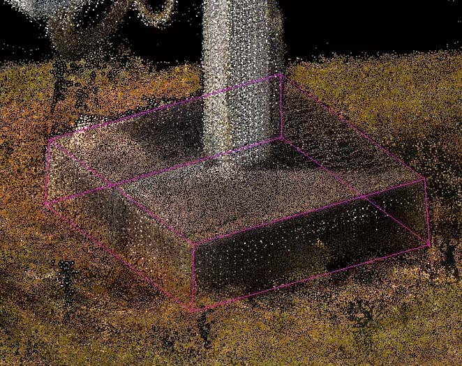
3D models of 763 concrete poles from LiDAR scan data, built in Bentley MicroStation with TerraSolid and fitted to each pole’s real dimensions.
Project snapshot
A geodetic and engineering company specializing in surveying, property management, and geospatial solutions.
- Location
- Czech Republic
- Team
- A GisPoint team working in LIDAR data processing and 3D modelling built the models and held the accuracy the project called for.
Stack
- Survey & CAD
- Bentley MicroStation: Used for 3D modeling Terra solid: Utilized for processing LIDAR data and creating precise models
The challenge, and what closed it
Technical challenge
Modelling the concrete poles accurately where grass and other obstructions blocked the view. Setting the orientation and height of each pole to its real-world dimensions. Handling minor deviations in pole shape and dimension without slowing the work.
What we did
Creation of digital 3D models for concrete poles based on laser scanning. Evaluation of different types of concrete poles (5 types identified). Model creation for the first concrete pole, free from obstructions like grass. Copying and adjusting models for other poles with modifications in height and orientation. Correction of models to eliminate any inaccuracies.
Why us
Pole Evaluation: Initial assessment identified five recurring types of concrete poles. Model Creation: A 3D model of the first pole was created, using a reference pole without obstructions. Copy and Adjustment: The base model was copied and modified for the remaining poles, adjusting height and orientation to match specific measurements. Final Adjustments: All models were reviewed and corrected for any inaccuracies.
Results
763 concrete poles were modelled in 3D to the precision the project required. The models carry the real dimensions and orientations of the poles and can be used as spatial data downstream.
What we delivered
Creation of digital 3D models for concrete poles based on laser scanning
Evaluation of different types of concrete poles (5 types identified)
Model creation for the first concrete pole, free from obstructions like grass
Copying and adjusting models for other poles with modifications in height and orientation
Correction of models to eliminate any inaccuracies