Orthophoto Generation Services | Hire GIS-Point team for high-precision aerial imagery and mapping solutions
GIS-Point

Orthophoto Generation

High-Resolution Orthophotos for Precision Geospatial Analysis and Mapping
Get Expert GIS Advice

Choose GIS-Point – Accurate Orthophotos for Smarter Mapping

GIS-Point transforms aerial and drone imagery into high-resolution orthophotos – ensuring geometric accuracy and seamless integration with LiDAR, DEMs, and CAD/GIS for faster, scalable spatial analysis.

390
+
projects in UK, Europe and America
170
+
satisfied customers
15
+
years
of commercial experience, analysis and implementation of GIS data
350
K+
km²
worked out and analyzed.

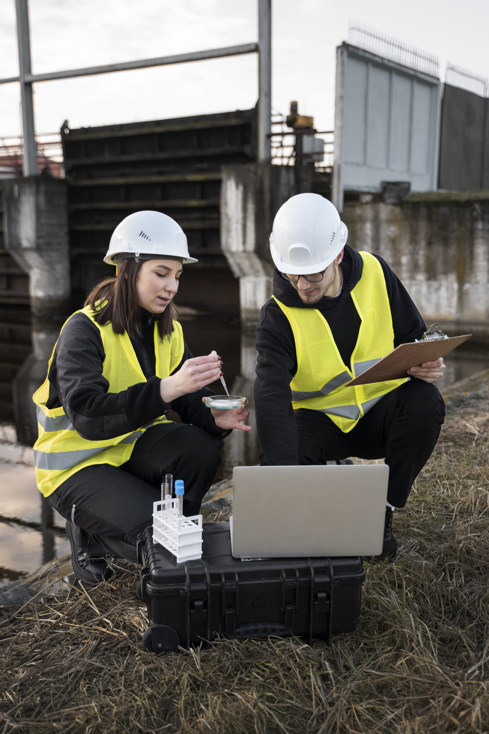
What is Orthophoto Generation?

Orthophoto generation is the process of converting aerial and drone imagery into geometrically corrected, true-scale images. Unlike regular photos, orthophotos eliminate distortions caused by terrain, tilt, and camera angle — making them ideal for accurate GIS analysis, land surveying, and infrastructure planning. At GIS-Point, we apply advanced correction techniques to produce seamless, high-resolution orthophotos tailored to your project needs.

Our orthophotos integrate easily with GIS, CAD, LiDAR, and elevation models, supporting everything from urban planning to environmental monitoring. With fast turnaround, custom formats, and precise results, GIS-Point helps you transform raw imagery into reliable geospatial insights.

Our Orthophoto Processing Solutions

  • High-Resolution Aerial and Drone Imagery Processing – Generating precise, high-resolution orthophotos from aerial and UAV imagery for detailed spatial representation.
  • Geometric Correction and Radiometric Adjustment – Removing terrain distortions and enhancing image consistency for seamless integration with GIS datasets.
  • Mosaic Creation for Large-Scale Mapping – Stitching multiple images into a single, high-accuracy orthomosaic, supporting extensive land surveys, infrastructure development, and smart city planning.
  • Integration with LiDAR and GIS Platforms – Enhancing 3D modeling, spatial analysis, and asset management by integrating orthophotos with LiDAR and GIS applications.
  • Custom Output Formats for Various Applications – Delivering orthophotos in multiple formats (GeoTIFF, JPEG2000, ECW, and CAD-compatible files) for GIS, CAD, and web-based mapping systems.
  • Elevation & Terrain Analysis Integration – Combining orthophotos with DEM (Digital Elevation Models) and DSM (Digital Surface Models) for advanced terrain mapping, hydrological modeling, and slope analysis.

Transform Your Geospatial Data with High-Quality Orthophotos

Enhance your mapping, surveying, and infrastructure planning with professional orthophoto generation services. Contact GIS-Point today to discuss your project requirements!

Get in touch

Industries we serve

Urban Planning & Infrastructure Development

Enabling precise land-use planning, road network mapping, and construction site monitoring.

Agriculture & Forestry

Assisting in crop health monitoring, land classification, irrigation planning, and forest resource management.

Environmental & Disaster Management

Supporting climate change assessments, flood mapping, erosion detection, and disaster response planning.

Surveying & Cartography

Providing high-accuracy base maps for cadastral surveys, land boundaries, and topographic applications.

Mining & Natural Resource Management

Supporting resource extraction planning, mine site monitoring, and geospatial analysis for land reclamation.

Energy & Utilities

Facilitating pipeline monitoring, renewable energy site selection, and infrastructure asset management.

Working on the Project:
A Step-by-Step Journey to Success

01

PREPARATION

You give us a pilot project – set us a
task, provide samples, templates,
instructions.
02

PILOT PROJECT

We carry out this pilot project
for FREE, according to all your
instructions.
03

AGREEMENT

You evaluate our work, we agree on
the cost of further work
04

LET’S STARTED!

We sign a cooperation agreement and
NDA, after which our team gets to
work.

Success Stories: How Our Clients Achieved Results with Our GIS Solutions

BIM

LiDAR

GIS

  • Create a digital spatial 3D map from mobile Lidar scanning data and panoramic images

    Location:

    Czech Republic

    To create a digital 3D map from mobile lidar scanning data and panoramic imagery.
  • Creating a digital spatial 3D map from mobile lidar scanning data

    Location:

    Czech Republic

    The input data is a cloud of Lidar points obtained using mobile Lidar scanning, as well as orthophoto maps, 360 panoramic photos.
  • Laser scanning of Kulparkivskyi Bridge Lviv,Ukraine

    Location:

    Lviv, Ukraine

    3D laser scanning of the object, namely the T1416 overpass over the railway track, and the creation of its BIM-model
  • Laser scanning of a the multi-storey apartments

    Location:

    Lviv, Ukraine

    3D laser scanning and creating BIM-model of an object.
  • Laser scanning of Kulparkivskyi Bridge Lviv,Ukraine

    Location:

    Lviv, Ukraine

    3D laser scanning of the object, namely the T1416 overpass over the railway track, and the creation of its BIM-model
  • Laser scanning of McDonald’s

    Location:

    Ukraine

    Accurate and detailed DTM representing the terrain features of the surveyed area.
  • Automatic tree recognition from orthophotos

    Location:

    Germany

    Automatic Tree Recognition with ArcGIS Pro is a project that aims to develop and implement an algorithm for automatic recognition of tree species based on remote sensing data.
  • Digitizing utility service connections

    Location:

    Canada

    The project encompasses the digitization of utility service connections, specifically for water, sewer, and storm services, spanning across 12,706 properties (parcels) within the City.
  • Updating the BDOT topographic database at a scale of 1:10000

    Location:

    Poland

    Using an orthophotomap, we check the relevance of the existing topographic objects in the database, as well as create new ones (which are not in the existing database).
  • Vectorization of roads and road signs

    Location:

    Czech Republic, Prostejov

    To create a 2D vector map in the city of Prostejov that includes road infrastructure and road signs.

Need precision imagery for your next project?

Get in touch with GIS-Point and let’s generate high-quality orthophotos tailored to your goals.

Get in touch
Our goal is to elevate our services by providing clients with rapid assistance and a superior level of service. The higher the quality of our services, the more time and money our clients save. And we excel at this!

Ievgen Lavrishko

Customers have no doubt about our expertise

Bell Ingram Design are delighted with the service provided by GISPoint in support of our work for our clients in rural Perthshire. The point cloud data from our local survey team was passed to your team in Ukraine and they turned it round into a useable 3D Revit model of the Grade B Listed Building more quickly than we could have hoped for.

At all times we were kept up to date with progress images, and the final product has proved to be a very robust basis for our design proposals. We will definitely be working with GISPoint again in the future.

We would like to extend our sincere thanks for the exceptional support and collaboration that we received during our recent project. Your team’s expertise, professionalism, and commitment to quality were instrumental in the success of our project.

We were particularly impressed with your team’s ability to quickly understand our needs and provide customized solutions that exceeded our expectations. Your communication and responsiveness throughout the project were also greatly appreciated.

We look forward to the opportunity to work with GISpoint Team ag…

Stanislav Mudrak

MDP GEO Testimonial

From the end of 2022, the GIS POINT company is one of our cooperating partners within the project focused on mobile mapping.

GIS Point participates in the evaluation of 3D data from mobile mapping – laser point cloud and panoramic photos. After they have been trained at the very beginning of the cooperation, the results are submitted on their part in the required quality and time.

The representatives of GIS Point are able to respond operatively and solve any requirements that arise in a very short time. If something needs to be resolved, they have no …

Jiří Habrovec

GEODROM Testimonial

We wanted to take a moment to express our appreciation for the productive and effective collaboration that we experienced during our recent project. The expertise and dedication of your team were invaluable in helping us achieve our goals, and we are grateful for your hard work and commitment.

We were particularly impressed with your team’s attention to detail and ability to consistently deliver high-quality results within our tight timelines. Your flexibility and willingness to adapt to changing project requirements were also greatly appreciated.

Tha…

Michal Šafařík

GB-geodezie Testimonial

We started to consider cooperation with GISpoint at time of full workload. We were looking for digital spatial data processor capable to work with the latest software tools.
Due to time pressure and lack of people on the job market we contacted based on recommendation the company GISpoint from Ukraine.
The start of the cooperation with GISpoint was scheduled for April 2023. The initial negotiations went smoothly. Ievgen Lavrishko communicated helpfully on behalf of GISpoint.
The cooperation concerned a large contract with time pressure for complet…

Stanislav Madron

Review GMtech

During our cooperation with the LLC “Mirnichy” at the project: “3D Models of buildings” specialists of your enterprise have shown themselves as professionals who perform their work qualitatively and conscientiously.

Why highly appreciate cooperation with LLC “Mirnichy” because it has been proven itself as a reliable and qualified partner. All works have been done on time and with a high level. LLC “Mirnichy” has been performed the work stipulated by the contract.

David Chodarad

Our team of professionals

Ievgen Lavrishko
CEO & Owner
Khrystyna Bochko
HR Generalist
Alevtyna Kostianchuk
Senior Project Manager
Andriiana Pavlyshyn
Head of Business Development
Roman Nahaiovskyi
Project Manager
Maria Kizim
Lead Generation Specialist
Ivanna Soltys
Tender Manager

Why Choose GIS-Point?

  • Dedicated GIS & IT Teams

    Offering full-service geospatial processing teams or team augmentation services to support your projects.


  • High-Accuracy Processing

    Utilizing advanced algorithms and AI-driven correction techniques for precise geometric and radiometric adjustments.

  • Seamless GIS Integration

    Optimized orthophotos for GIS-based analysis, CAD applications, and real-time mapping.

  • Customizable Solutions

    Delivering tailored outputs to meet project-specific requirements and industry standards.

  • Fast & Reliable Turnaround

    Streamlined workflows ensure timely data processing and delivery for large-scale projects.

Contact us today to start your project!

    United Kingdom

    Devonshire str., 41, Ground Floor, London W1G 7AJ, UK

    Estonia

    Harju maakond, Tallinn, Kesklinna linnaosa, Kaupmehe tn 7-120, 10114, Estonia

    Ukraine

    Ukraine, Lviv, Sadova street, 2a/1
    +380672088520 Ievgen Lavrishko
info@gis-point.com