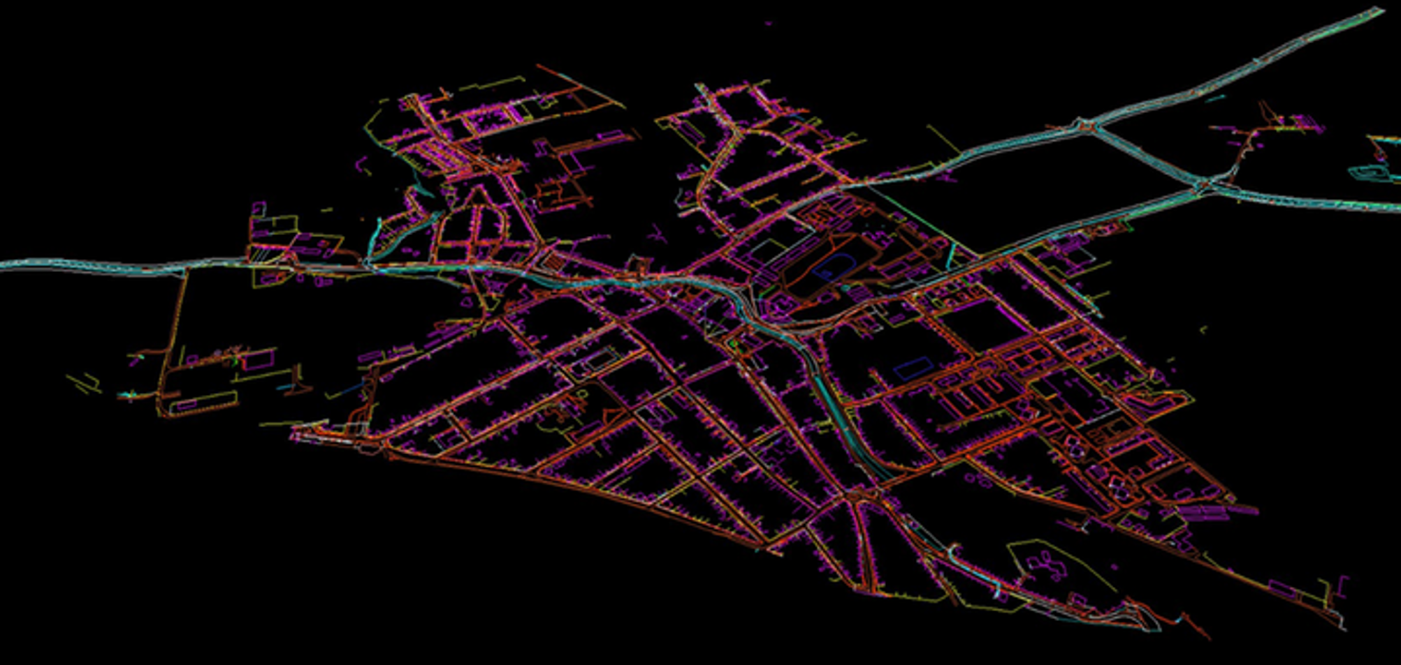
LiDAR – Digital 3D Mapping from Mobile LiDAR and Panoramic Imagery

Project Details

This project involved creating and updating digital spatial 3D maps of road networks across 1135 km and 736 km using mobile LIDAR scanning, orthophoto, and aerial scanning data. The detailed maps support ongoing road monitoring, infrastructure assessment, and project development for road modernization and repair.

Client: A geodetic and engineering company specializing in surveying, property management, and geospatial solutions.

Sector:

  • Geodesy and cartography
    Landscape design
  • Engineering
    LIDAR Data Processing Service

Sub Sector:

  • 3D Mapping
  • Infrastructure Monitoring 

Services:

  • LiDAR Data Processing
  • 3D Mapping
  • Vectorization of Road Networks
  • Infrastructure Monitoring and Modernization Planning

Solution:

  • Creation and update of electronic vector maps for road networks using mobile LIDAR scanning data
  • Utilization of orthophotos with 5 cm precision for detailed object recognition
  • 3D vectorization using X, Y, Z coordinates to accurately represent road and surrounding infrastructure
  • Additional use of aerial scanning and 365-degree photos for comprehensive monitoring and analysis
  • Integration of data for road modernization and redevelopment project planning

Location: Czech Republic

Technology and Software:

  • Marushka 3D Design: Used for 3D vectorization and map creation
  • Mobile LIDAR and Aerial Scanning: Employed for accurate data collection

People:
A dedicated team of specialists from GisPoint, worked on this project. Their expertise in LIDAR scanning, 3D mapping, and infrastructure monitoring ensured high-quality data collection and processing, resulting in an accurate representation of the road networks.

Process & Challenges

Process:

Data Acquisition: LIDAR scanning (mobile and aerial) was performed across large distances, supplemented by high-precision orthophotos and 365-degree images.

3D Mapping: Data was processed and vectorized in 3D (X, Y, Z coordinates) using Marushka 3D Design.

Data Integration: Multiple data sources were combined to create comprehensive and up-to-date road network maps.

Final Adjustments: Quality checks ensured the maps met the requirements for infrastructure monitoring and future project planning.

Challenges:

The complexity of processing and integrating data from different scanning technologies, including mobile and aerial LIDAR.

Ensuring the precision of 3D vectorization for accurate representation of infrastructure elements.

Managing the large volume of data while maintaining consistency and accuracy across the mapped areas.

Result

The project resulted in highly detailed and updated 3D vector maps of road networks and surrounding infrastructure. These maps will be used for monitoring road conditions, planning modernization projects, and facilitating future infrastructure development.

Our Team

Ievgen Lavrishko
CEO & Owner
Khrystyna Bochko
HR Generalist
Alevtyna Kostianchuk
Senior Project Manager
Andriiana Pavlyshyn
Head of Business Development
Roman Nahaiovskyi
Project Manager
Maria Kizim
Lead Generation Specialist
Ivanna Soltys
Tender Manager

Navigating Our Impressive GIS Portfolio

  • Creating a digital spatial 3D map from mobile lidar scanning data

    Location:

    Czech Republic

    The input data is a cloud of Lidar points obtained using mobile Lidar scanning, as well as orthophoto maps, 360 panoramic photos.
  • Creating a digital spatial 3D model of a concrete support

    Location:

    Czech Republic

    A digital spatial 3D model of a concrete support was created in Bentley MicroStation – Terra solid based on laser scanning.
  • Determining the area with snow cover on a mountain range using Lidar data

    Location:

    Poland

    Classification of point clouds for obtaining high-quality digital DEM, DSM, DTM, TIN models and determination of areas with snow cover.
  • Creation of a digital spatial 3D/2D model of the Tunnel

    Location:

    Czech Republic

    To create 3D models of the tunnel and 2D sections based on Laser Scanning.
  • Creation and updating of topographics data and underground communications databases

    Creation and updating of topographics data and underground communications databases on a scale of 1:500.
  • Accurate 3D Vectorization of Mobile Mapping Data

    Project on vectorization of objects obtained from mobile map data

Working on the Project:
A Step-by-Step Journey to Success

01

PREPARATION

You give us a pilot project – set us a
task, provide samples, templates,
instructions.
02

PILOT PROJECT

We carry out this pilot project
for FREE, according to all your
instructions.
03

AGREEMENT

You evaluate our work, we agree on
the cost of further work.
04

LET’S STARTED!

We sign a cooperation agreement and
NDA, after which our team gets to
work.

Have a similar project?

Contact us, we’ll help with its implementation.

    United Kingdom

    Devonshire str., 41, Ground Floor, London W1G 7AJ, UK

    Estonia

    Harju maakond, Tallinn, Kesklinna linnaosa, Kaupmehe tn 7-120, 10114, Estonia

    Ukraine

    Ukraine, Lviv, Sadova street, 2a/1
    +380672088520 Ievgen Lavrishko
info@gis-point.com
    LiDAR – Creation and updating of topographics data and underground communications databases

    Project Details

    This project involved creating and updating digital spatial 3D maps of road networks across 1135 km and 736 km using mobile LIDAR scanning, orthophoto, and aerial scanning data. The detailed maps support ongoing road monitoring, infrastructure assessment, and project development for road modernization and repair.

    Client: A geodetic and engineering company specializing in surveying, property management, and geospatial solutions.

    Sector:

    • Geodesy and cartography
      Landscape design
    • Engineering
      LIDAR Data Processing Service

    Sub Sector:

    • 3D Mapping
    • Infrastructure Monitoring 

    Services:

    • LiDAR Data Processing
    • 3D Mapping
    • Vectorization of Road Networks
    • Infrastructure Monitoring and Modernization Planning

    Solution:

    • Creation and update of electronic vector maps for road networks using mobile LIDAR scanning data
    • Utilization of orthophotos with 5 cm precision for detailed object recognition
    • 3D vectorization using X, Y, Z coordinates to accurately represent road and surrounding infrastructure
    • Additional use of aerial scanning and 365-degree photos for comprehensive monitoring and analysis
    • Integration of data for road modernization and redevelopment project planning

    Location: Czech Republic

    Technology and Software:

    • Marushka 3D Design: Used for 3D vectorization and map creation
    • Mobile LIDAR and Aerial Scanning: Employed for accurate data collection

    People:
    A dedicated team of specialists from GisPoint, worked on this project. Their expertise in LIDAR scanning, 3D mapping, and infrastructure monitoring ensured high-quality data collection and processing, resulting in an accurate representation of the road networks.

    Have a similar project?

    Contact us, we’ll help with its implementation.

      United Kingdom

      Devonshire str., 41, Ground Floor, London W1G 7AJ, UK

      Estonia

      Harju maakond, Tallinn, Kesklinna linnaosa, Kaupmehe tn 7-120, 10114, Estonia

      Ukraine

      Ukraine, Lviv, Sadova street, 2a/1
      +380672088520 Ievgen Lavrishko
info@gis-point.com
      LiDAR – Point Classification for Power Transmission Lines

      Project Details

      This project involved creating and updating digital spatial 3D maps of road networks across 1135 km and 736 km using mobile LIDAR scanning, orthophoto, and aerial scanning data. The detailed maps support ongoing road monitoring, infrastructure assessment, and project development for road modernization and repair.

      Client: A geodetic and engineering company specializing in surveying, property management, and geospatial solutions.

      Sector:

      • Geodesy and cartography
        Landscape design
      • Engineering
        LIDAR Data Processing Service

      Sub Sector:

      • 3D Mapping
      • Infrastructure Monitoring 

      Services:

      • LiDAR Data Processing
      • 3D Mapping
      • Vectorization of Road Networks
      • Infrastructure Monitoring and Modernization Planning

      Solution:

      • Creation and update of electronic vector maps for road networks using mobile LIDAR scanning data
      • Utilization of orthophotos with 5 cm precision for detailed object recognition
      • 3D vectorization using X, Y, Z coordinates to accurately represent road and surrounding infrastructure
      • Additional use of aerial scanning and 365-degree photos for comprehensive monitoring and analysis
      • Integration of data for road modernization and redevelopment project planning

      Location: Czech Republic

      Technology and Software:

      • Marushka 3D Design: Used for 3D vectorization and map creation
      • Mobile LIDAR and Aerial Scanning: Employed for accurate data collection

      People:
      A dedicated team of specialists from GisPoint, worked on this project. Their expertise in LIDAR scanning, 3D mapping, and infrastructure monitoring ensured high-quality data collection and processing, resulting in an accurate representation of the road networks.

      Have a similar project?

      Contact us, we’ll help with its implementation.

        United Kingdom

        Devonshire str., 41, Ground Floor, London W1G 7AJ, UK

        Estonia

        Harju maakond, Tallinn, Kesklinna linnaosa, Kaupmehe tn 7-120, 10114, Estonia

        Ukraine

        Ukraine, Lviv, Sadova street, 2a/1
        +380672088520 Ievgen Lavrishko
info@gis-point.com
        LiDAR – Classification of LiDAR point clouds for the city of Oslo

        Project Details

        This project involved creating and updating digital spatial 3D maps of road networks across 1135 km and 736 km using mobile LIDAR scanning, orthophoto, and aerial scanning data. The detailed maps support ongoing road monitoring, infrastructure assessment, and project development for road modernization and repair.

        Client: A geodetic and engineering company specializing in surveying, property management, and geospatial solutions.

        Sector:

        • Geodesy and cartography
          Landscape design
        • Engineering
          LIDAR Data Processing Service

        Sub Sector:

        • 3D Mapping
        • Infrastructure Monitoring 

        Services:

        • LiDAR Data Processing
        • 3D Mapping
        • Vectorization of Road Networks
        • Infrastructure Monitoring and Modernization Planning

        Solution:

        • Creation and update of electronic vector maps for road networks using mobile LIDAR scanning data
        • Utilization of orthophotos with 5 cm precision for detailed object recognition
        • 3D vectorization using X, Y, Z coordinates to accurately represent road and surrounding infrastructure
        • Additional use of aerial scanning and 365-degree photos for comprehensive monitoring and analysis
        • Integration of data for road modernization and redevelopment project planning

        Location: Czech Republic

        Technology and Software:

        • Marushka 3D Design: Used for 3D vectorization and map creation
        • Mobile LIDAR and Aerial Scanning: Employed for accurate data collection

        People:
        A dedicated team of specialists from GisPoint, worked on this project. Their expertise in LIDAR scanning, 3D mapping, and infrastructure monitoring ensured high-quality data collection and processing, resulting in an accurate representation of the road networks.

        Have a similar project?

        Contact us, we’ll help with its implementation.

          United Kingdom

          Devonshire str., 41, Ground Floor, London W1G 7AJ, UK

          Estonia

          Harju maakond, Tallinn, Kesklinna linnaosa, Kaupmehe tn 7-120, 10114, Estonia

          Ukraine

          Ukraine, Lviv, Sadova street, 2a/1
          +380672088520 Ievgen Lavrishko
info@gis-point.com
          LiDAR – Classification mobile LiDAR data, 3D mapping

          Project Details

          This project involved creating and updating digital spatial 3D maps of road networks across 1135 km and 736 km using mobile LIDAR scanning, orthophoto, and aerial scanning data. The detailed maps support ongoing road monitoring, infrastructure assessment, and project development for road modernization and repair.

          Client: A geodetic and engineering company specializing in surveying, property management, and geospatial solutions.

          Sector:

          • Geodesy and cartography
            Landscape design
          • Engineering
            LIDAR Data Processing Service

          Sub Sector:

          • 3D Mapping
          • Infrastructure Monitoring 

          Services:

          • LiDAR Data Processing
          • 3D Mapping
          • Vectorization of Road Networks
          • Infrastructure Monitoring and Modernization Planning

          Solution:

          • Creation and update of electronic vector maps for road networks using mobile LIDAR scanning data
          • Utilization of orthophotos with 5 cm precision for detailed object recognition
          • 3D vectorization using X, Y, Z coordinates to accurately represent road and surrounding infrastructure
          • Additional use of aerial scanning and 365-degree photos for comprehensive monitoring and analysis
          • Integration of data for road modernization and redevelopment project planning

          Location: Czech Republic

          Technology and Software:

          • Marushka 3D Design: Used for 3D vectorization and map creation
          • Mobile LIDAR and Aerial Scanning: Employed for accurate data collection

          People:
          A dedicated team of specialists from GisPoint, worked on this project. Their expertise in LIDAR scanning, 3D mapping, and infrastructure monitoring ensured high-quality data collection and processing, resulting in an accurate representation of the road networks.

          Have a similar project?

          Contact us, we’ll help with its implementation.

            United Kingdom

            Devonshire str., 41, Ground Floor, London W1G 7AJ, UK

            Estonia

            Harju maakond, Tallinn, Kesklinna linnaosa, Kaupmehe tn 7-120, 10114, Estonia

            Ukraine

            Ukraine, Lviv, Sadova street, 2a/1
            +380672088520 Ievgen Lavrishko
info@gis-point.com
            LiDAR – Laser scanning of the facades of Poshtovyi Avenue Kryvyi Rih, Ukraine

            Project Details

            This project involved creating and updating digital spatial 3D maps of road networks across 1135 km and 736 km using mobile LIDAR scanning, orthophoto, and aerial scanning data. The detailed maps support ongoing road monitoring, infrastructure assessment, and project development for road modernization and repair.

            Client: A geodetic and engineering company specializing in surveying, property management, and geospatial solutions.

            Sector:

            • Geodesy and cartography
              Landscape design
            • Engineering
              LIDAR Data Processing Service

            Sub Sector:

            • 3D Mapping
            • Infrastructure Monitoring 

            Services:

            • LiDAR Data Processing
            • 3D Mapping
            • Vectorization of Road Networks
            • Infrastructure Monitoring and Modernization Planning

            Solution:

            • Creation and update of electronic vector maps for road networks using mobile LIDAR scanning data
            • Utilization of orthophotos with 5 cm precision for detailed object recognition
            • 3D vectorization using X, Y, Z coordinates to accurately represent road and surrounding infrastructure
            • Additional use of aerial scanning and 365-degree photos for comprehensive monitoring and analysis
            • Integration of data for road modernization and redevelopment project planning

            Location: Czech Republic

            Technology and Software:

            • Marushka 3D Design: Used for 3D vectorization and map creation
            • Mobile LIDAR and Aerial Scanning: Employed for accurate data collection

            People:
            A dedicated team of specialists from GisPoint, worked on this project. Their expertise in LIDAR scanning, 3D mapping, and infrastructure monitoring ensured high-quality data collection and processing, resulting in an accurate representation of the road networks.

            Have a similar project?

            Contact us, we’ll help with its implementation.

              United Kingdom

              Devonshire str., 41, Ground Floor, London W1G 7AJ, UK

              Estonia

              Harju maakond, Tallinn, Kesklinna linnaosa, Kaupmehe tn 7-120, 10114, Estonia

              Ukraine

              Ukraine, Lviv, Sadova street, 2a/1
              +380672088520 Ievgen Lavrishko
info@gis-point.com

              LiDAR – DTM model

              Project Details

              This project involved creating and updating digital spatial 3D maps of road networks across 1135 km and 736 km using mobile LIDAR scanning, orthophoto, and aerial scanning data. The detailed maps support ongoing road monitoring, infrastructure assessment, and project development for road modernization and repair.

              Client: A geodetic and engineering company specializing in surveying, property management, and geospatial solutions.

              Sector:

              • Geodesy and cartography
                Landscape design
              • Engineering
                LIDAR Data Processing Service

              Sub Sector:

              • 3D Mapping
              • Infrastructure Monitoring 

              Services:

              • LiDAR Data Processing
              • 3D Mapping
              • Vectorization of Road Networks
              • Infrastructure Monitoring and Modernization Planning

              Solution:

              • Creation and update of electronic vector maps for road networks using mobile LIDAR scanning data
              • Utilization of orthophotos with 5 cm precision for detailed object recognition
              • 3D vectorization using X, Y, Z coordinates to accurately represent road and surrounding infrastructure
              • Additional use of aerial scanning and 365-degree photos for comprehensive monitoring and analysis
              • Integration of data for road modernization and redevelopment project planning

              Location: Czech Republic

              Technology and Software:

              • Marushka 3D Design: Used for 3D vectorization and map creation
              • Mobile LIDAR and Aerial Scanning: Employed for accurate data collection

              People:
              A dedicated team of specialists from GisPoint, worked on this project. Their expertise in LIDAR scanning, 3D mapping, and infrastructure monitoring ensured high-quality data collection and processing, resulting in an accurate representation of the road networks.

              Have a similar project?

              Contact us, we’ll help with its implementation.

                United Kingdom

                Devonshire str., 41, Ground Floor, London W1G 7AJ, UK

                Estonia

                Harju maakond, Tallinn, Kesklinna linnaosa, Kaupmehe tn 7-120, 10114, Estonia

                Ukraine

                Ukraine, Lviv, Sadova street, 2a/1
                +380672088520 Ievgen Lavrishko
info@gis-point.com

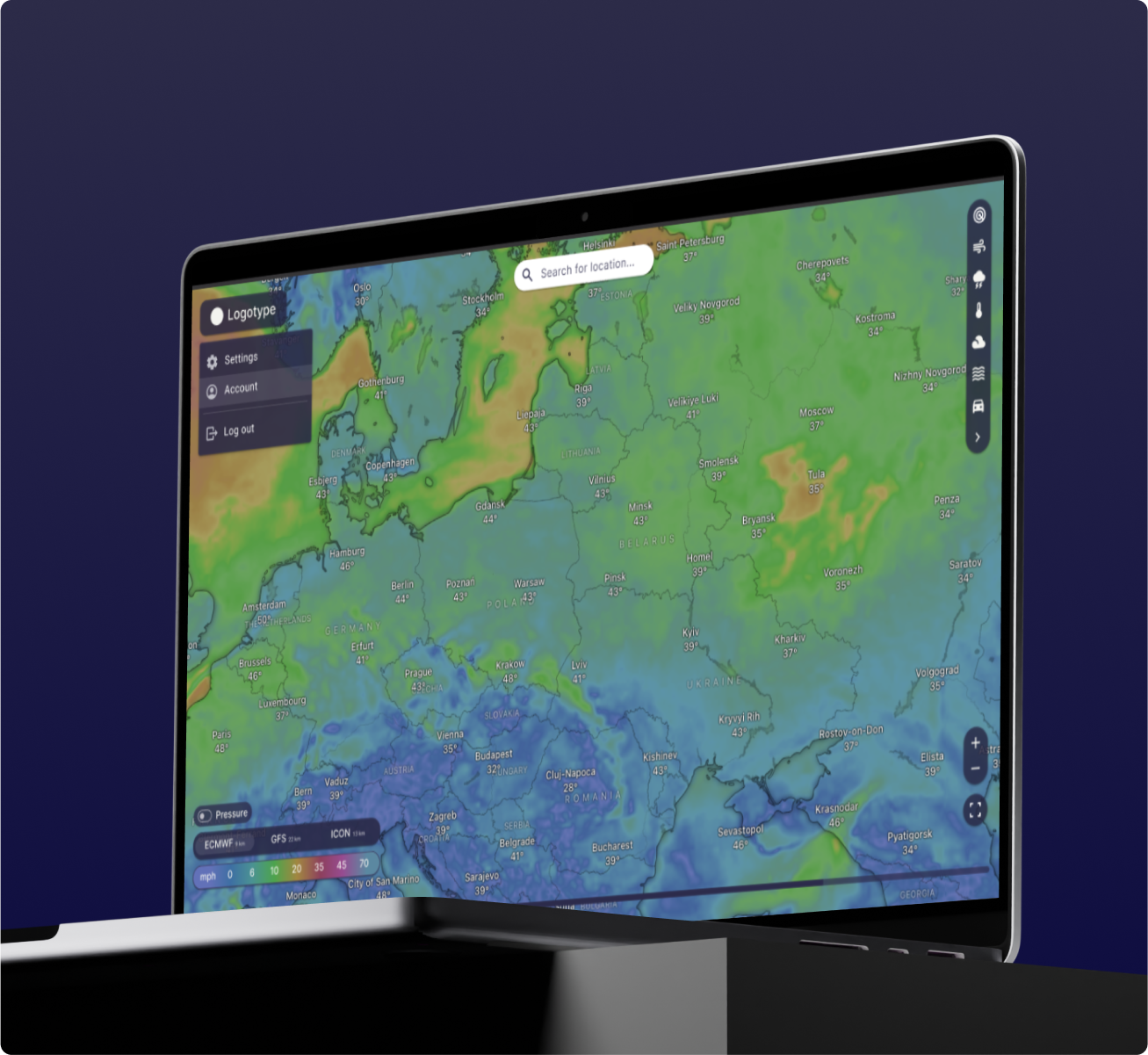
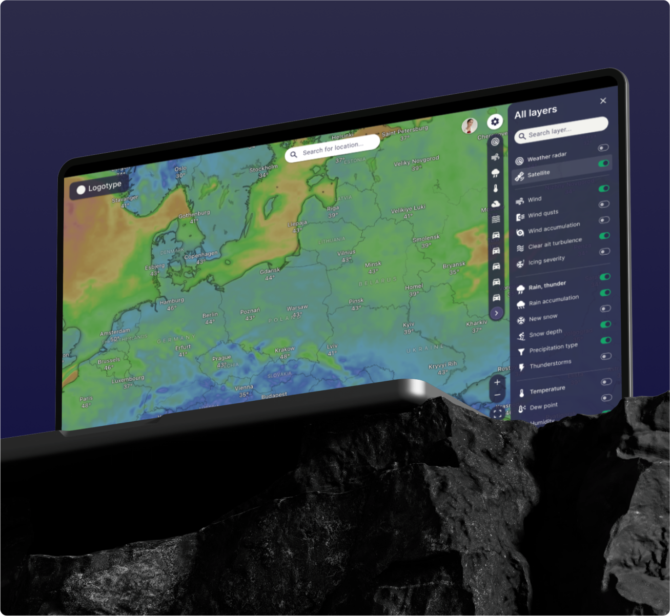
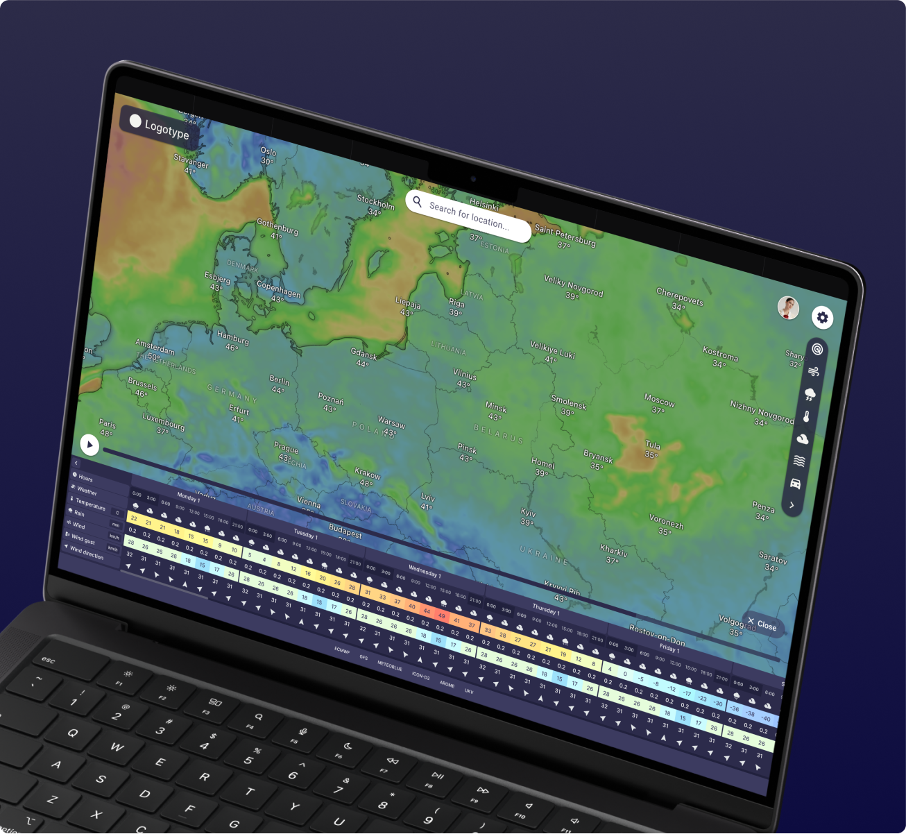
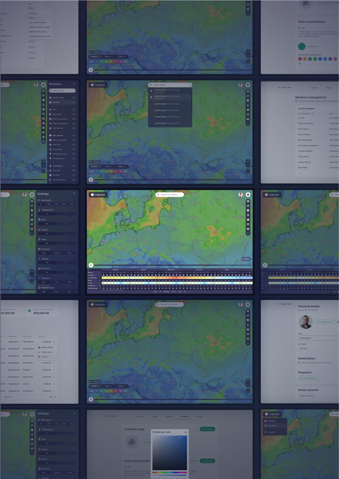
                SOFT – Software development for a weather forecast program

                Project Details

                This project involved creating and updating digital spatial 3D maps of road networks across 1135 km and 736 km using mobile LIDAR scanning, orthophoto, and aerial scanning data. The detailed maps support ongoing road monitoring, infrastructure assessment, and project development for road modernization and repair.

                Client: A geodetic and engineering company specializing in surveying, property management, and geospatial solutions.

                Sector:

                • Geodesy and cartography
                  Landscape design
                • Engineering
                  LIDAR Data Processing Service

                Sub Sector:

                • 3D Mapping
                • Infrastructure Monitoring 

                Services:

                • LiDAR Data Processing
                • 3D Mapping
                • Vectorization of Road Networks
                • Infrastructure Monitoring and Modernization Planning

                Solution:

                • Creation and update of electronic vector maps for road networks using mobile LIDAR scanning data
                • Utilization of orthophotos with 5 cm precision for detailed object recognition
                • 3D vectorization using X, Y, Z coordinates to accurately represent road and surrounding infrastructure
                • Additional use of aerial scanning and 365-degree photos for comprehensive monitoring and analysis
                • Integration of data for road modernization and redevelopment project planning

                Location: Czech Republic

                Technology and Software:

                • Marushka 3D Design: Used for 3D vectorization and map creation
                • Mobile LIDAR and Aerial Scanning: Employed for accurate data collection

                People:
                A dedicated team of specialists from GisPoint, worked on this project. Their expertise in LIDAR scanning, 3D mapping, and infrastructure monitoring ensured high-quality data collection and processing, resulting in an accurate representation of the road networks.

                Process & Challenges

                Process:

                • Identifying client requirements and determining the weather parameters to be displayed on the platform.
                • Designing the system architecture to support large volumes of real-time weather data.
                • Integrating the Windy API and other weather data sources.
                • Developing an admin panel to manage user functions and permissions.
                • Testing the platform’s functionality and optimizing performance to handle large data loads.


                Challenges:

                • API Integration: Ensuring correct and fast integration with the Windy API for real-time weather data processing and visualization.
                • Data Visualization: Creating an intuitive interface to display complex weather parameters in a simple and understandable form.
                • Scalability: The platform needed to handle a large flow of data, ensuring stable performance for multiple users simultaneously.
                • Multilingual Support: Implementing multilingual support for users from different countries.

                Result

                The result was the creation of a powerful platform that provides users with accurate real-time weather data. The platform significantly improved decision-making for users in sectors such as transport, agriculture, and emergency services. Thanks to the integration with the Windy API, users can track extreme weather events, allowing for timely responses to potential risks.

                Our Team

                Ievgen Lavrishko
                CEO & Owner
                Khrystyna Bochko
                HR Generalist
                Alevtyna Kostianchuk
                Senior Project Manager
                Andriiana Pavlyshyn
                Head of Business Development
                Roman Nahaiovskyi
                Project Manager
                Maria Kizim
                Lead Generation Specialist
                Ivanna Soltys
                Tender Manager

                Navigating Our Impressive SOFT Portfolio

                • Development software for a soil subsidence

                  Development software for a soil subsidence
                • Tracking system for public transport

                  The system is designed to comprehensively address the issues of public passenger transport
                • Software for bus forecasting tables

                  Develop software for public transport which display on tables arrival information about bus, tram and trolleybus.
                • Development of a Satellite Images Sales Platform 

                  A portal for the sale of satellite images
                • Oil and gas software products

                  Software Development for the energy industry to control and track of logistics, drilling, mining.

                Working on the Project:
                A Step-by-Step Journey to Success

                01

                PREPARATION

                You give us a pilot project – set us a
                task, provide samples, templates,
                instructions.
                02

                PILOT PROJECT

                We carry out this pilot project
                for FREE, according to all your
                instructions.
                03

                AGREEMENT

                You evaluate our work, we agree on
                the cost of further work.
                04

                LET’S STARTED!

                We sign a cooperation agreement and
                NDA, after which our team gets to
                work.

                Have a similar project?

                Contact us, we’ll help with its implementation.

                  United Kingdom

                  Devonshire str., 41, Ground Floor, London W1G 7AJ, UK

                  Estonia

                  Harju maakond, Tallinn, Kesklinna linnaosa, Kaupmehe tn 7-120, 10114, Estonia

                  Ukraine

                  Ukraine, Lviv, Sadova street, 2a/1
                  +380672088520 Ievgen Lavrishko
info@gis-point.com

                  SOFT – A portal for the sale of satellite images

                  Project Details

                  This project involved creating and updating digital spatial 3D maps of road networks across 1135 km and 736 km using mobile LIDAR scanning, orthophoto, and aerial scanning data. The detailed maps support ongoing road monitoring, infrastructure assessment, and project development for road modernization and repair.

                  Client: A geodetic and engineering company specializing in surveying, property management, and geospatial solutions.

                  Sector:

                  • Geodesy and cartography
                    Landscape design
                  • Engineering
                    LIDAR Data Processing Service

                  Sub Sector:

                  • 3D Mapping
                  • Infrastructure Monitoring 

                  Services:

                  • LiDAR Data Processing
                  • 3D Mapping
                  • Vectorization of Road Networks
                  • Infrastructure Monitoring and Modernization Planning

                  Solution:

                  • Creation and update of electronic vector maps for road networks using mobile LIDAR scanning data
                  • Utilization of orthophotos with 5 cm precision for detailed object recognition
                  • 3D vectorization using X, Y, Z coordinates to accurately represent road and surrounding infrastructure
                  • Additional use of aerial scanning and 365-degree photos for comprehensive monitoring and analysis
                  • Integration of data for road modernization and redevelopment project planning

                  Location: Czech Republic

                  Technology and Software:

                  • Marushka 3D Design: Used for 3D vectorization and map creation
                  • Mobile LIDAR and Aerial Scanning: Employed for accurate data collection

                  People:
                  A dedicated team of specialists from GisPoint, worked on this project. Their expertise in LIDAR scanning, 3D mapping, and infrastructure monitoring ensured high-quality data collection and processing, resulting in an accurate representation of the road networks.

                  Process & Challenges

                  Process:

                  The development process included:

                  • Requirement analysis and client consultations
                  • Designing a scalable architecture using AWS cloud services
                  • Development of the backend using .Net
                  • Front-end development using Angular
                  • Integration of satellite imagery data processing and geospatial analytics tools
                  • Testing and optimization for high performance under heavy loads

                  Challenges:

                  • Real-time Data Processing: The platform needed to handle large datasets and provide near real-time updates for satellite imagery.
                  • User Accessibility: The client required an intuitive interface that could be used by non-experts while still offering advanced features for professional users.
                  • Cloud Integration: Ensuring seamless cloud-based storage and processing to handle the large volume of satellite images efficiently.

                  Result

                  The platform allowed the consulting company to provide a unique service in Saudi Arabia, offering sateallite imagery and advanced analytics to a broader audience. It became a valuable tool for various sectors, including agriculture, urban planning, and environmental monitoring. Users can now quickly acquire up-to-date geospatial data and perform analyses without needing expert knowledge in the field.

                  Our Team

                  Ievgen Lavrishko
                  CEO & Owner
                  Khrystyna Bochko
                  HR Generalist
                  Alevtyna Kostianchuk
                  Senior Project Manager
                  Andriiana Pavlyshyn
                  Head of Business Development
                  Roman Nahaiovskyi
                  Project Manager
                  Maria Kizim
                  Lead Generation Specialist
                  Ivanna Soltys
                  Tender Manager

                  Navigating Our Impressive SOFT Portfolio

                  • Development software for a soil subsidence

                    Development software for a soil subsidence
                  • Logistic/crm applications for senders and carriers

                    Software solution to manage all transportation processes and activities across logistics networks.
                  • Oil and gas software products

                    Software Development for the energy industry to control and track of logistics, drilling, mining.
                  • Software development for a weather forecast program

                    Software development for a weather forecast program
                  • Software for bus forecasting tables

                    Develop software for public transport which display on tables arrival information about bus, tram and trolleybus.

                  Working on the Project:
                  A Step-by-Step Journey to Success

                  01

                  PREPARATION

                  You give us a pilot project – set us a
                  task, provide samples, templates,
                  instructions.
                  02

                  PILOT PROJECT

                  We carry out this pilot project
                  for FREE, according to all your
                  instructions.
                  03

                  AGREEMENT

                  You evaluate our work, we agree on
                  the cost of further work
                  04

                  LET’S STARTED!

                  We sign a cooperation agreement and
                  NDA, after which our team gets to
                  work.

                  Have a similar project?

                  Contact us, we’ll help with its implementation.

                    United Kingdom

                    Devonshire str., 41, Ground Floor, London W1G 7AJ, UK

                    Estonia

                    Harju maakond, Tallinn, Kesklinna linnaosa, Kaupmehe tn 7-120, 10114, Estonia

                    Ukraine

                    Ukraine, Lviv, Sadova street, 2a/1
                    +380672088520 Ievgen Lavrishko
info@gis-point.com

                    LiDAR point cloud classification mobile scanning

                    Project Details

                    This project involved creating and updating digital spatial 3D maps of road networks across 1135 km and 736 km using mobile LIDAR scanning, orthophoto, and aerial scanning data. The detailed maps support ongoing road monitoring, infrastructure assessment, and project development for road modernization and repair.

                    Client: A geodetic and engineering company specializing in surveying, property management, and geospatial solutions.

                    Sector:

                    • Geodesy and cartography
                      Landscape design
                    • Engineering
                      LIDAR Data Processing Service

                    Sub Sector:

                    • 3D Mapping
                    • Infrastructure Monitoring 

                    Services:

                    • LiDAR Data Processing
                    • 3D Mapping
                    • Vectorization of Road Networks
                    • Infrastructure Monitoring and Modernization Planning

                    Solution:

                    • Creation and update of electronic vector maps for road networks using mobile LIDAR scanning data
                    • Utilization of orthophotos with 5 cm precision for detailed object recognition
                    • 3D vectorization using X, Y, Z coordinates to accurately represent road and surrounding infrastructure
                    • Additional use of aerial scanning and 365-degree photos for comprehensive monitoring and analysis
                    • Integration of data for road modernization and redevelopment project planning

                    Location: Czech Republic

                    Technology and Software:

                    • Marushka 3D Design: Used for 3D vectorization and map creation
                    • Mobile LIDAR and Aerial Scanning: Employed for accurate data collection

                    People:
                    A dedicated team of specialists from GisPoint, worked on this project. Their expertise in LIDAR scanning, 3D mapping, and infrastructure monitoring ensured high-quality data collection and processing, resulting in an accurate representation of the road networks.

                    Have a similar project?

                    Contact us, we’ll help with its implementation.

                      United Kingdom

                      Devonshire str., 41, Ground Floor, London W1G 7AJ, UK

                      Estonia

                      Harju maakond, Tallinn, Kesklinna linnaosa, Kaupmehe tn 7-120, 10114, Estonia

                      Ukraine

                      Ukraine, Lviv, Sadova street, 2a/1
                      +380672088520 Ievgen Lavrishko
info@gis-point.com