
Project Details
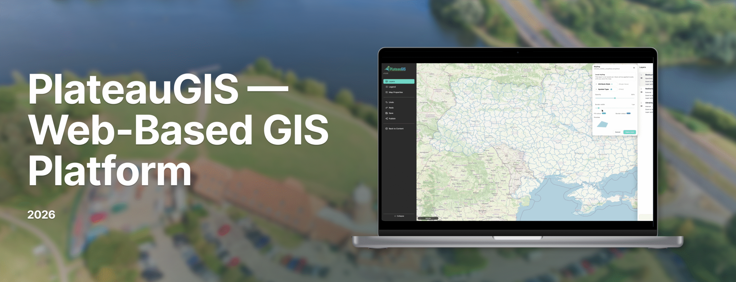
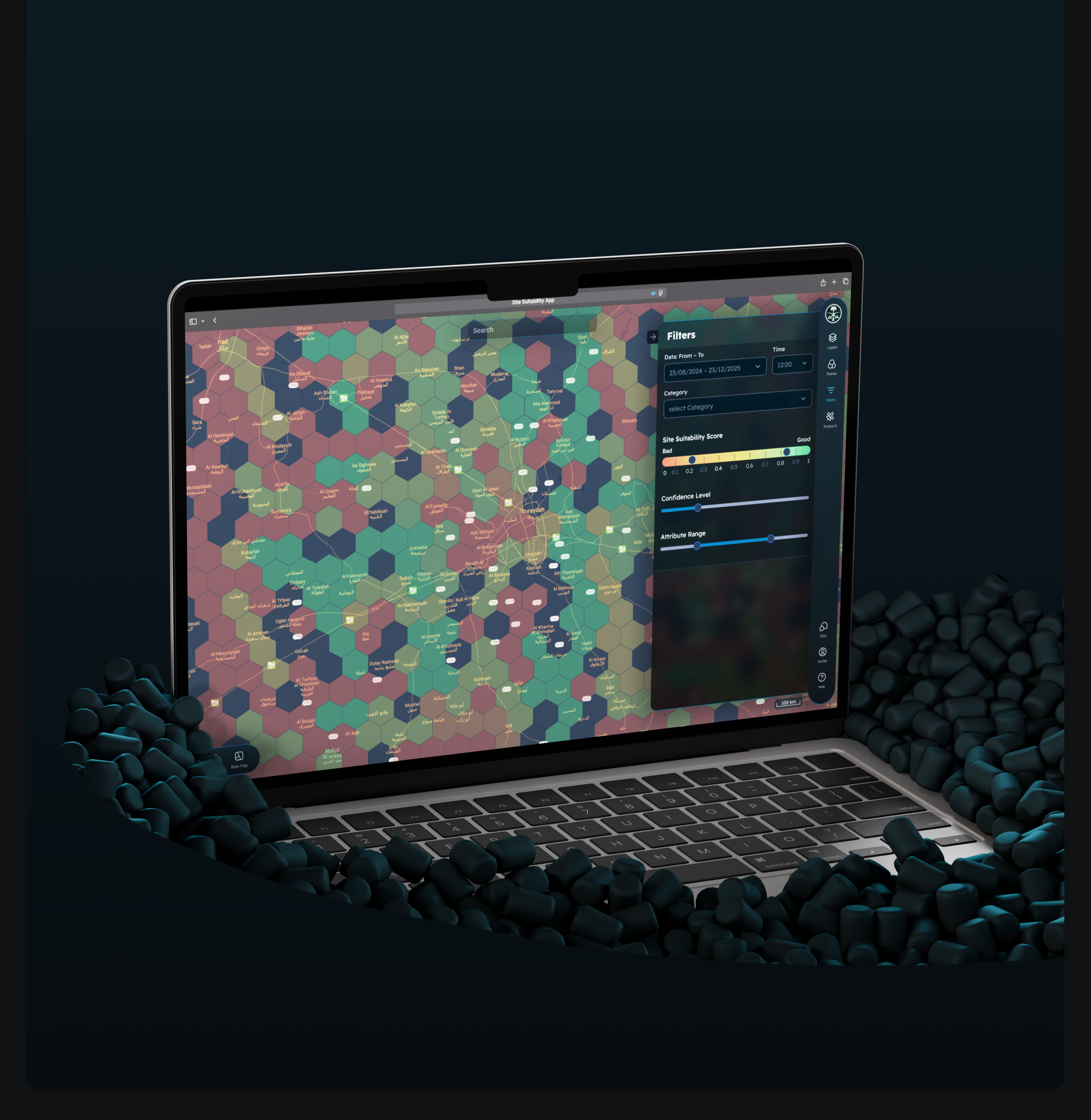
A GIS-focused technology client in the Netherlands commissioned the development of PlateauGIS — a centralized platform where organizations can manage geospatial data and publish interactive maps without requiring GIS desktop software expertise. The platform was designed to support diverse user types, from technical GIS professionals to non-specialist municipal staff.
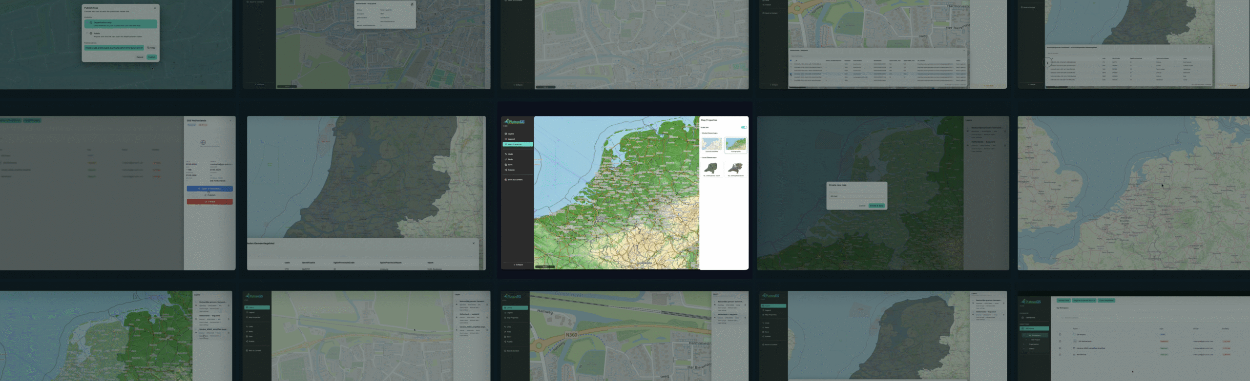
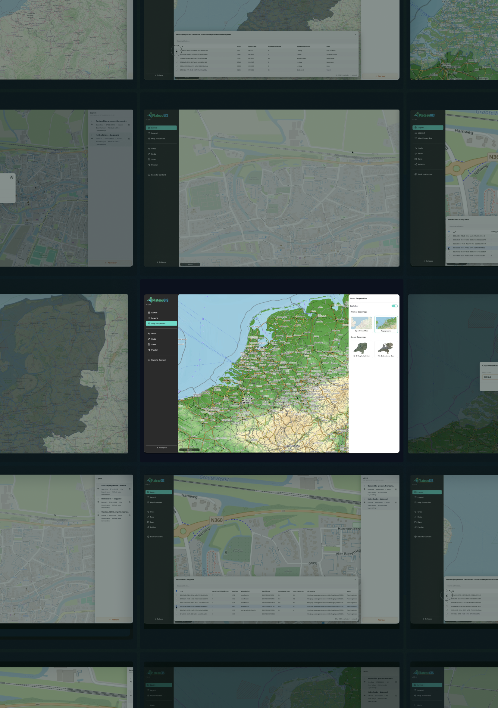
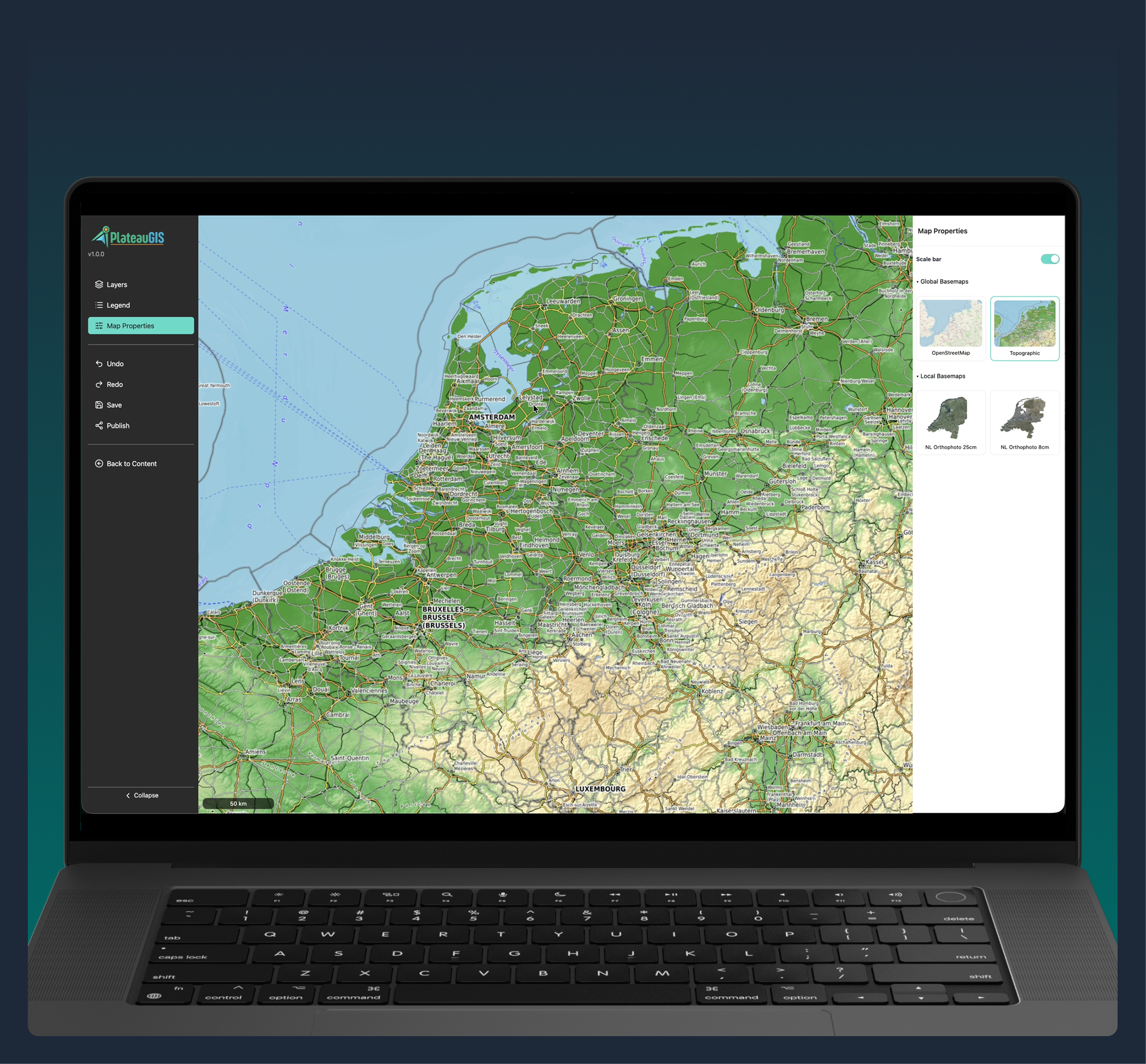
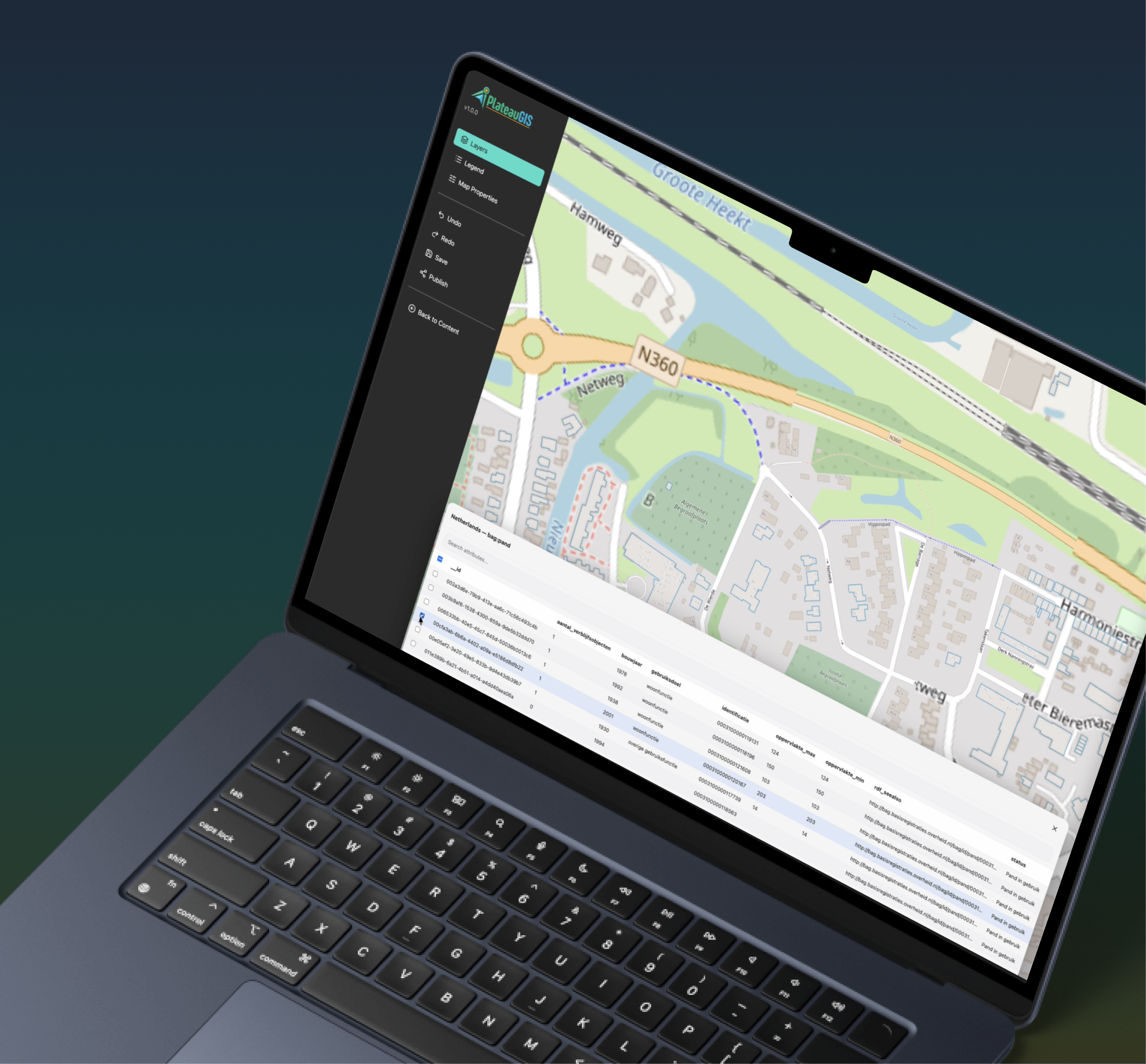
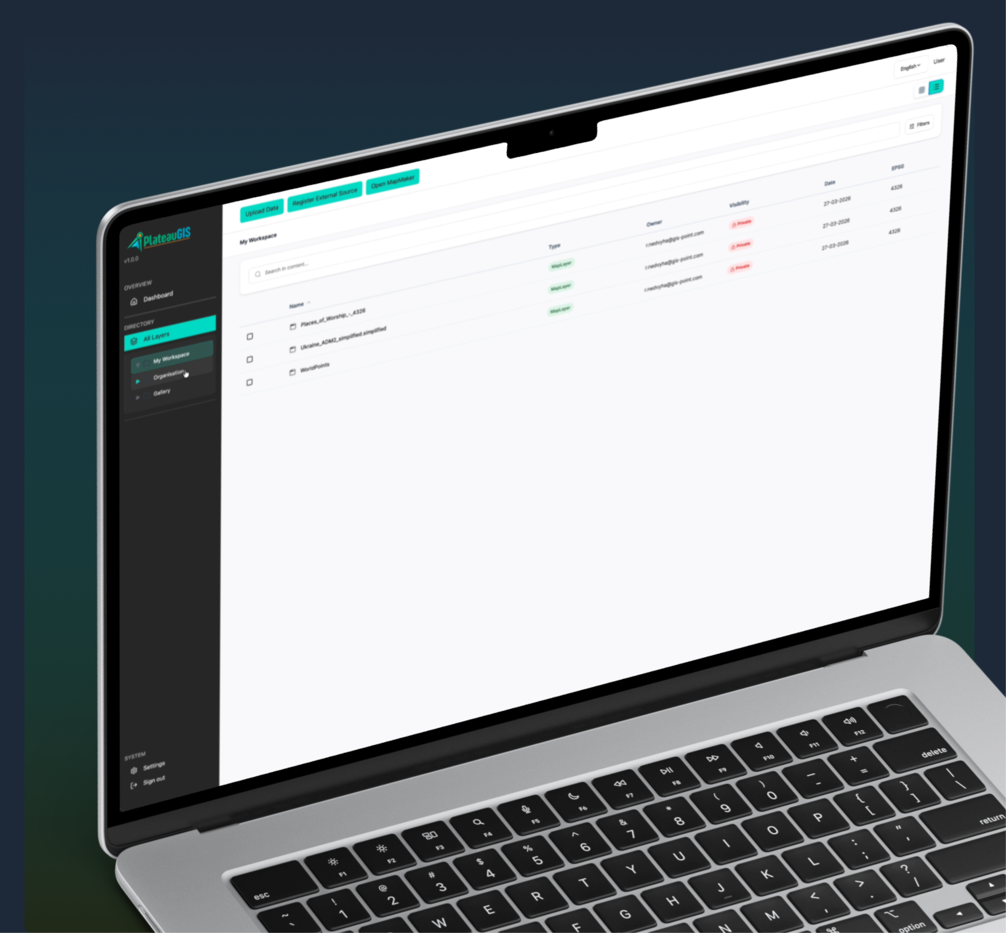
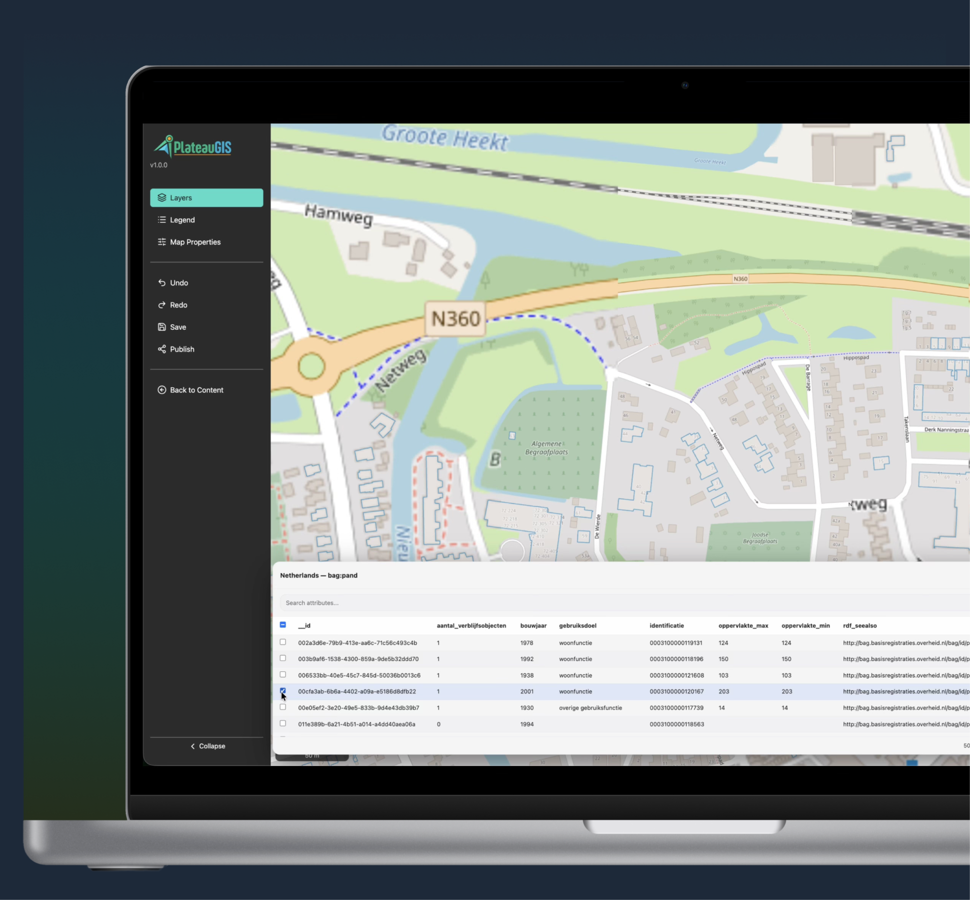
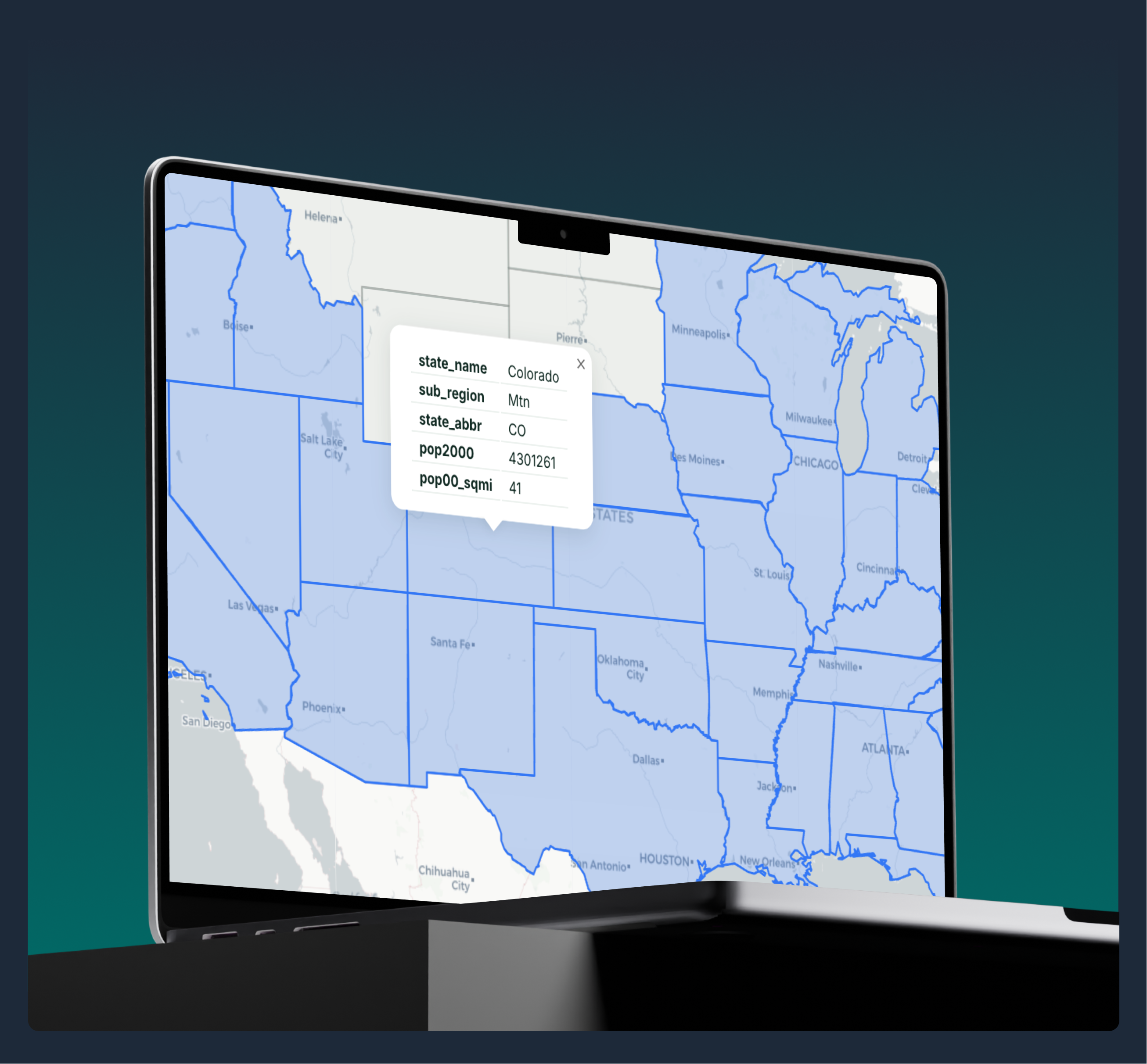
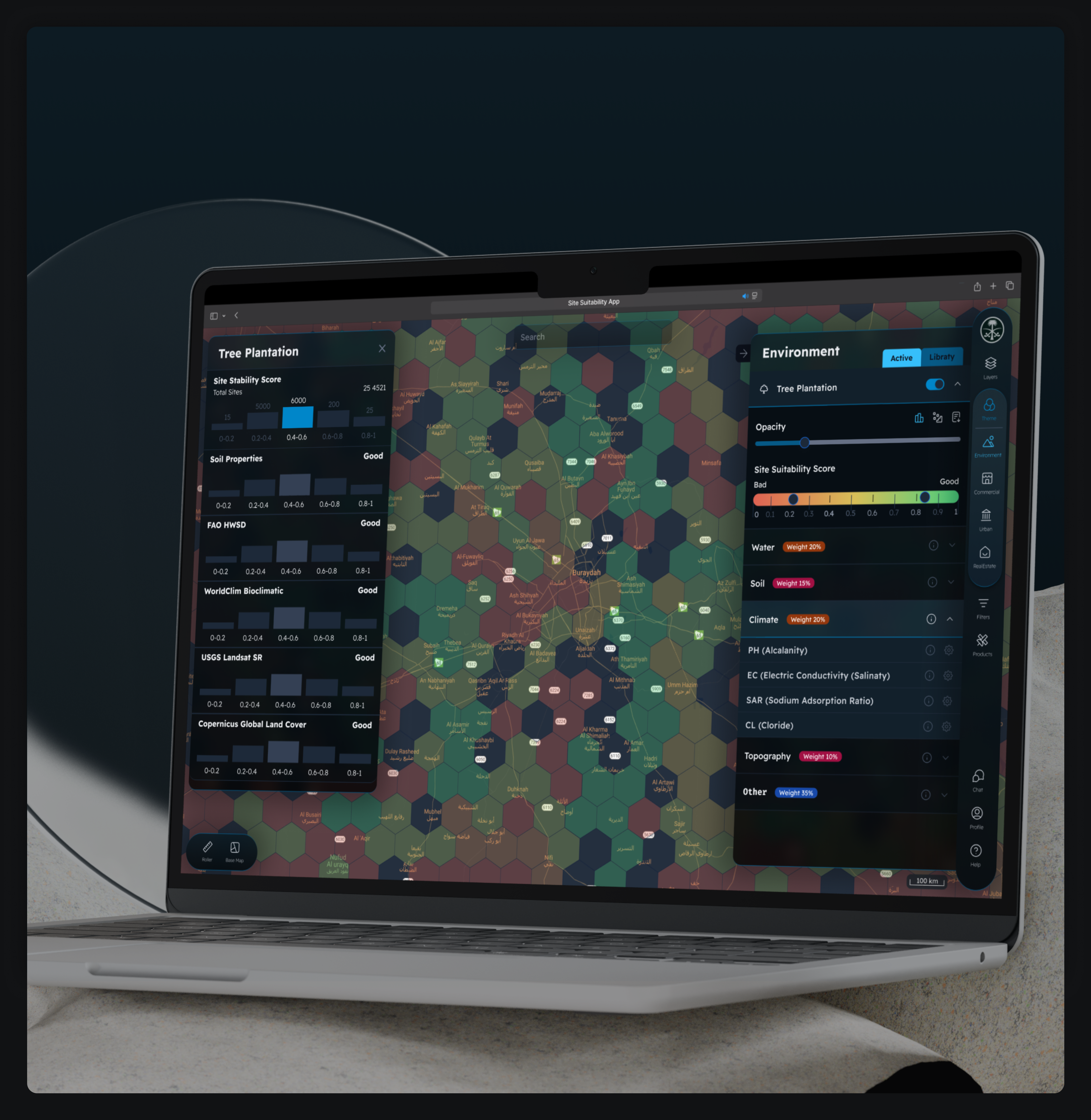
The solution accommodates multiple concurrent organizations in fully isolated workspaces, each with custom subdomain routing (e.g., orgname.plateaugis.eu), branding, and locale configuration. Core capabilities include a hierarchical file manager for geospatial datasets, a feature-rich map editor with layer styling and attribute inspection, and a one-click map publisher generating shareable URLs for public or organization-only access. The platform also supports external OGC services (WMS/WFS) and provides full bilingual support in English and Dutch.
Client: GIS Technology Company (Netherlands)
Sector: Geographic Information Systems
Sub-Sector: Geospatial Platforms & Web GIS
Location: Netherlands
Services:
Full-cycle software development, geospatial platform engineering, interactive map editor development, custom UI/UX design, cloud-based architecture, WMS/WFS integration, multi-tenant SaaS architecture, CI/CD and DevOps.
Solution:
Development of PlateauGIS — a multi-tenant, web-based Geographic Information System platform enabling organizations to upload, manage, and style geospatial datasets, compose interactive multi-layer maps, and publish them for internal or public consumption. The platform serves municipalities, environmental agencies, urban planners, and GIS professionals through isolated organizational workspaces with custom branding, role-based access control, and full support for industry-standard geospatial formats.
People:
The team comprised a project manager who led agile delivery cycles and coordinated client requirements through iterative sprints. Backend engineers built the async REST API using FastAPI, PostgreSQL/PostGIS, and GeoServer integration. Frontend engineers developed the interactive map editor and file manager using React 19 and OpenLayers. GIS specialists handled geospatial data processing, OGC service integration, and SLD styling. DevOps engineers managed the Docker-based infrastructure, CI/CD pipelines, and production deployment on Ubuntu VMs. QA engineers conducted functional, integration, and security testing across all platform modules.
Technology and Software:
- Frontend: React 19 + TypeScript, Vite 7, MUI v7, React Router 7, i18next
- Map Editing: OpenLayers 10.7
- Map Viewing: Leaflet 1.9
- Backend: FastAPI (Python 3.12), SQLAlchemy 2.0 (async), Pydantic v2
- Database: PostgreSQL 16 + PostGIS 3.4
- Map Server: GeoServer 2.23
- Infrastructure: Docker, Docker Compose, Nginx, GitHub Actions CI/CD
- Cloud/Deployment: Ubuntu 24.04 VMs, Certbot (HTTPS)
Process & Challenges
Process:
- Business analysis and system requirements documentation, defining user roles (Admin, Editor, Viewer) and establishing the multi-tenant architecture design;
- System architecture design following a clean layered approach (Routes → Services → Repositories → Database), along with GeoServer integration strategy;
- Backend development using FastAPI (Python 3.12), SQLAlchemy 2.0, PostGIS, and a GeoServer REST client with JWT-based authentication and role-based access control;
- Frontend development of the React 19 + TypeScript SPA with an OpenLayers-powered map editor, a Leaflet-based published map viewer, and the MUI component library;
- Geospatial and OGC integration, including GeoServer for WMS/WFS layer publishing, OWSLib-based capabilities parsing for external services, and processing of Shapefile, GeoJSON, GeoPackage, and CSV formats using GDAL and Fiona;
- Testing and quality assurance using pytest, covering functional, integration, and security testing across geospatial processing, multi-tenant isolation, and role-based access controls;
- Cloud deployment and CI/CD via Docker Compose on Ubuntu VMs, GitHub Actions pipelines, automated Alembic database migrations, versioned frontend releases, and Nginx reverse proxy with HTTPS.
Challenges:
- Multi-Tenant Data Isolation: Ensuring complete organizational data separation across shared infrastructure required subdomain-based tenant resolution, context-scoped database queries, and middleware-level isolation enforced at every API endpoint.
- Geospatial Data Processing: Handling diverse geodata formats — Shapefile, GeoJSON, GeoPackage, and CSV — with automatic EPSG detection, bounding box extraction, and GeoServer layer registration required a robust processing pipeline using GDAL, Fiona, and PostGIS.
- Interactive Map Performance: Delivering smooth real-time rendering with multiple overlapping vector and raster layers, large paginated feature sets, and dynamic style classification demanded careful optimization of OpenLayers rendering and server-side pagination.
- External OGC Service Integration: Automatically discovering and consuming external WMS/WFS services with varying GetCapabilities structures required robust OWSLib parsing, 24-hour capability caching, and graceful error handling for invalid or unreachable endpoints.
Result
PlateauGIS was successfully delivered as a production-ready platform serving municipalities, environmental agencies, and GIS professionals across the Netherlands. The platform consolidates geospatial data management, interactive map creation, and map publication into a single, intuitive web interface — eliminating the need for complex GIS desktop software for publishing and sharing spatial content.
Its multi-tenant architecture supports unlimited organizations with complete data isolation, custom branding, and locale-specific configuration. The GeoServer-backed publishing layer ensures OGC-compliant WMS/WFS delivery at scale. The platform’s clean architecture, containerized deployment, and automated CI/CD pipeline provide a solid foundation for ongoing feature development, with clear paths toward Redis caching, object storage, and AI-assisted spatial analysis.
Our Team

Ievgen Lavrishko

Khrystyna Bochko

Alevtyna Kostianchuk

Andriiana Pavlyshyn

Roman Nahaiovskyi

Maria Kizim

Ivanna Soltys
Navigating Our Impressive SOFT Portfolio
-
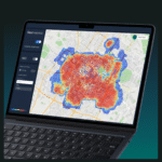
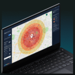
A large European retail chain was planning rapid expansion and needed a faster way to evaluate potential store locations. GIS-Point developed a GeoAnalytics platform that consolidates mobility, population, and competitive data into a single analytical environment, enabling the client to assess new locations through automated spatial analytics and interactive maps.
-
An AgTech startup needed a way to transform large volumes of agricultural spatial data into actionable insights for farm managers. GIS-Point developed Farm Intelligence AI, an AI-powered geospatial analytics platform that allows users to analyze farm data through natural language queries and visualize results instantly on an interactive map.
-
Development Web Platform for Digital Soil Mapping and Analysis
-
The system is designed to comprehensively address the issues of public passenger transport

Working on the Project:
A Step-by-Step Journey to Success
PREPARATION
task, provide samples, templates,
instructions.
PILOT PROJECT
for FREE, according to all your
instructions.
AGREEMENT
the cost of further work.
LET’S STARTED!
NDA, after which our team gets to
work.
Have a similar project?
Contact us, we’ll help with its implementation.
United Kingdom
Devonshire str., 41, Ground Floor, London W1G 7AJ, UK
Estonia
Harju maakond, Tallinn, Kesklinna linnaosa, Kaupmehe tn 7-120, 10114, Estonia
Ukraine
Ukraine, Lviv, Sadova street, 2a/1
+380672088520 Ievgen Lavrishko
info@gis-point.com