

Project Details
Client: Agricultural Tech Startup (Saudi Arabia)
Sector: Agriculture Technology
Sub Sector: Precision Agriculture and Remote Sensing
Services:
- Full-cycle software development
- Satellite data integration
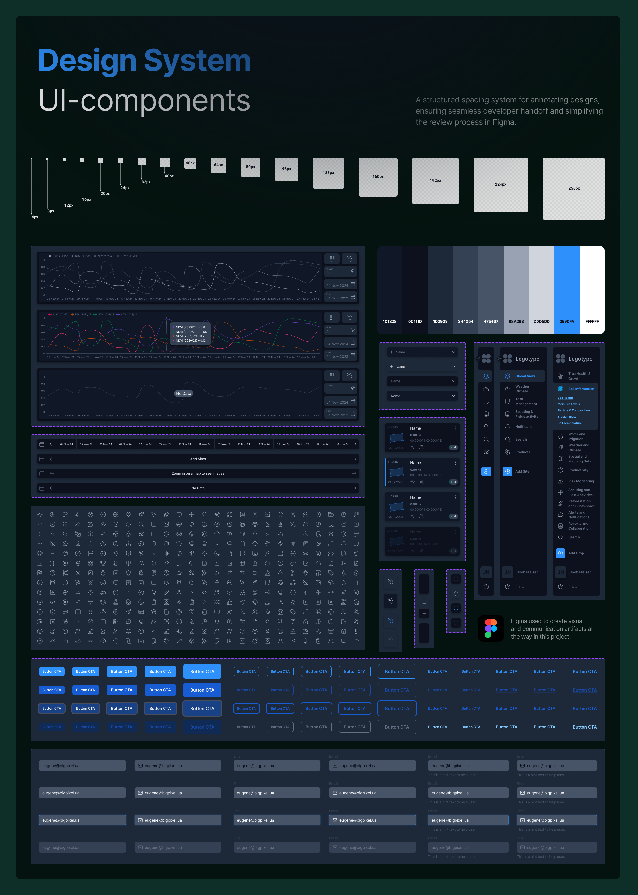
- Custom UI/UX design
- Cloud-based architecture
- Geospatial analytics
Solution:
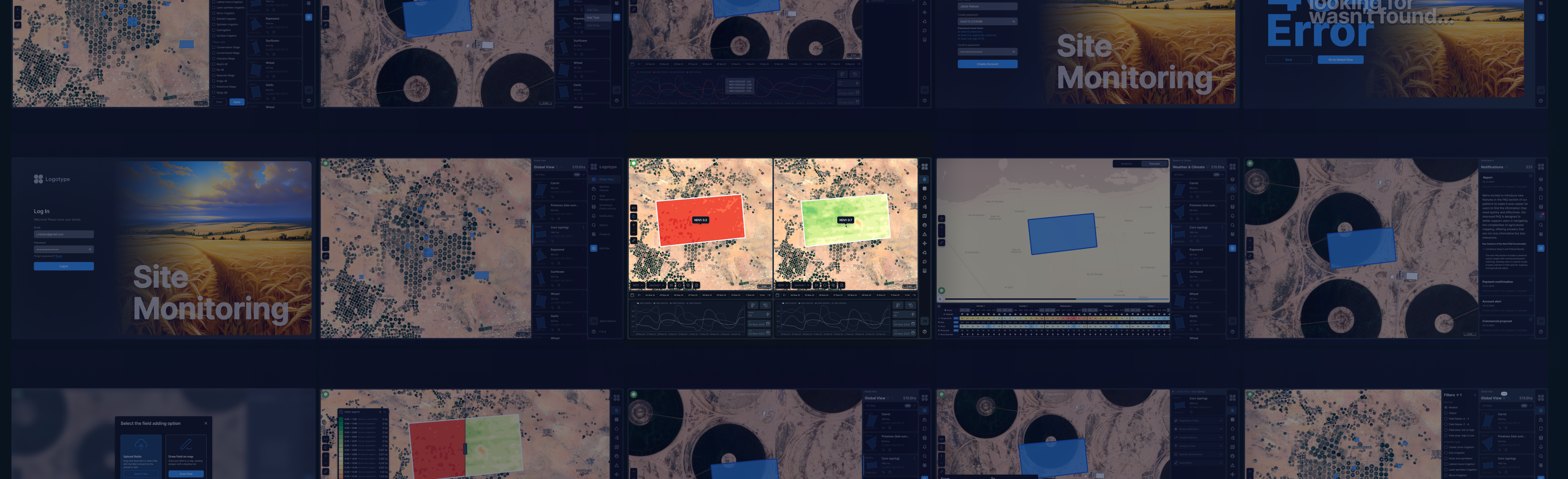
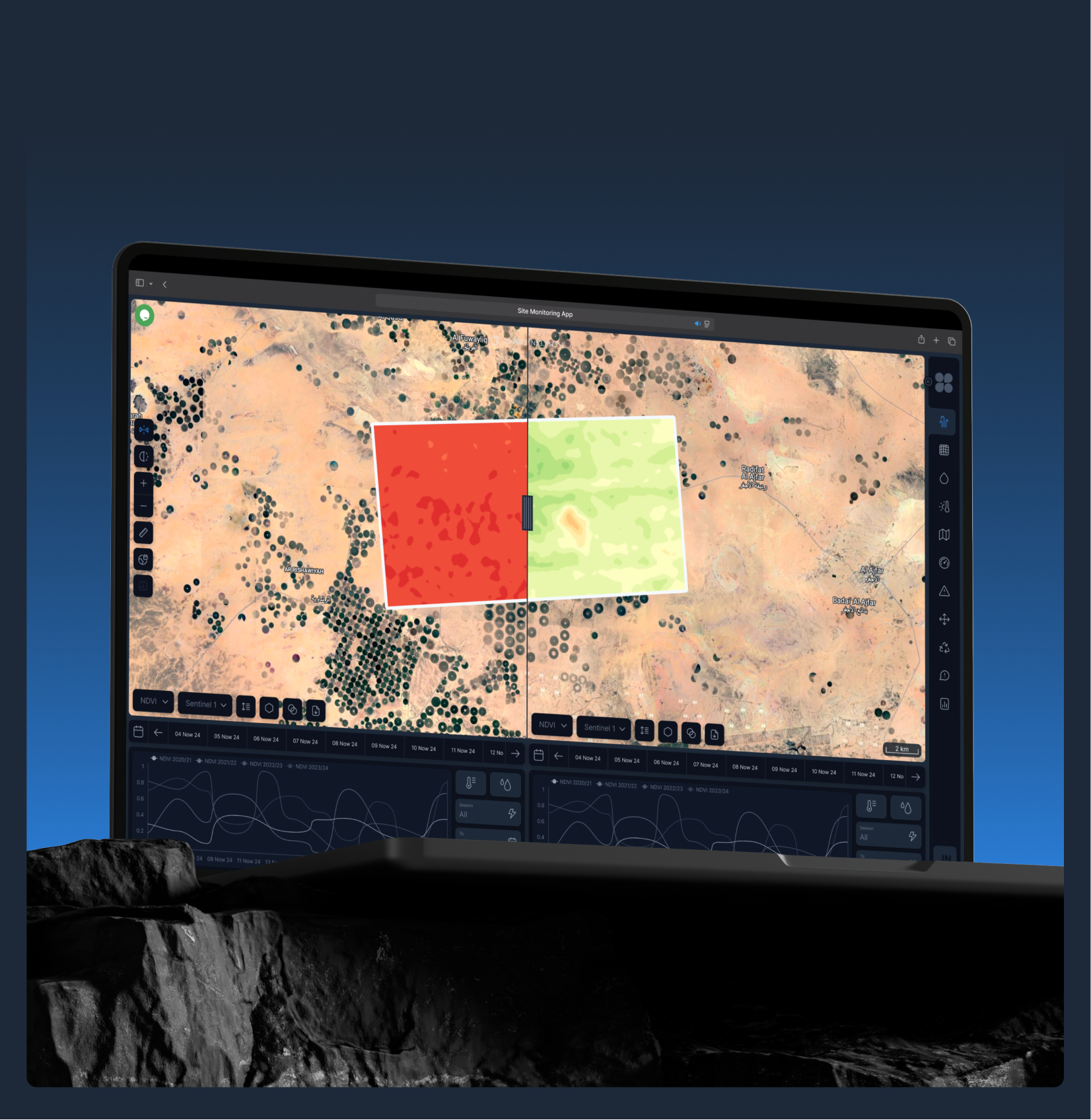
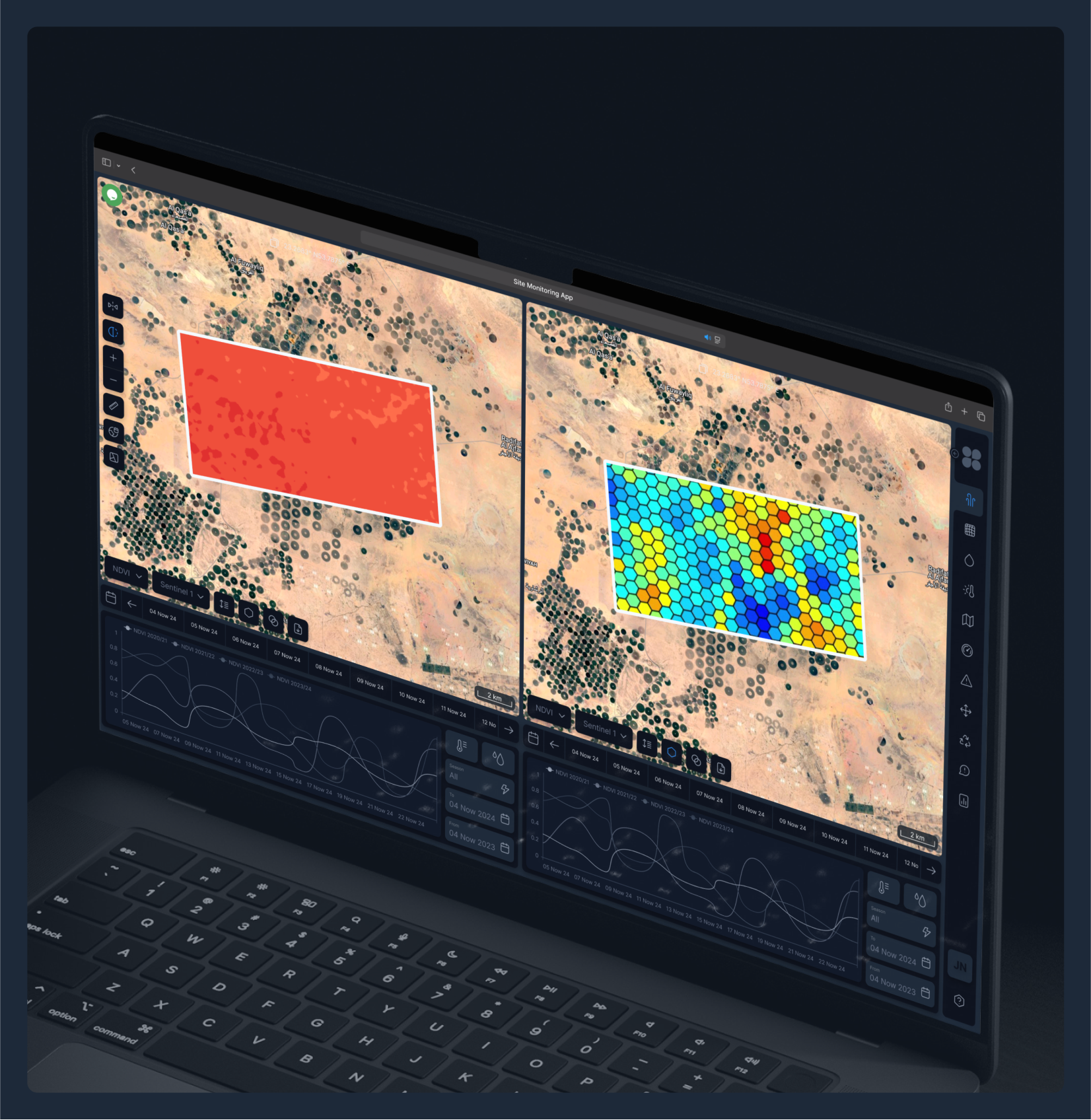
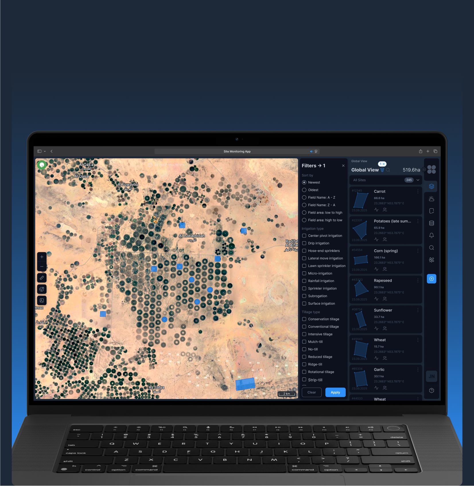
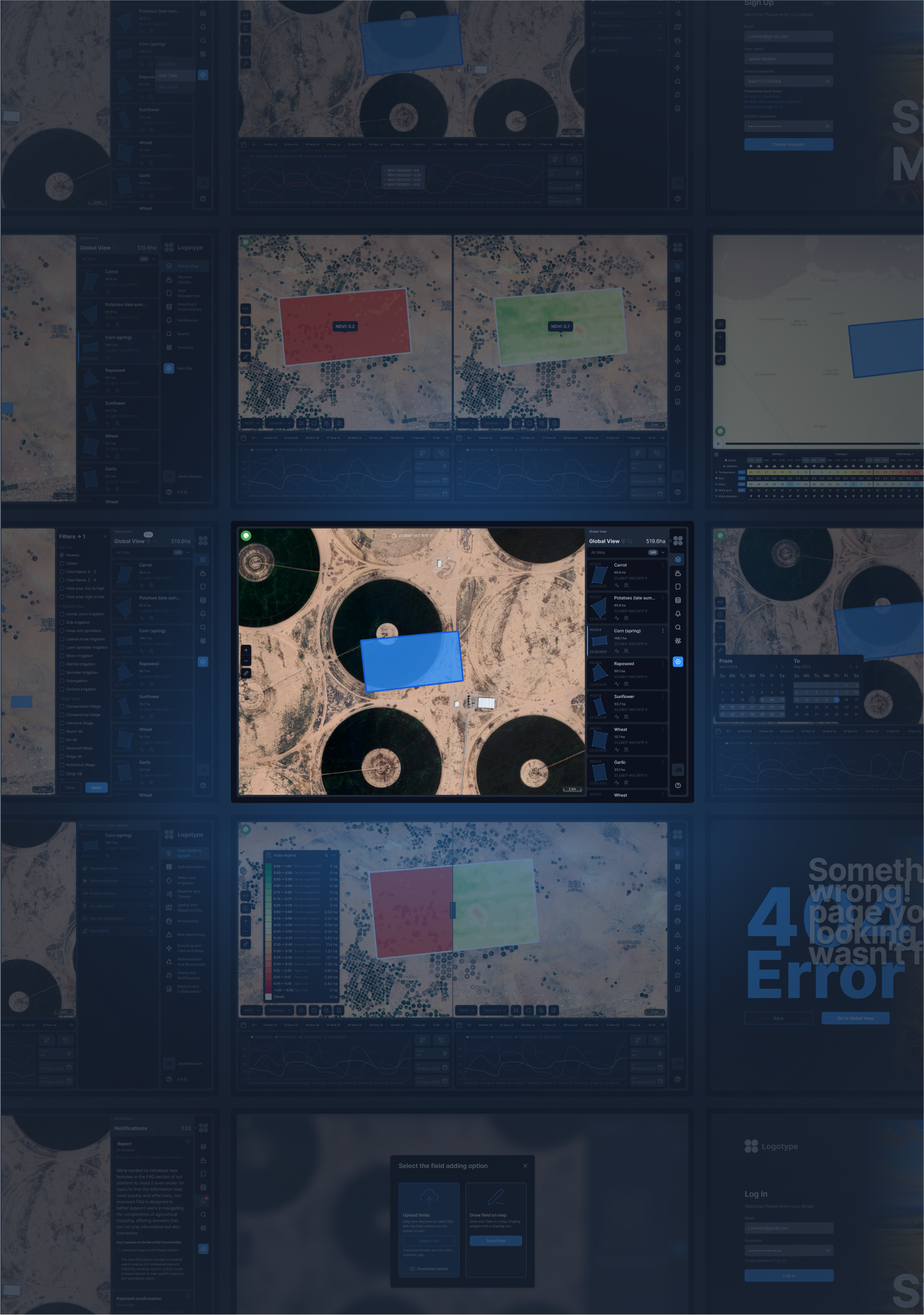
Development of a web-based platform that enables farmers, agronomists, and agricultural companies to monitor crop health, weather conditions, soil moisture, and elevation data using satellite imagery and environmental data. The solution delivers real-time insights to improve farm productivity and sustainability practices.
Location: Saudi Arabia
Technology and Software:
- Database: PostgreSQL
- Cloud services: AWS (EC2, S3)
- Front-end: Angular
- Back-end: .NET Core with ABP Framework
People:
The team comprised software developers, remote sensing specialists, and cloud engineers. The project manager led the agile development cycle, ensuring client requirements were met through iterative delivery. The backend team used .NET Core and the ABP Framework to handle data processing and user management, while the frontend team delivered an interactive experience using Angular. Our DevOps specialists ensured cloud infrastructure scalability and performance.
Process & Challenges
Process:
The development process included:
- Business analysis and system requirements documentation;
- Modular architecture design for scalability and flexibility;
- Backend development using .NET Core and ABP Framework;
- Frontend development using Angular;
- Integration of Sentinel-2 satellite data and OpenWeather API;
- Secure role-based user authentication using OAuth2.0 and JWT;
- Testing, QA, and cloud deployment (AWS).
Challenges:
- Data Integration: Processing large satellite datasets and combining them with real-time weather and environmental data.
- Interactive Mapping: Delivering fast and responsive geospatial visualizations with multiple data overlays.
- Scalability: Ensuring the system can support a growing user base and increasingly large volumes of geospatial data.
Result
The result was the creation of a powerful platform that provides users with accurate real-time weather data. The platform significantly improved decision-making for users in sectors such as transport, agriculture, and emergency services. Thanks to the integration with the Windy API, users can track extreme weather events, allowing for timely responses to potential risks.
Our Team

Ievgen Lavrishko

Khrystyna Bochko

Alevtyna Kostianchuk

Andriiana Pavlyshyn

Roman Nahaiovskyi

Maria Kizim

Ivanna Soltys
Navigating Our Impressive SOFT Portfolio
-
Development software for a soil subsidence


-
The system is designed to comprehensively address the issues of public passenger transport

-
Develop software for public transport which display on tables arrival information about bus, tram and trolleybus.

-
A portal for the sale of satellite images


-
Software Development for the energy industry to control and track of logistics, drilling, mining.

Working on the Project:
A Step-by-Step Journey to Success
PREPARATION
task, provide samples, templates,
instructions.
PILOT PROJECT
for FREE, according to all your
instructions.
AGREEMENT
the cost of further work.
LET’S STARTED!
NDA, after which our team gets to
work.
Have a similar project?
Contact us, we’ll help with its implementation.
United Kingdom
Devonshire str., 41, Ground Floor, London W1G 7AJ, UK
Estonia
Harju maakond, Tallinn, Kesklinna linnaosa, Kaupmehe tn 7-120, 10114, Estonia
Ukraine
Ukraine, Lviv, Sadova street, 2a/1
+380672088520 Ievgen Lavrishko
info@gis-point.com