
Project Overview
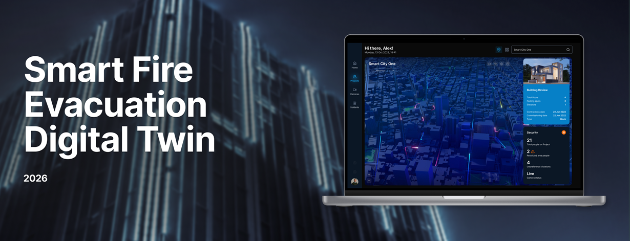
A European client required an advanced platform to improve fire safety monitoring and emergency response across large buildings and urban environments. GIS-Point developed a Smart Fire Evacuation Digital Twin, an AI-powered 3D platform that integrates sensor networks, surveillance systems, and spatial analytics to provide real-time situational awareness and predictive evacuation planning.
Title: Smart Fire Evacuation Digital Twin
Client: Confidential
Sector: Safety / Smart City
Sub Sector: Fire Safety / Digital Twin / IoT
Location: Europe
Challenge & Solution
Challenge:
Large buildings and city districts rely on multiple fire safety systems, sensors, alarms, and surveillance devices that often operate independently. This fragmentation makes it difficult for operators to obtain a complete real-time picture during emergency situations.
Traditional fire safety systems are primarily reactive and offer limited predictive capabilities. Emergency teams also face challenges in monitoring evacuation flows, simulating potential fire scenarios, and ensuring compliance with strict safety regulations.
The client required a unified platform capable of integrating heterogeneous data streams from IoT devices, LiDAR sensors, cameras, and alarm systems while providing real-time situational awareness and predictive evacuation planning across complex environments.
Solution:
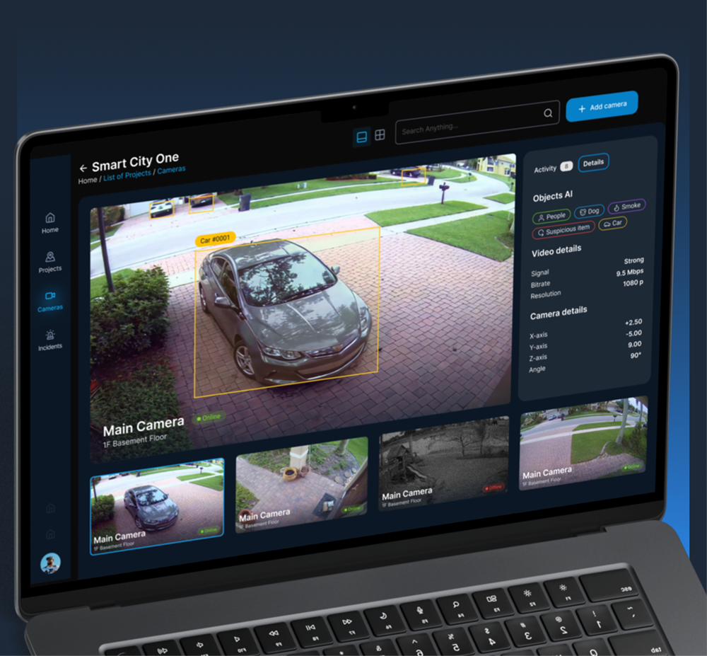
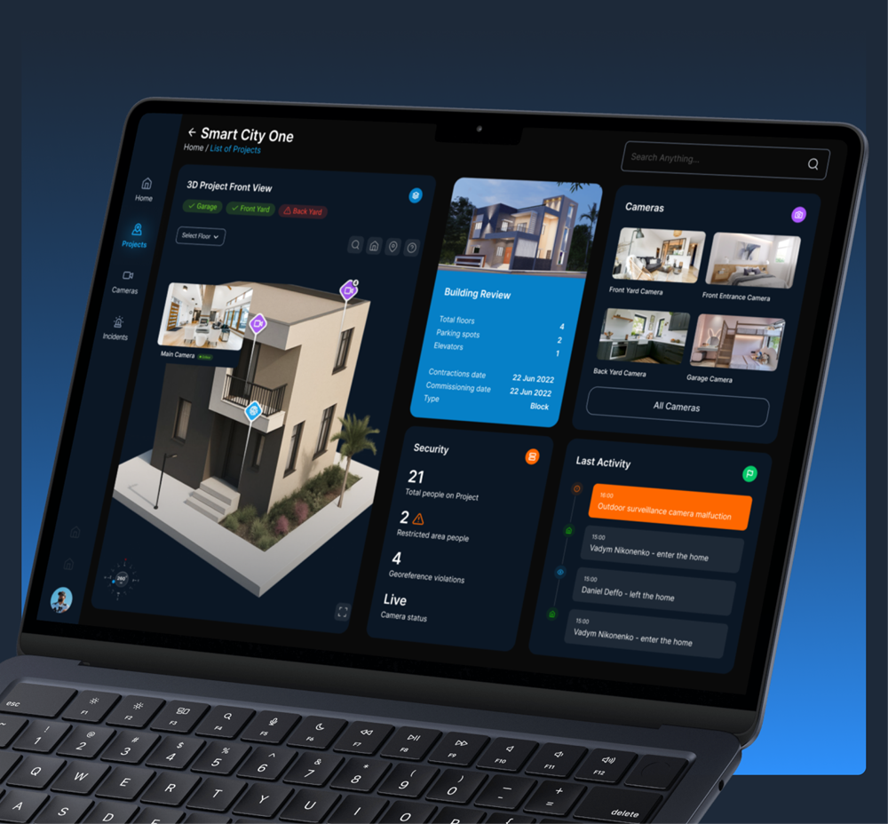
We developed an AI-powered 3D Digital Twin platform that integrates fire safety systems, IoT sensors, LiDAR feeds, and cameras into a single interactive environment.
The platform provides real-time visualization of buildings or city districts, enabling operators to detect hazards, monitor people flow, and dynamically plan evacuation routes. AI models analyze sensor data to predict fire risks and simulate evacuation scenarios, helping emergency teams respond faster and more effectively.
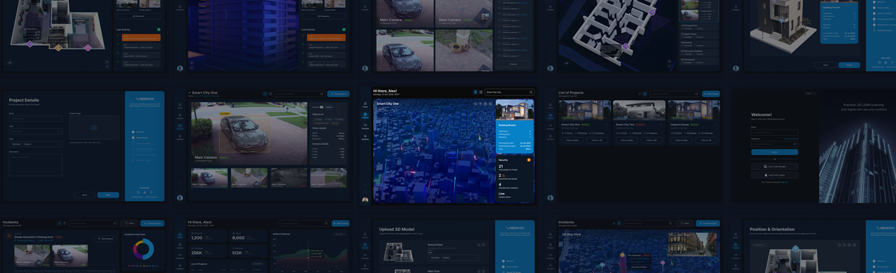
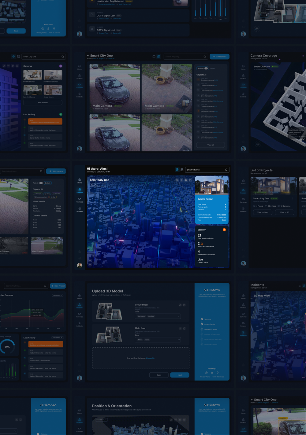
Platform Capabilities
The platform provides advanced situational awareness and predictive safety analytics through:
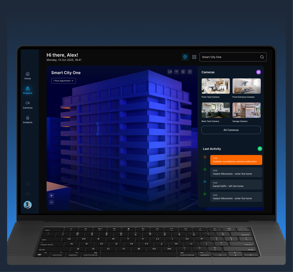
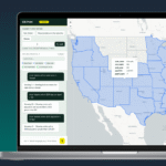
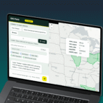
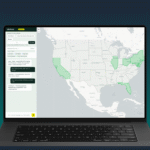
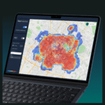
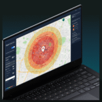
- Real-time 3D visualization of buildings, apartments, or city blocks with live sensor overlays
- AI-based fire risk detection and hazard prediction
- Dynamic evacuation routing and people flow monitoring
- Simulation of fire scenarios using graph algorithms and predictive models
- Integration with city-level dispatch systems and Smart City SOC environments
- Blockchain-based audit logs and automated safety compliance checks
- VR/AR training environments for fire brigades and facility teams
Key Services:
- Digital Twin Development: Creation of real-time 3D environments for buildings or city districts with integrated sensor data.
- AI & Predictive Analytics: AI models for fire detection, hazard prediction, and evacuation route optimization.
- IoT System Integration: Integration with sensors, alarms, LiDAR devices, and monitoring systems.
- Compliance & Audit Automation: Automated monitoring and blockchain-based audit trails for safety inspections.
Technology and Software:
- 3D & BIM: IFC 4.3, CityGML, IndoorGML, OGC 3D Tiles
- AI & Machine Learning: YOLOv5, LSTM prediction models
- IoT & Edge Systems: LiDAR, mmWave radar, IP cameras, MQTT, WebSockets
- Web Platform: React, Node.js, WebGL, Three.js
- Database & GIS: PostgreSQL + PostGIS
- Deployment & Infrastructure: Docker, Kubernetes
- Security: Blockchain-based logging, RBAC access control, GDPR compliance
People:
The project was delivered by a multidisciplinary team including software engineers, AI/ML specialists, 3D and GIS developers, IoT engineers, and safety compliance experts.
The AI/ML team developed computer vision models and predictive algorithms for hazard detection and evacuation analysis, while the 3D development team implemented real-time visualization, VR/AR simulations, and sensor integrations. Together, the team ensured the platform was scalable, secure, and compliant with international fire safety standards.
Implementation Process
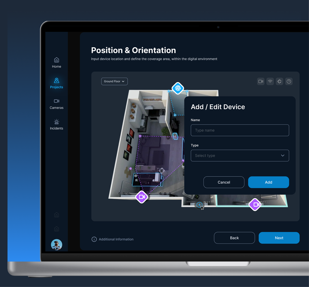
- 3D Environment Preparation: Collection and processing of building or city district 3D models.
- Sensor Mapping & Integration: Automated mapping of sensor and device locations across the digital twin environment.
- Real-Time Data Streaming: Continuous data ingestion from IoT devices, cameras, and monitoring systems.
- AI Model Execution: Processing sensor streams with computer vision and predictive models for fire detection and evacuation analysis.
- 3D Visualization: Interactive visualization of live data and emergency scenarios within the digital twin environment.
- Compliance Logging: Immutable logging of events and safety checks for regulatory compliance.
Results
The project delivered a scalable AI-driven digital twin platform that transforms fire safety management from reactive monitoring to predictive risk prevention. Operators gain full spatial awareness of facilities and city environments, allowing them to detect hazards earlier, coordinate emergency responses faster, and manage evacuations more effectively.
Key outcomes include:
- Real-time situational awareness across buildings and city districts
- Faster emergency response through predictive fire detection and evacuation modeling
- Improved coordination with city-level dispatch and emergency services
- Automated compliance monitoring and transparent audit records
- Enhanced training capabilities through immersive VR/AR simulations
The solution significantly improves safety and operational control for smart cities, critical infrastructure, and large facilities.
Our Team

Ievgen Lavrishko

Khrystyna Bochko

Alevtyna Kostianchuk

Andriiana Pavlyshyn

Roman Nahaiovskyi

Maria Kizim

Ivanna Soltys
Navigating Our Impressive SOFT Portfolio
-
Development of a Precision Agriculture Site Monitoring Platform


-
Development of an Interactive Street Panorama and GIS Layer Management Platform


-
Development of a Web-Based 3D Point Cloud Visualization Platform


-
Software development for a weather forecast program


-
An AgTech startup needed a way to transform large volumes of agricultural spatial data into actionable insights for farm managers. GIS-Point developed Farm Intelligence AI, an AI-powered geospatial analytics platform that allows users to analyze farm data through natural language queries and visualize results instantly on an interactive map.
-
A large European retail chain was planning rapid expansion and needed a faster way to evaluate potential store locations. GIS-Point developed a GeoAnalytics platform that consolidates mobility, population, and competitive data into a single analytical environment, enabling the client to assess new locations through automated spatial analytics and interactive maps.
Working on the Project:
A Step-by-Step Journey to Success
PREPARATION
task, provide samples, templates,
instructions.
PILOT PROJECT
for FREE, according to all your
instructions.
AGREEMENT
the cost of further work.
LET’S STARTED!
NDA, after which our team gets to
work.
Have a similar project?
Contact us, we’ll help with its implementation.
United Kingdom
Devonshire str., 41, Ground Floor, London W1G 7AJ, UK
Estonia
Harju maakond, Tallinn, Kesklinna linnaosa, Kaupmehe tn 7-120, 10114, Estonia
Ukraine
Ukraine, Lviv, Sadova street, 2a/1
+380672088520 Ievgen Lavrishko
info@gis-point.com